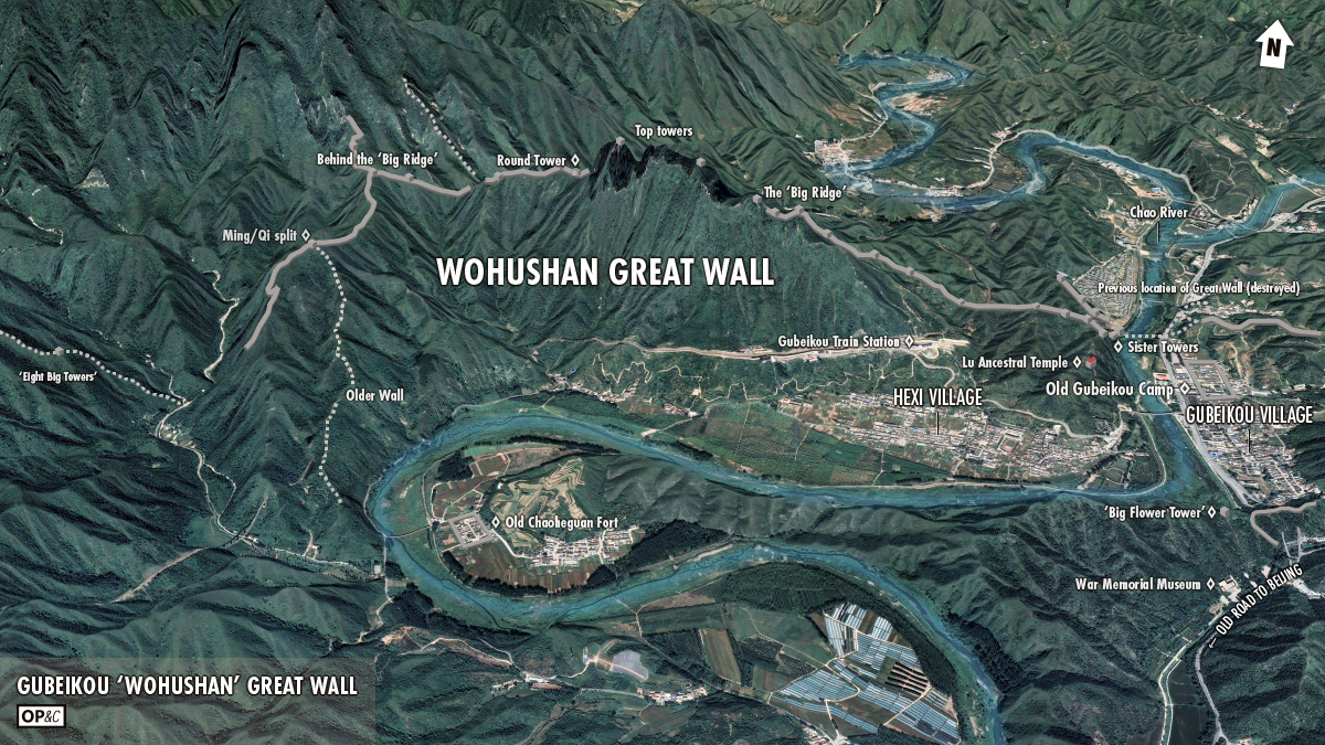
Gubeikou ‘Wohushan’ Great Wall
A collection of 50+ photos from various visits and hikes at the Gubeikou ‘Wohushan’ Great Wall.
What’s in this post?
- Intro
- Gubeikou ‘Wohushan’ Great Wall map
- Photos from the Sister Towers area
- Photos from the Wohushan ‘big ridge’ and top towers area
- Photos from the Great Wall behind the Wohushan ‘big ridge’
- Photos from the Great Wall above Chaoheguan Village
- Chaoheguan Village and other views
- Notes and links, more maps
- To-do list

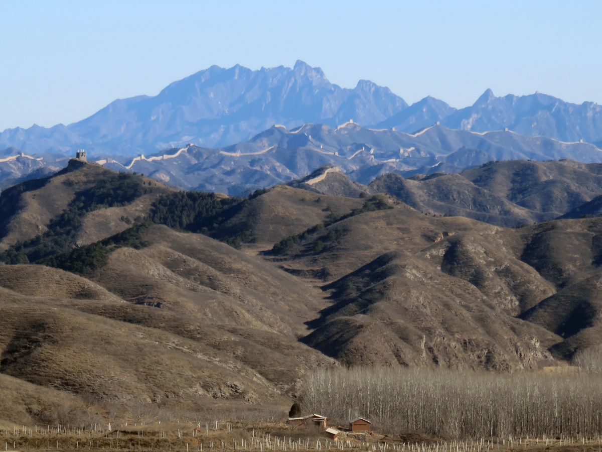
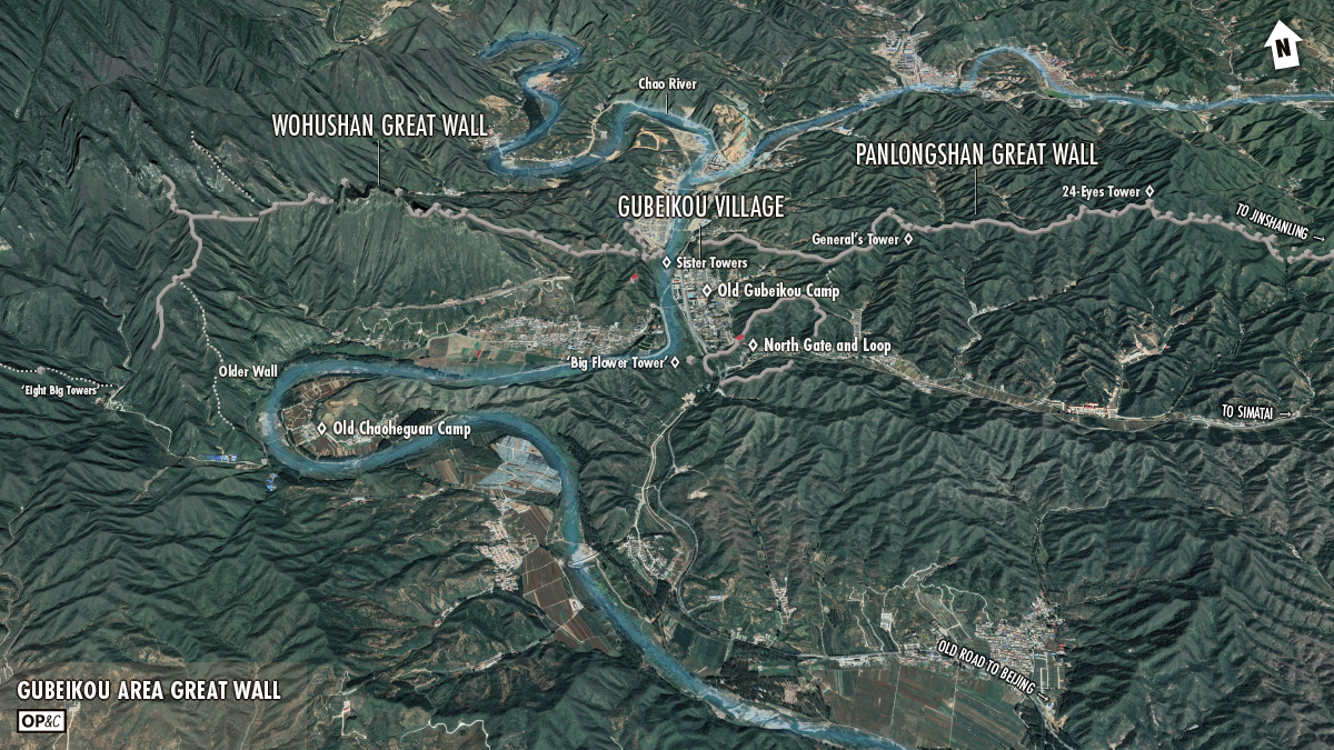
The Wohushan Great Wall is the western end of the Gubeikou Great Wall, the part on the west side of the Chao River. (On the east side of the river it’s the Panlongshan Great Wall.)
‘Wohushan’ translates as Crouching Tiger Mountain—same ‘Crouching Tiger’ as the movie ‘Crouching Tiger, Hidden Dragon’.
I’ve heard people claim that the Gubeikou Great Wall is the oldest Great Wall in Beijing. But most of what you see of the Great Wall at Gubeikou was finished during the later years of the Ming Dynasty (1368–1644 AD), especially the parts with the big towers and brick walls and battlements. The Ming Dynasty was the last of the dynasties to build and maintain the Great Wall, so those parts aren’t the oldest in Beijing. The claims of “oldest Great Wall in Beijing” probably refer to the two-metre-wide line of stones and rocks on one of the ridgelines of Wohushan, said to have been built during the Northern Qi Dynasty (550–577 AD), with the idea that the Ming wall was built over the top of the Northern Qi wall—except for this bit, which was left exposed when the Ming wall architects decided to take it in a different direction.
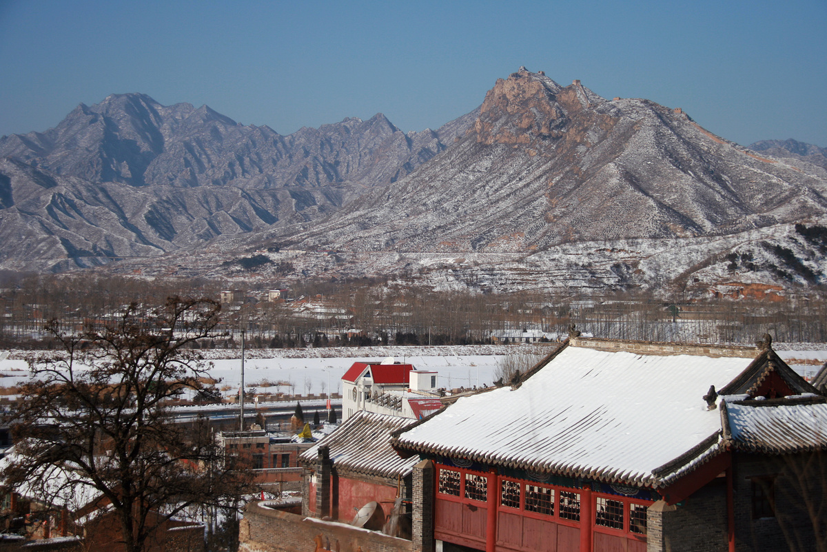
There are four main parts to the Wohushan Great Wall: the Sister Towers part; the Wohushan ‘big ridge’; the wall just behind the big ridge; and the wall above Chaoheguan Village. In Chaoheguan Village there are also remnants of walls from a Ming-era fort and a Gods of Plagues temple. The Gubeikou train station is also on the Wohushan side of the river.
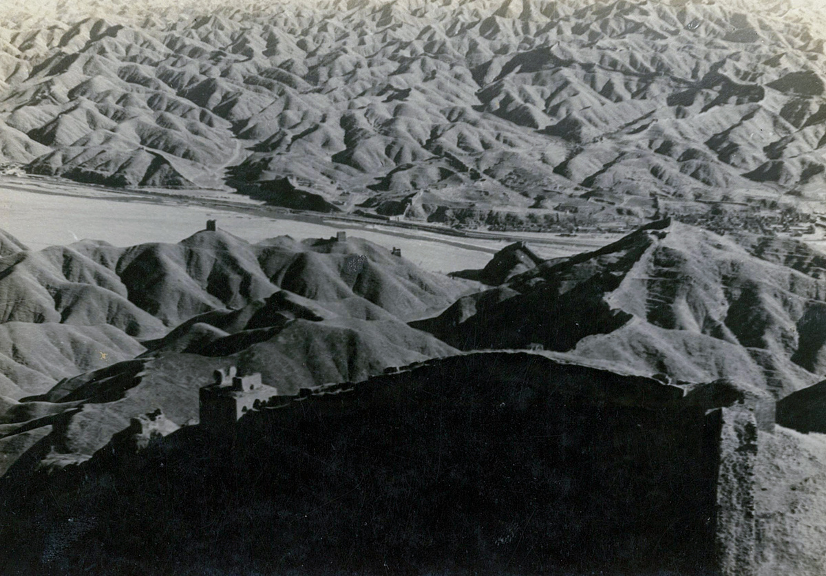
The photos in this post are grouped into the four main parts I mentioned, with a bonus section covering Chaoheguan Village and some extra views. I’ve also included some public domain photos that were taken in the early- to mid-1900s.
This is part of a series of three Gubeikou posts—the others being the one about the Panlongshan Great Wall, and one that covers the main general and historical info about the Gubeikou Great Wall, with photos from the village and the North Gate and loop of Great Wall around there.
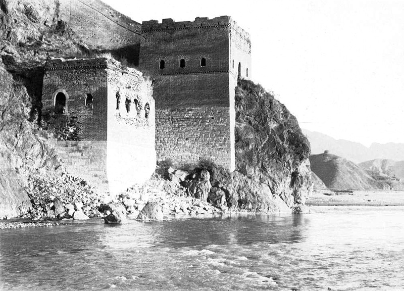
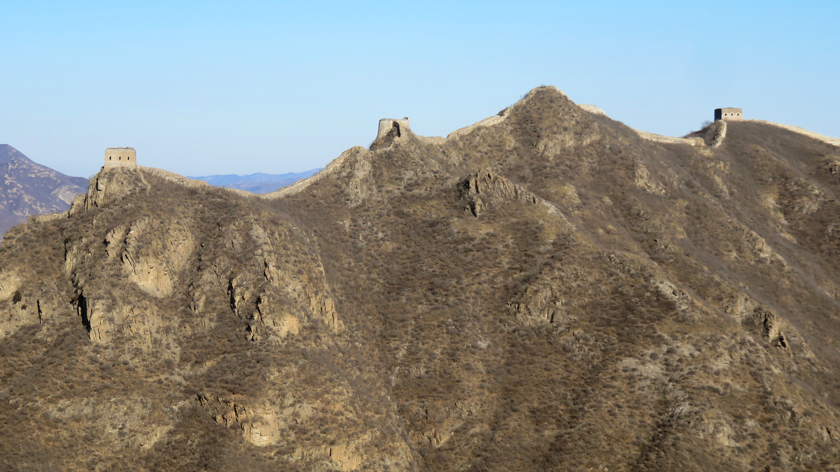
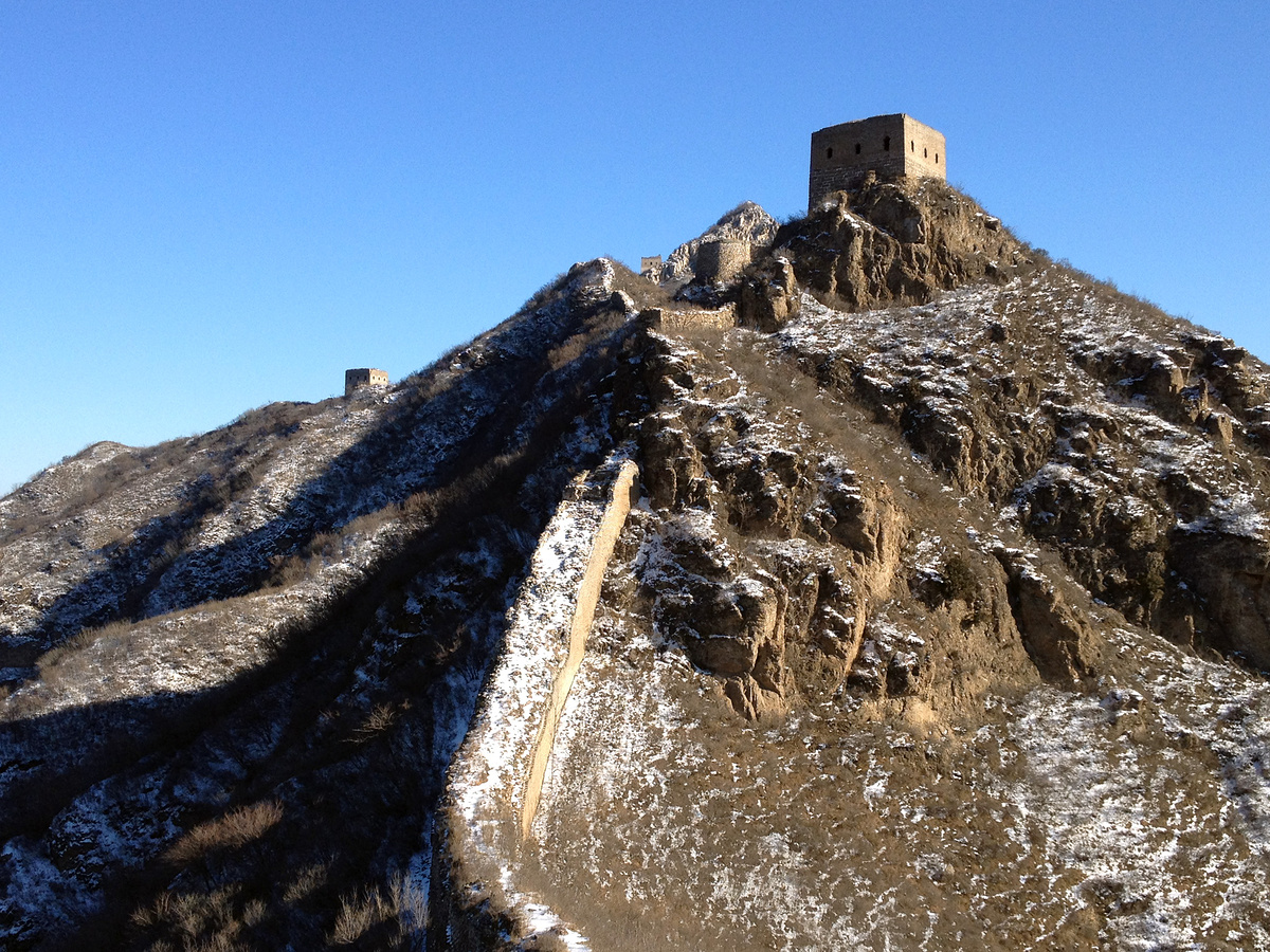
Sister Towers area
They’re called the Sister Towers because they’re built so close together. In Chinese it’s Jiěmèi Lóu (姐妹楼). Jiě (姐) means ‘older sister’, Mèi (妹) means ‘younger sister’, and I suppose that would make the larger tower the Big Sister. I haven’t actually visited these two towers, or the wall nearby. I have seen the Sisters from the wall above. A proper visit is on the to-do list, especially as there’s also a rare three-level tower on a nearby hill.


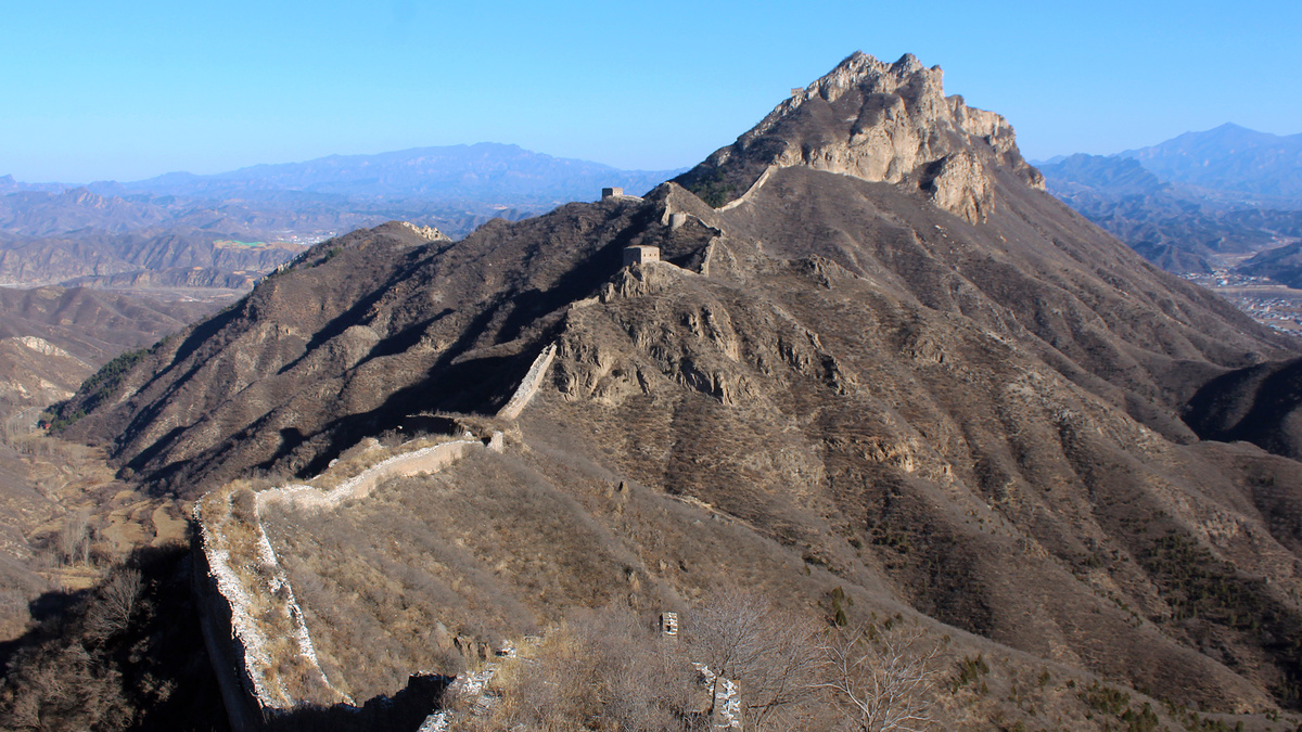
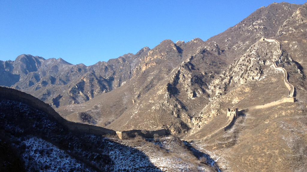
The next two photos were taken from the Wohushan ‘big ridge’ and show the wall above the Sister Towers, the main fortifications on the other side of the river, and a little bit of Gubeikou Village and the Panlongshan Great Wall.

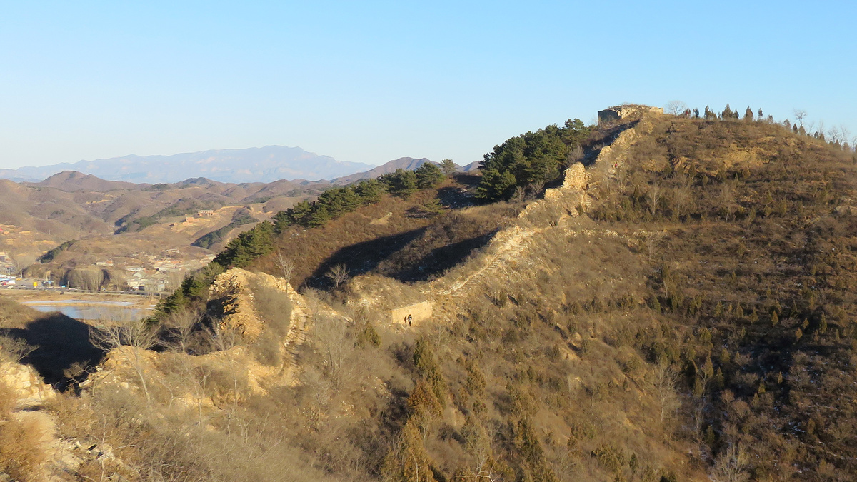
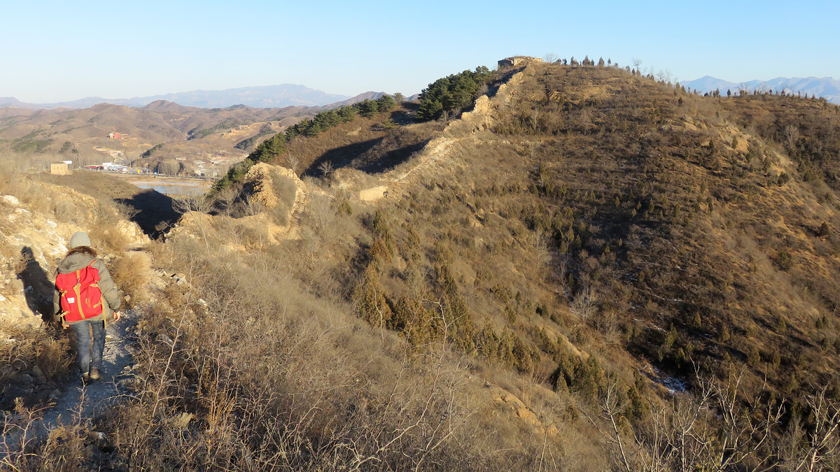
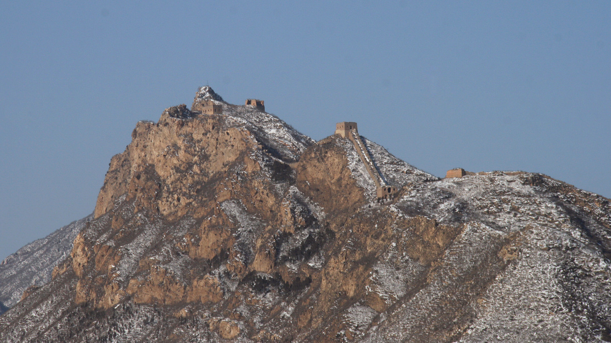
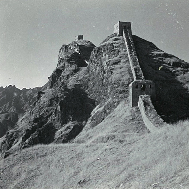
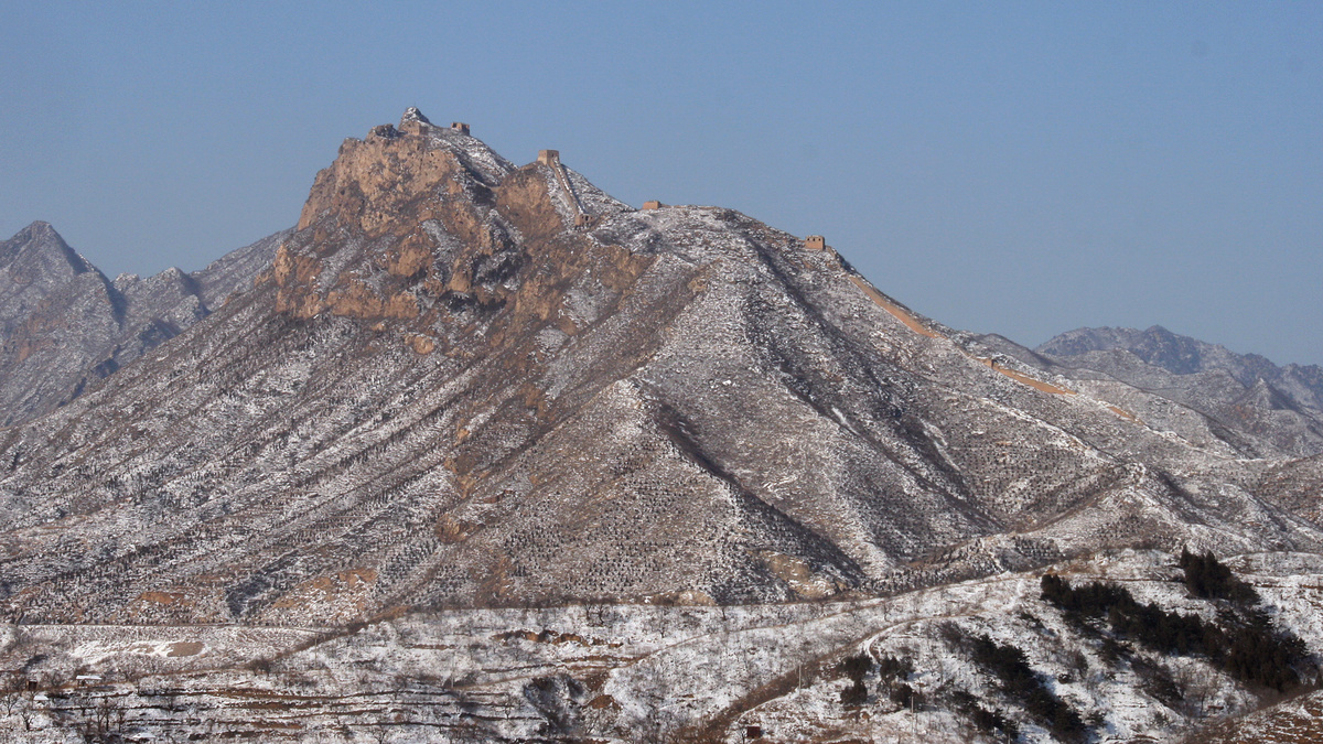
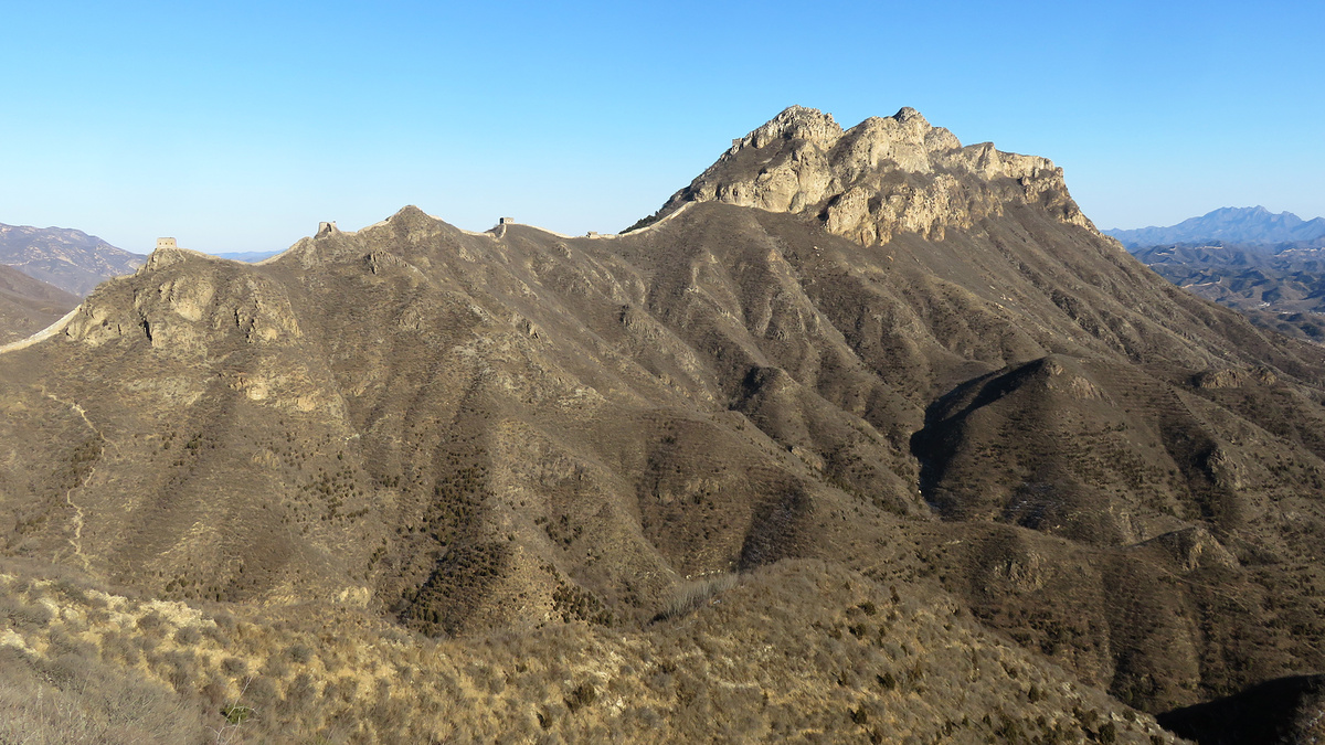
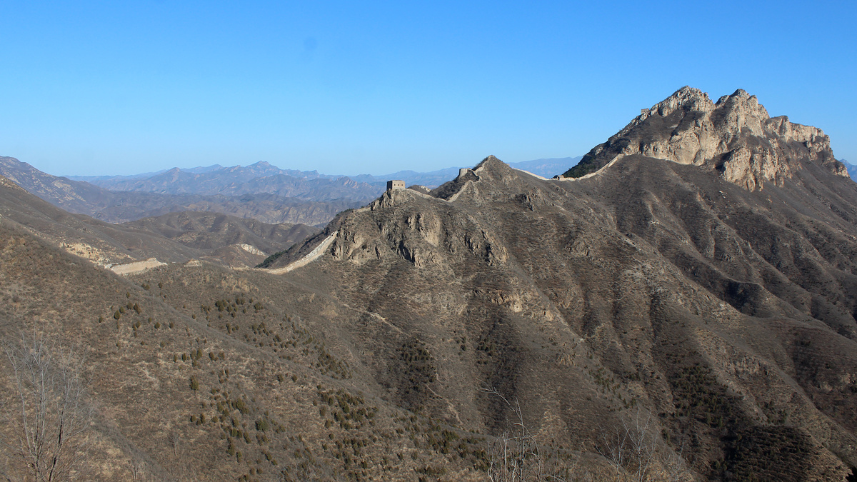
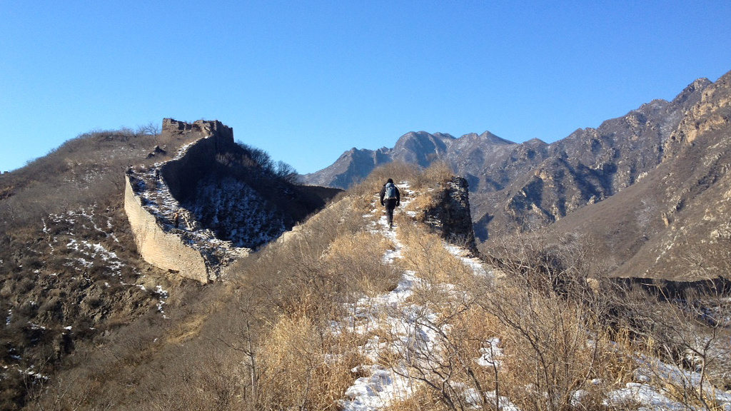
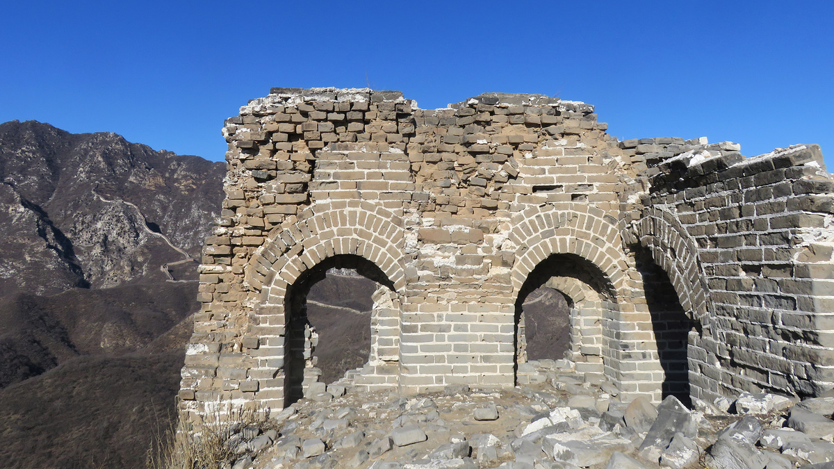
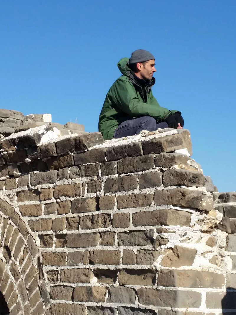
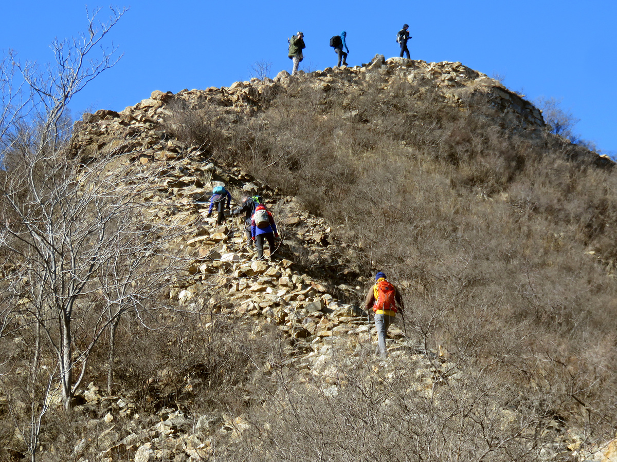
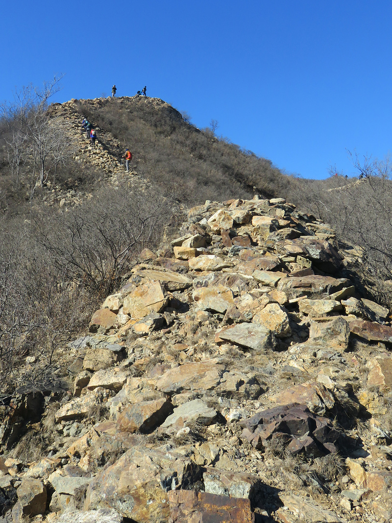
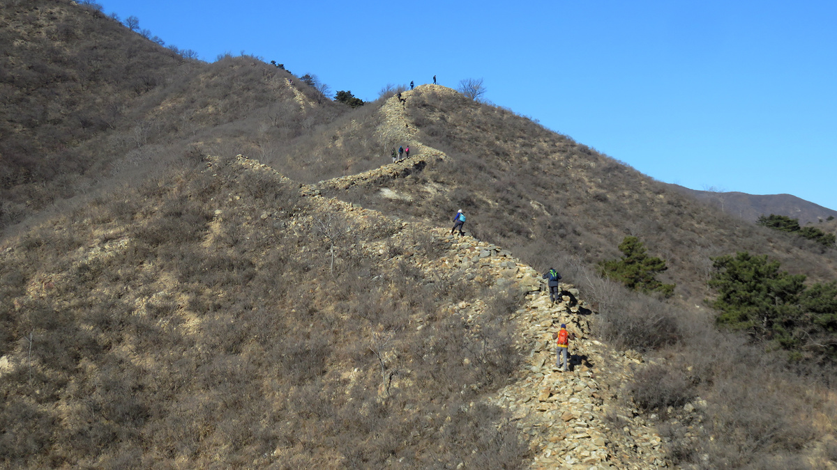
The Wohushan ‘big ridge’ and top towers
This is the main part of the Great Wall at Wohushan, and I’ve never hiked it. Also on the to-do list. The shape of the big ridge is probably what inspired the ‘Crouching Tiger’ name of the mountain.

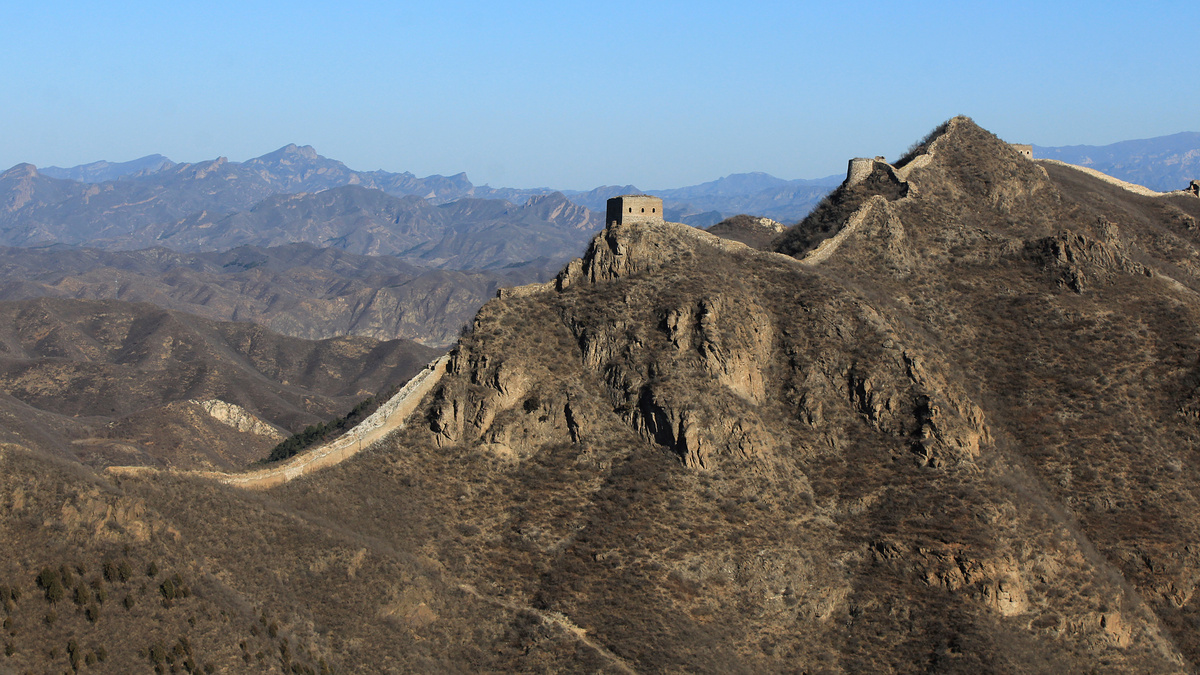
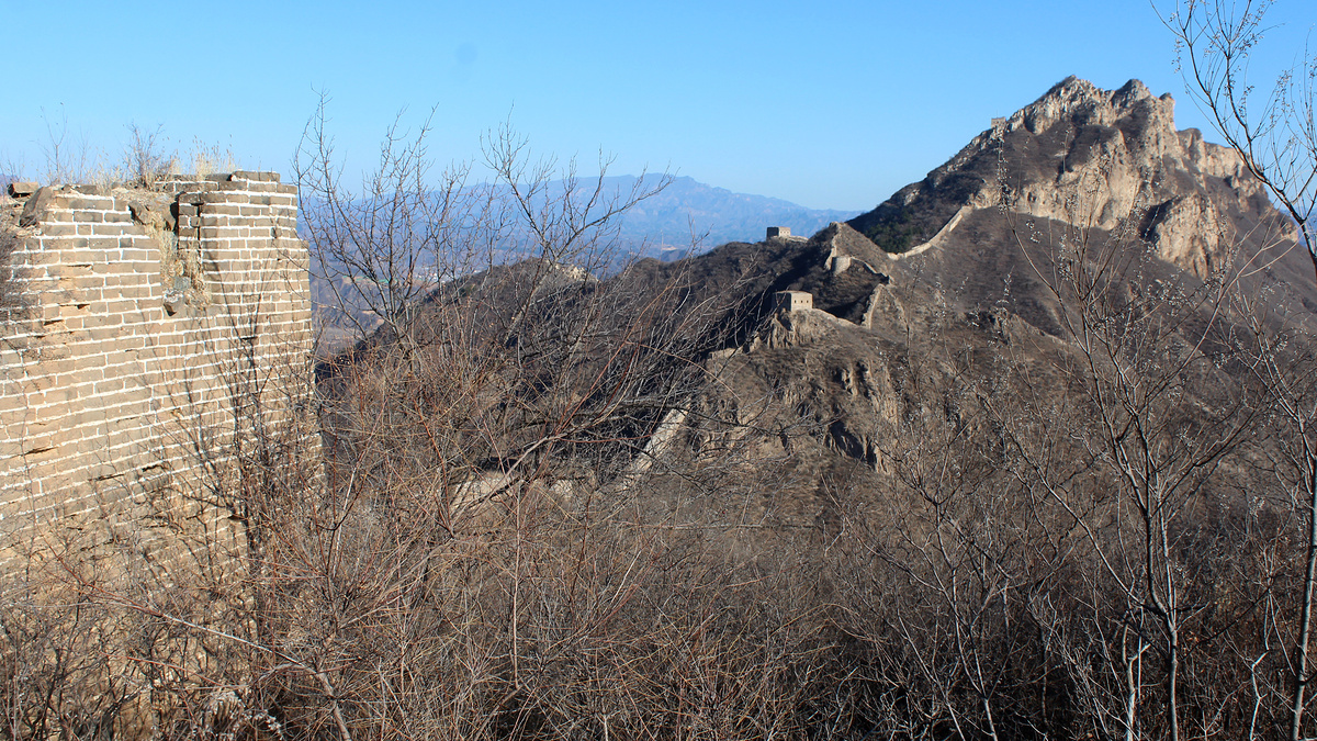
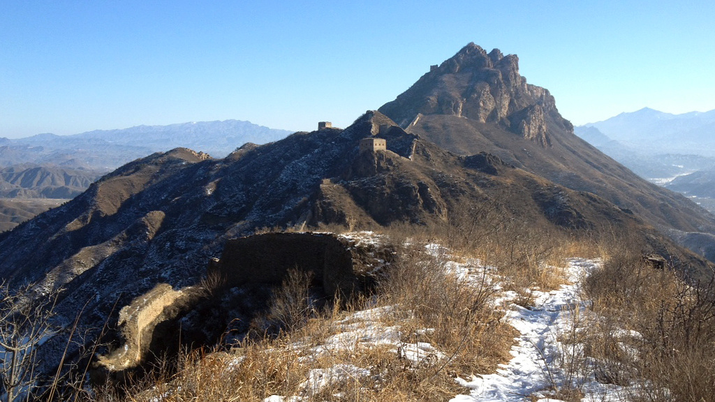
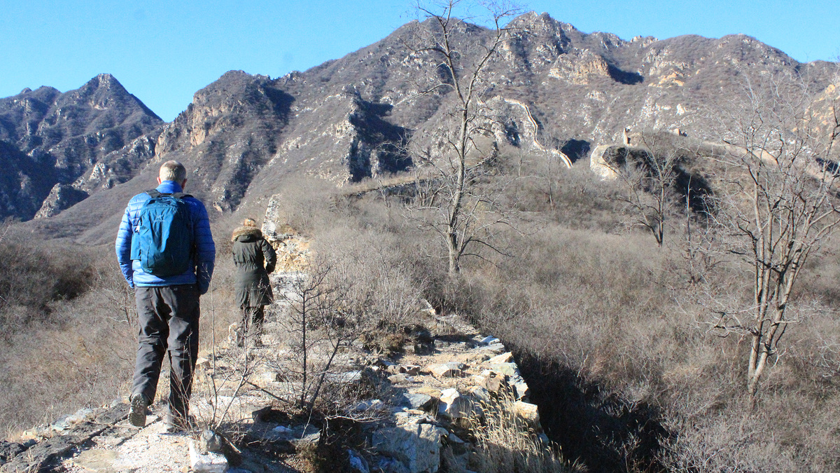
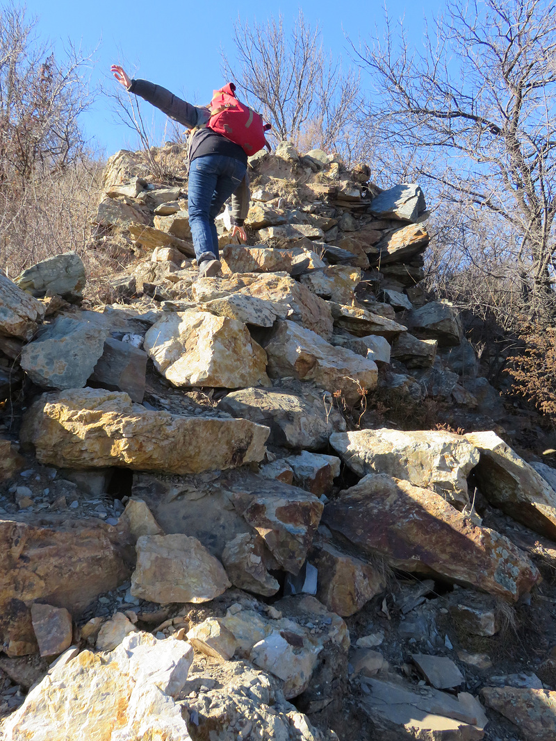
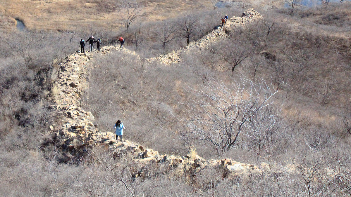
Great Wall behind the big ridge
I’ve hiked the lower section of this part of the Wohushan Great Wall. I haven’t been on the upper section with the round tower.


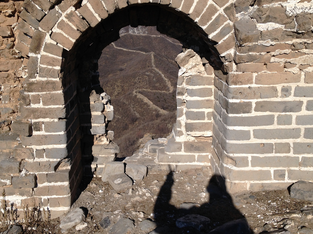
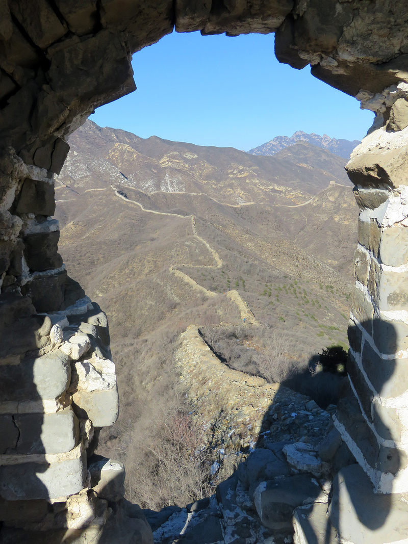
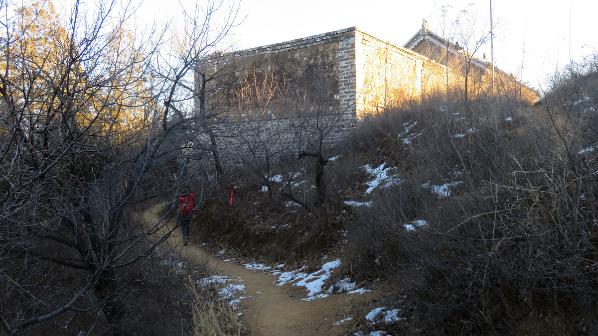
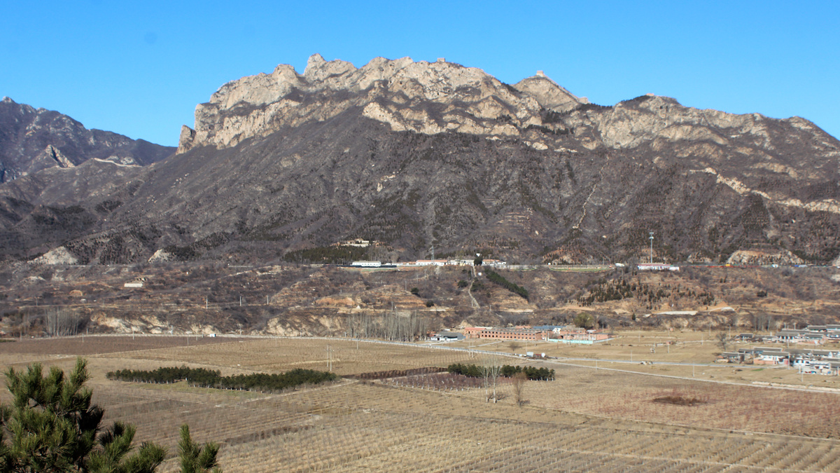
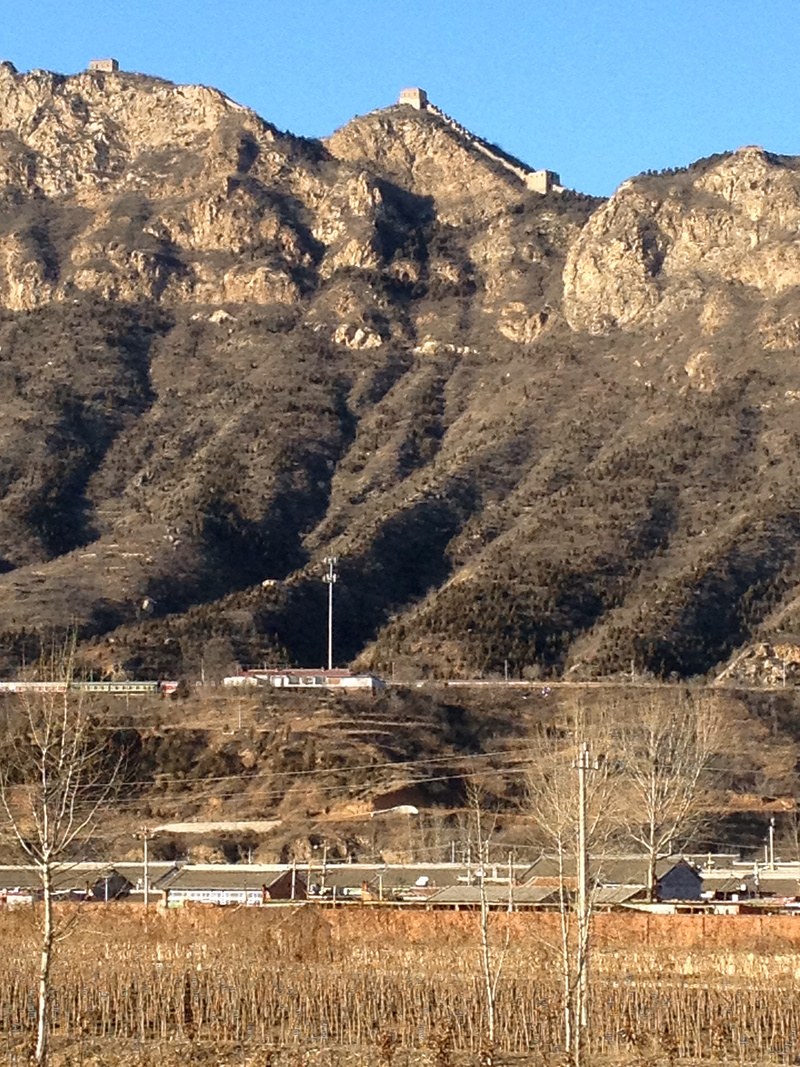
Great Wall above Chaoheguan Village
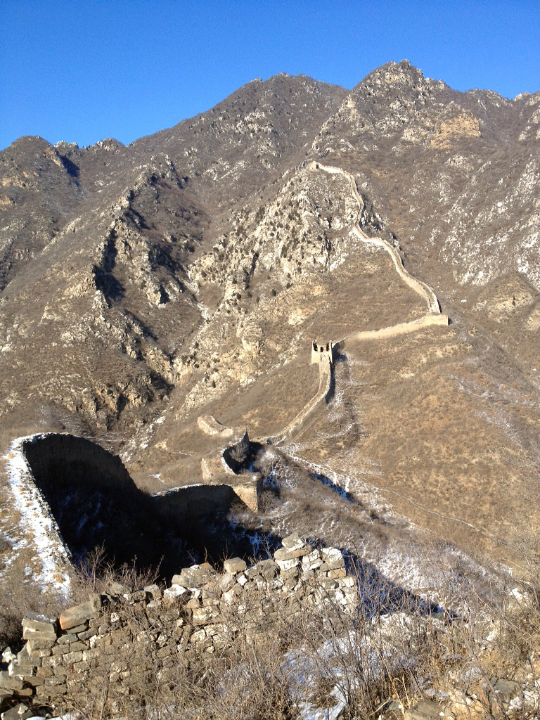
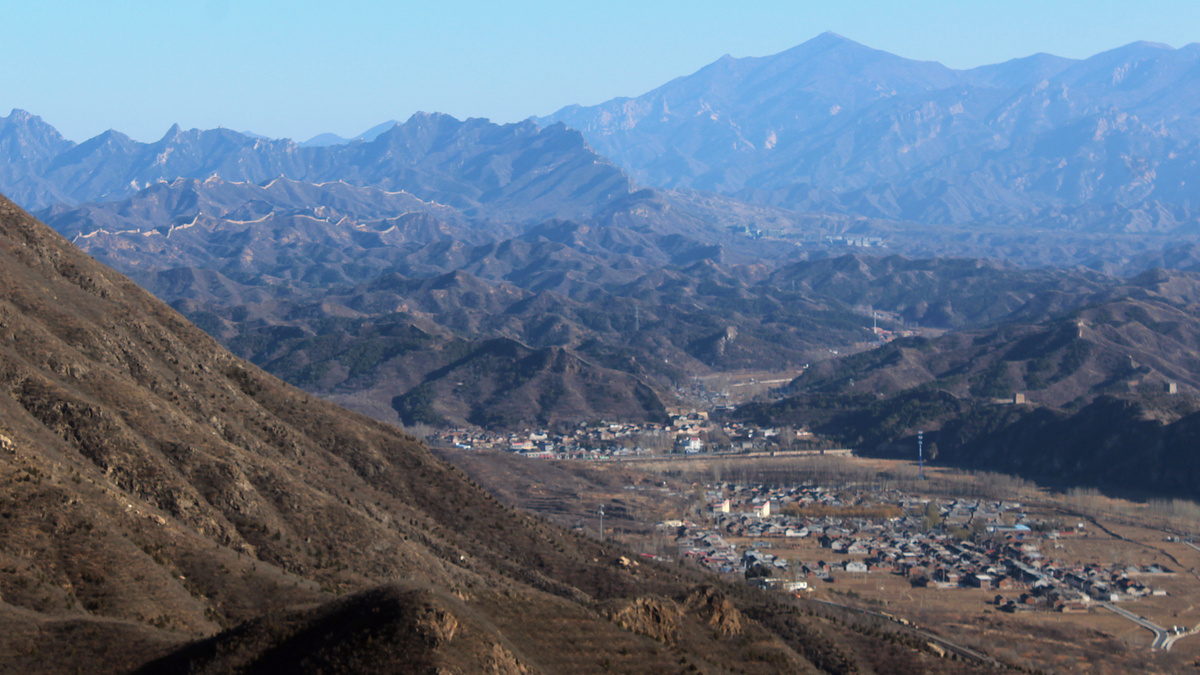
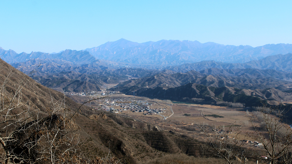
The Great Wall splits at the collapsed tower. The rocky and stony wall you see in the next photos is the part that’s supposed to date back to the Northern Qi Dynasty. (These next few photos are also in reverse order to the direction we were hiking i.e. the first one is nearest the collapsed tower, the last one is nearest the village.)
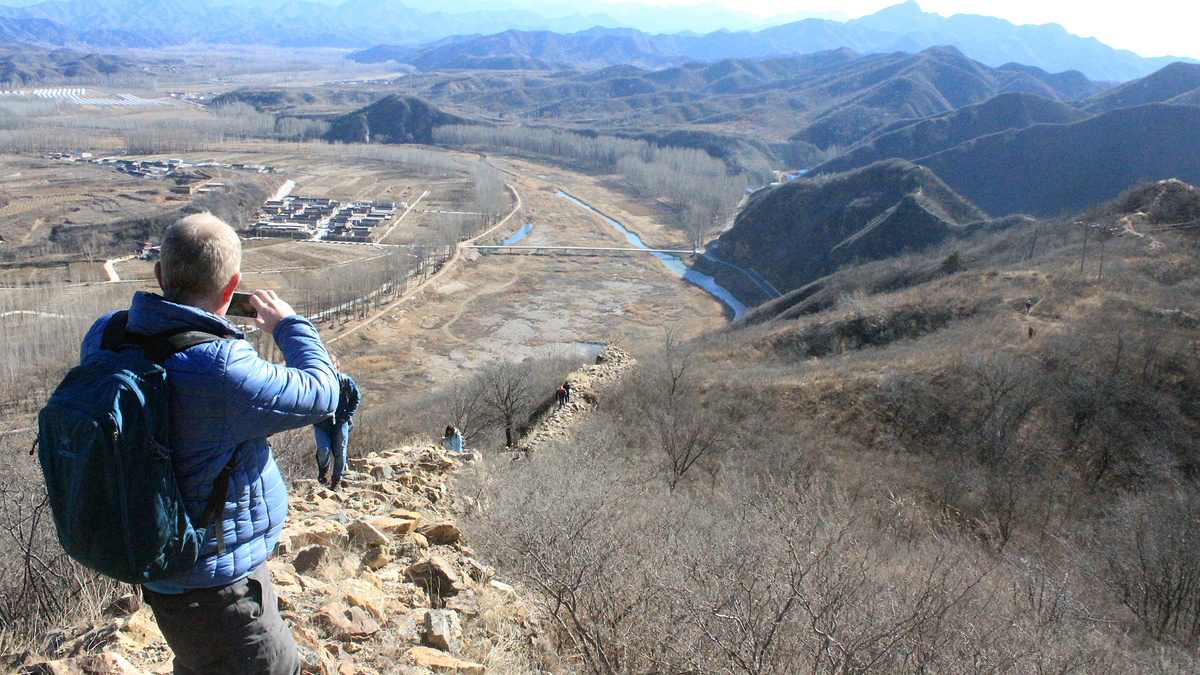
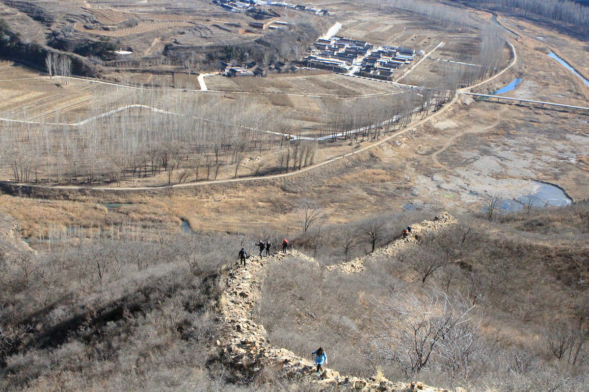
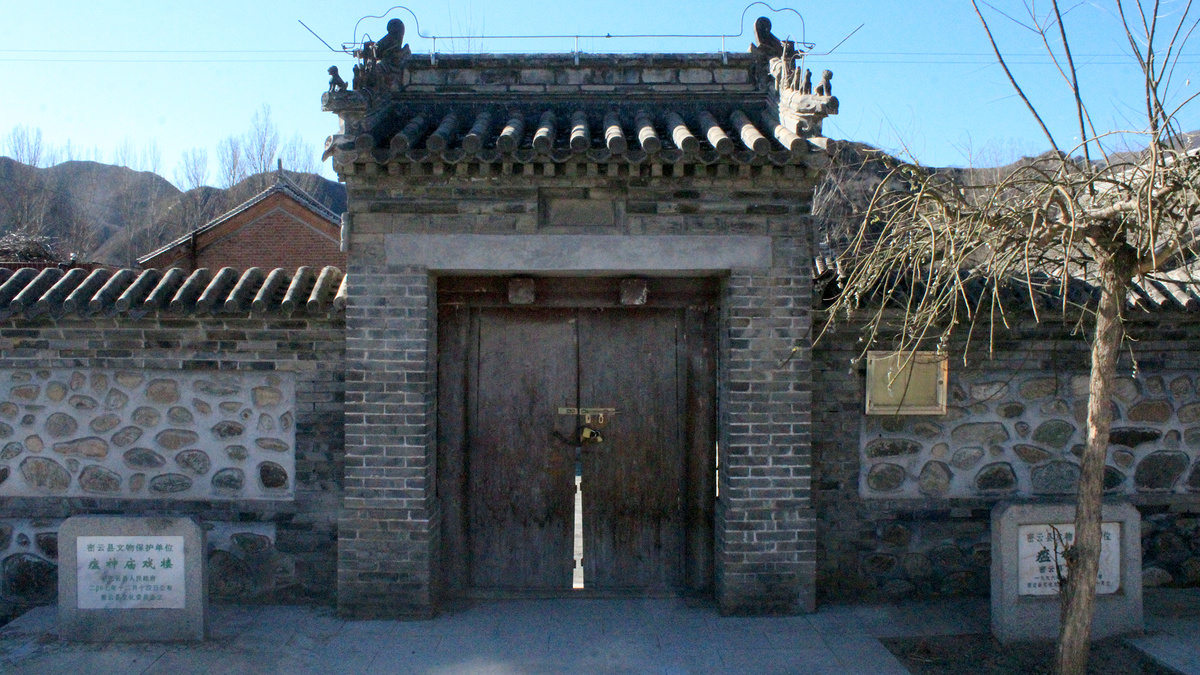
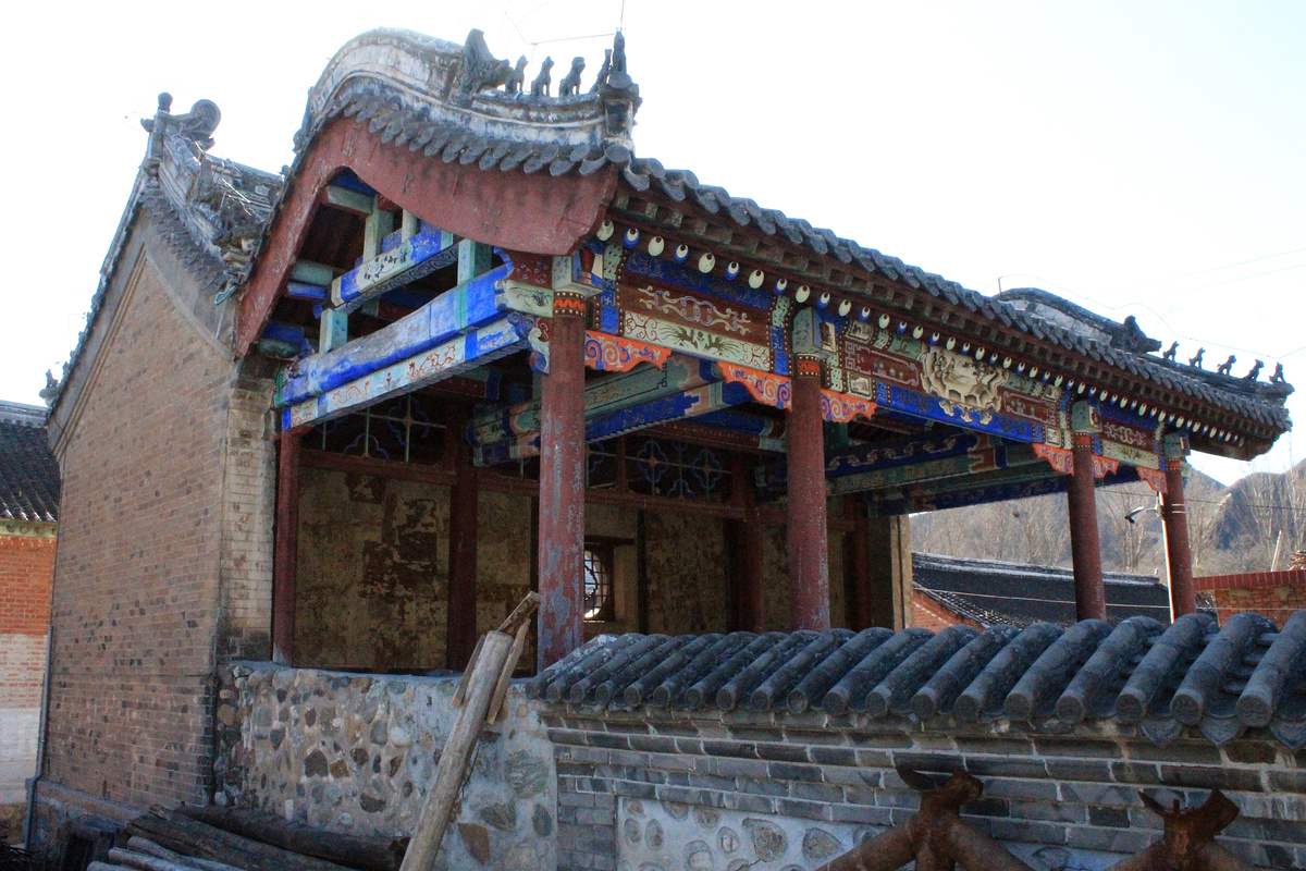
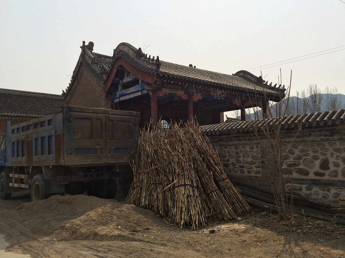
In the preceding photo you can see a small collection of houses in a square shape. That’s Chaoheguan Village, and it used to be a fort. Parts of the walls remain, as well as the Gods of Plagues Temple.
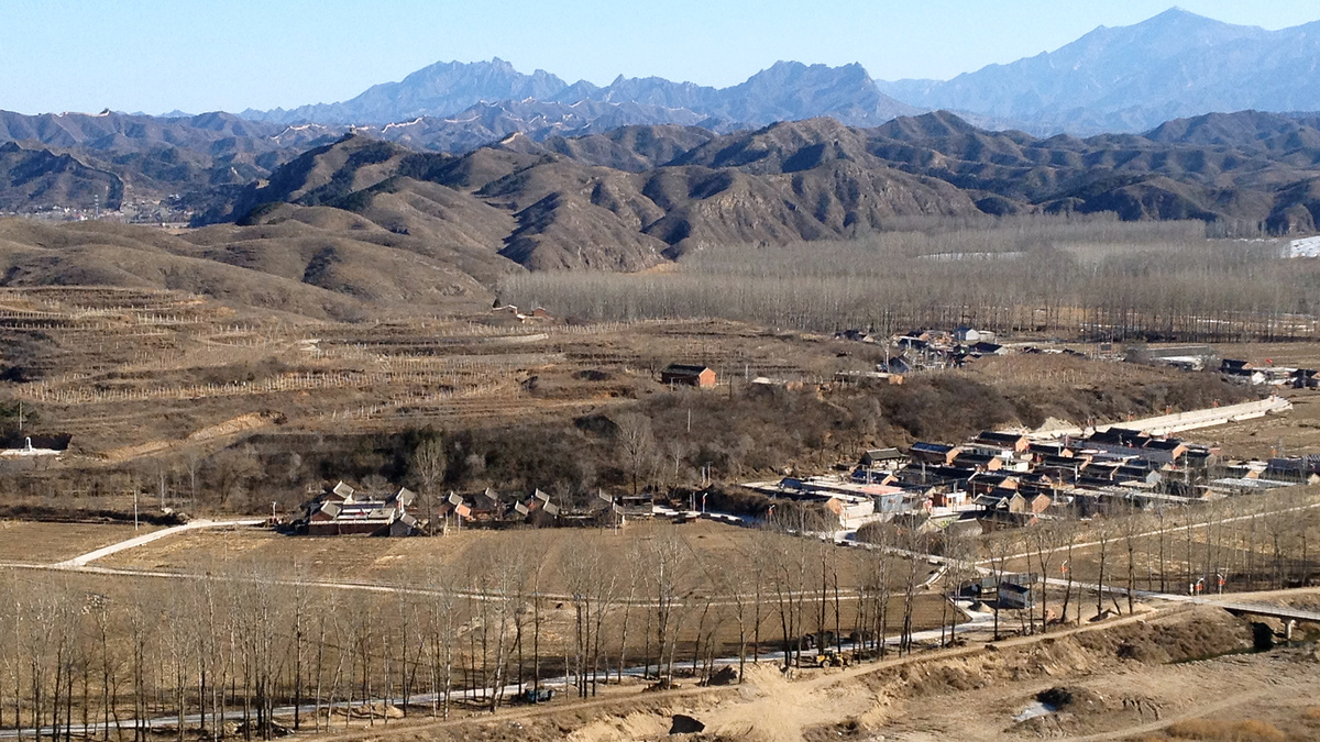
Chaoheguan Village and other views
In Chaoheguan Village there’s a plaque with historical information about the old fort. The brief version is that it was built during the Hongwu period of the Ming Dynasty (1368–1398 AD), it’s a square shape with an area of approximately 155m2, and its old North Gate no longer exists. (Walked through here a few times, haven’t seen a South Gate either.)

Notes and links
Beijing Hikers used to have a hike called the Gubeikou West Circuit, but fire-wardens and fences made it too difficult to reliably get on the wall here, and rascally local guide Old Mr C didn’t help things either.
Gubeikou Great Wall information
Gubeikou Great Wall
Gǔběikǒu / 古北口 / Old North Pass
Wòhǔ Shān Chángchéng / 卧虎山长城 / Crouching Tiger Mountain Great Wall
Jiěmèi Lóu / 姐妹楼 / Sister Towers
Northern Qi Dynasty
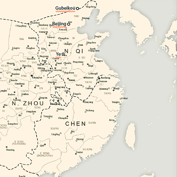
I grabbed a map from Wikipedia that shows the borders of the Northern Qi Dynasty in 572 AD and added some annotations to show the rough location of Gubeikou (right on the northern border), Beijing (at the time called Yan), and Ye (the capital of the Northern Qi).
Maps
Some more of the GPS maps I made for this area.
To-do
- In general: figure out how to dodge the fire-wardens and fences that prevent people from getting on to the wall here
- Visit the Sister Towers
- Visit the three-level Great Wall tower near the Sister Towers
- Hike the Wohushan ‘big ridge’ all the way over past the round tower
- Hike the spur section of the wall behind the big ridge and see if there’s any more wall on that side of the valley
- Sneak into the Forest Park and hike up the Big Eight Towers.