Simatai Great Wall
A collection of photos from various visits to the Simatai Great Wall, plus maps and general Simatai Great Wall info.
What’s in this post?
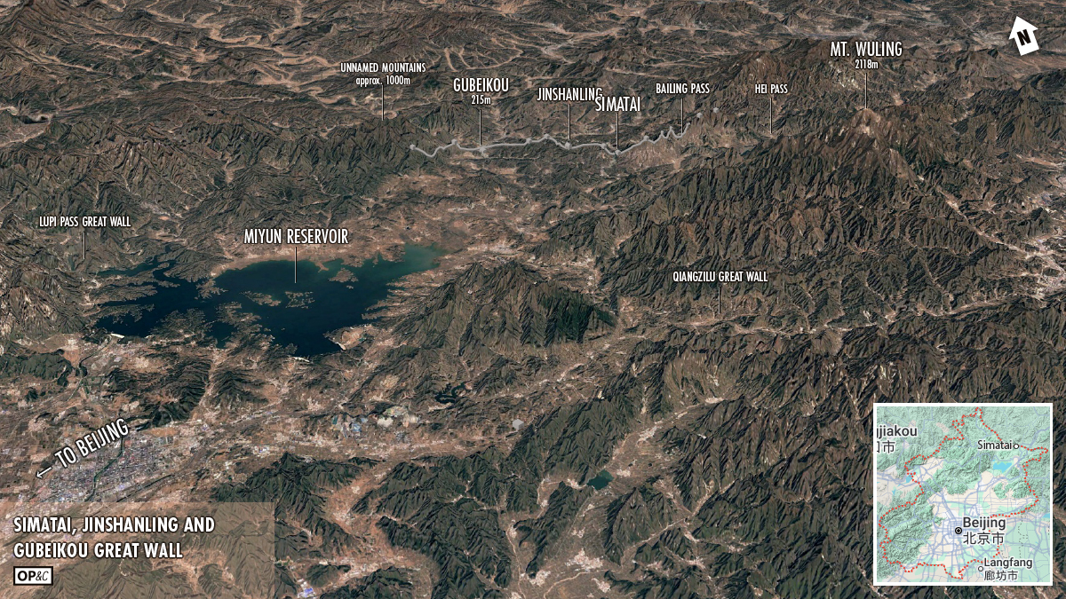
The Simatai Great Wall is near the eastern end of a nearly continuous line of Great Wall that runs from Gubeikou to Hei Pass, blocking the Chao River valley and the passes in an area of low hills in a gap between higher mountains.
The Great Wall at Simatai was first built back in the Northern Qi Dynasty, expanded and reinforced during the Ming Dynasty, repaired again and opened to tourists in 1990, and then made part of a massive tourist attraction in the 2010s.
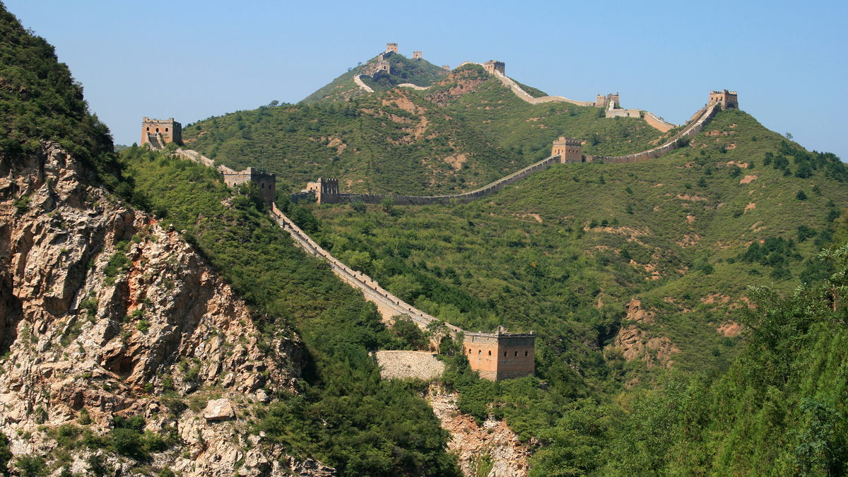
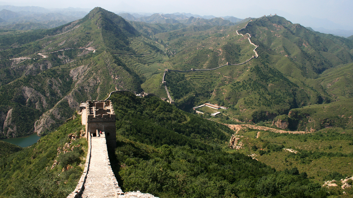
The east side of the Simatai Great Wall peaks on a jagged ridge, with steep and skinny walls climbing to towers atop high cliffs, and some of those cliffs are so steep it seems like a wall would be entirely unnecessary. I don’t have photos of those parts (I haven’t been able to get up there yet) but I do have some information about a raid by a “Twice-Scorned Mongol Woman” that resulted in the orders for those extra fortifications. (More on that further down.)
Here’s a basic introduction to the Simatai Great Wall that I wrote for Beijing Hikers.
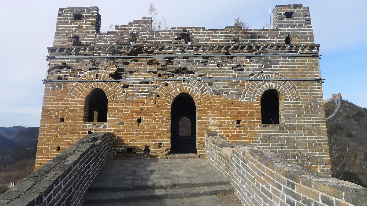
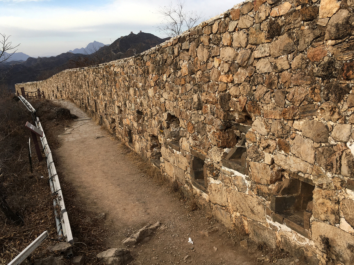
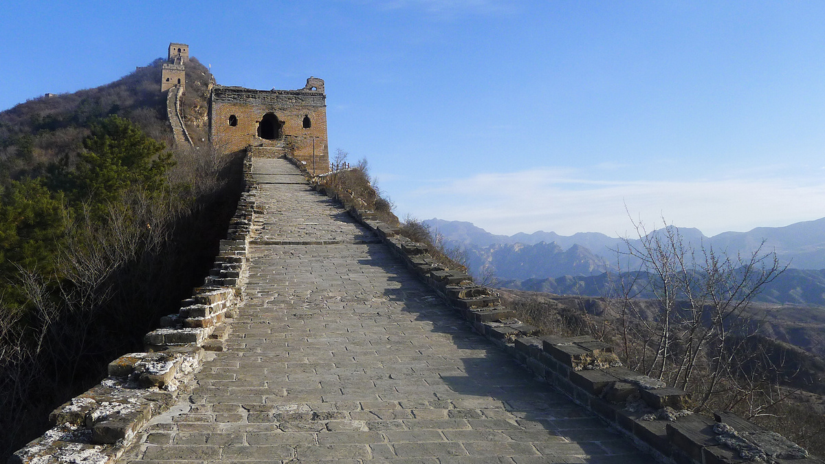
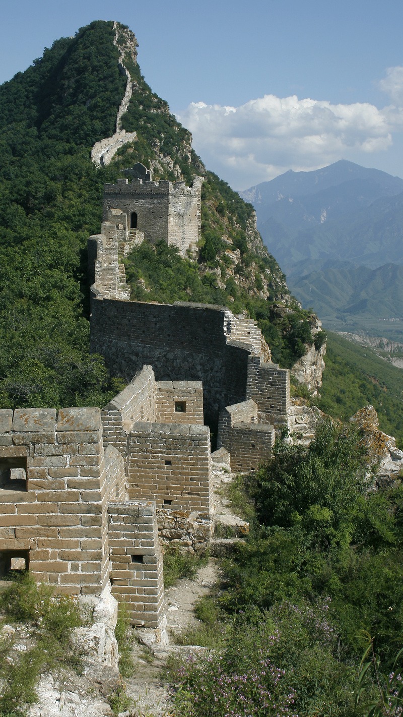
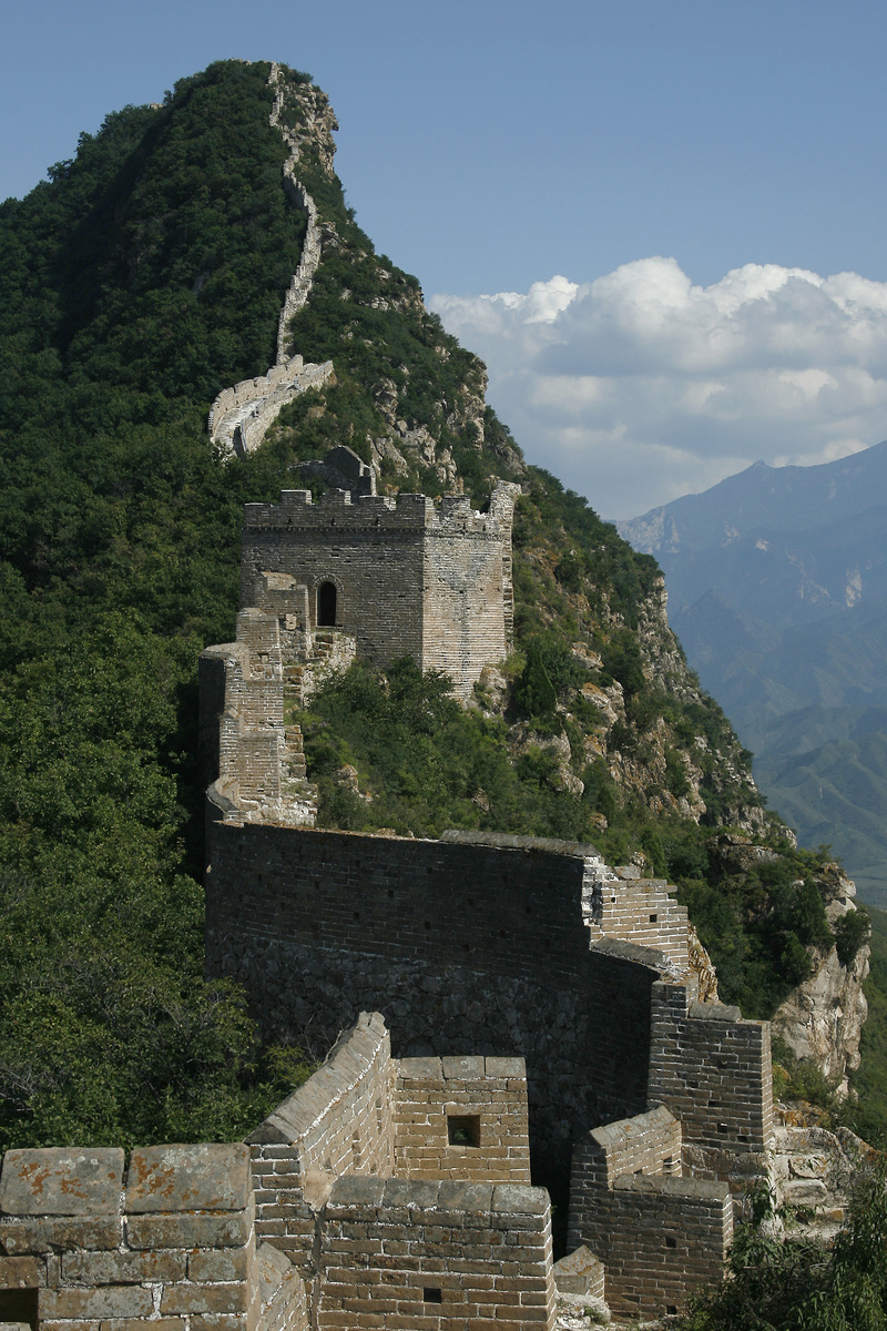
The Simatai Great Wall is an excellent example of what the main sections of Great Wall looked during the peak of the Ming Dynasty—solid foundations cut from local rock and topped by brick battlements, with large, closely-spaced towers that feature interesting architectural touches.
The wall here was repaired and opened to tourists in 1990. Before then, its main construction periods were in the Northern Qi Dynasty (550-577, likely just a low line of rocks and stones), the early Ming Dynasty (late 1400s, built on top of the older Northern Qi wall), and the later part of the Ming Dynasty (1570s, in the style that is seen today).
Interesting architectural features include single-sided walls that cross narrow ridges, and towers with multiple levels, different floor plans, different numbers of windows, and different designs for the roofs and doors.
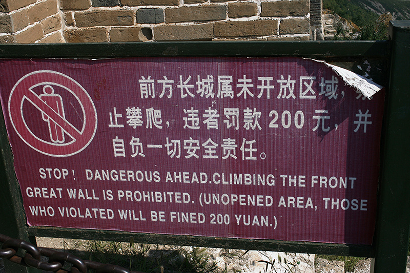
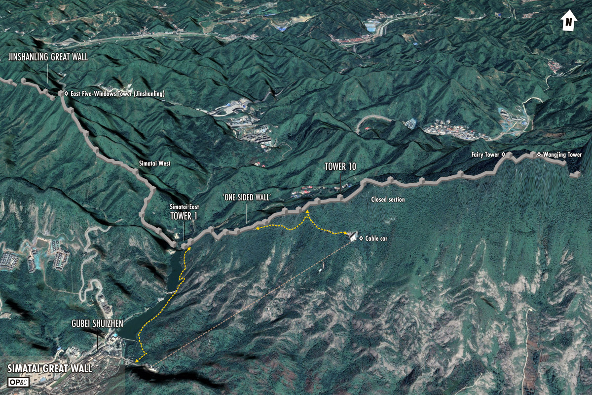
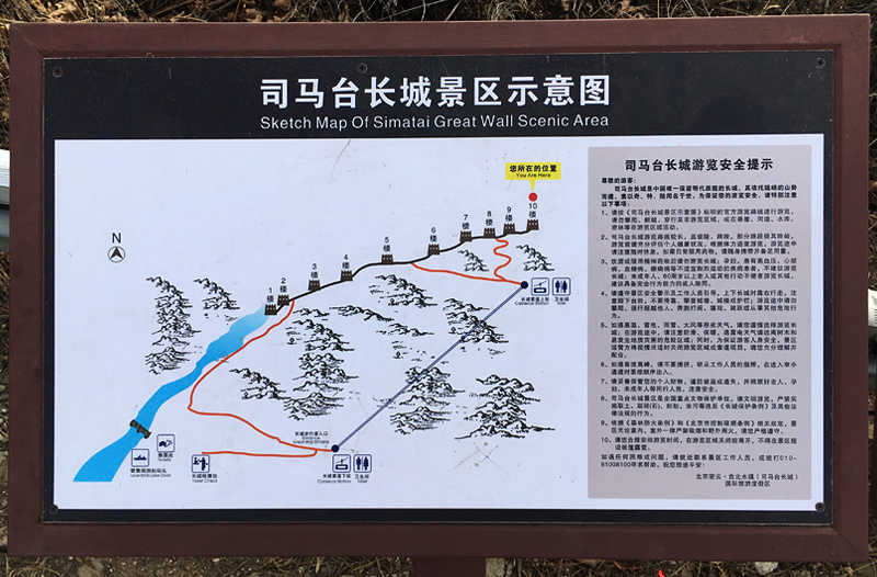
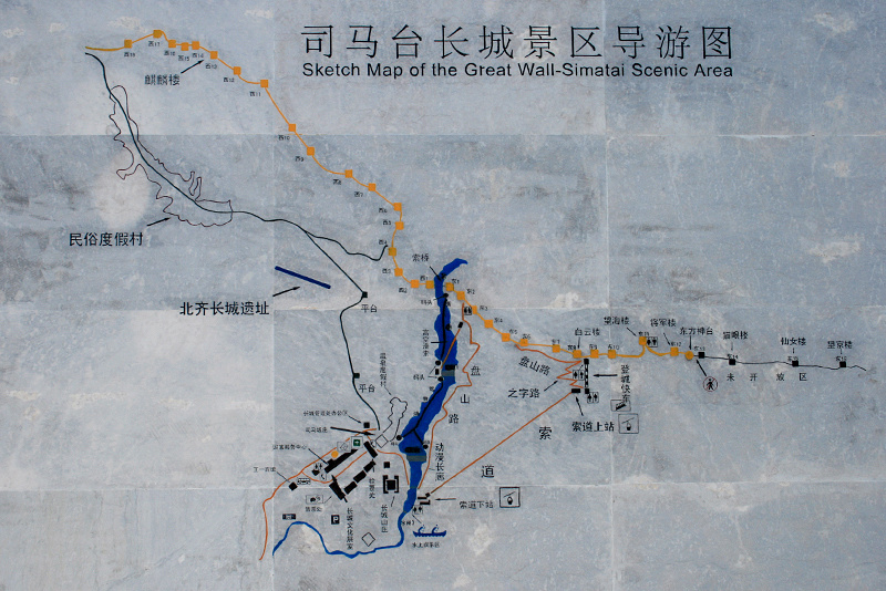
In 2010 the whole area below the Simatai Great Wall was closed down for its transformation into the Gubei Shuizhen. Currently only the first ten towers on the east side of Simatai are open to visitors, which means the most famous (and dangerous) parts – Fairy Tower, Wangjing Tower, the Sky Ladder – are off-limits.
Simatai Great Wall and the Gubei Shuizhen Lantern Festival Fair (www.beijinghikers.com)
That covers most of it pretty good.
Below is a collection of photos that shows nearly all of the Simatai Great Wall—the top of the west side, the middle of the west side, the first ten towers on the east side, and then a few more from near Towers 11 and 12 on the east side.
You’ll see some shots from a January 2023 visit, a few from a hike in from the Jinshanling side in June 2021, plus a couple borrowed from HJ, who had extremely nice weather on a 2009 visit to the top section of the east side of Simatai.
The photos from 2023 and 2021 were taken with the Leica D-LUX 5 and the old iPhone SE; photos from 2009 were taken with HJ’s huge Canon-something-or-other DSLR.
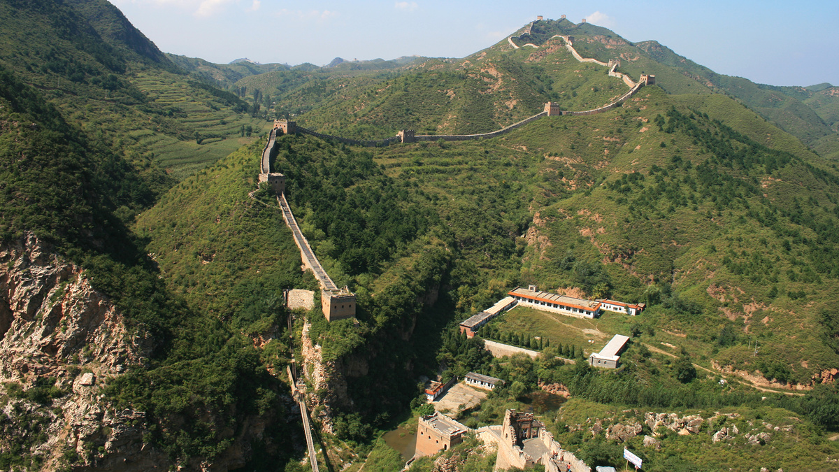
Simatai Great Wall west side
Between the eastern end of the Jinshanling Great Wall and the western end of the Simatai Great Wall there’s a stretch of 3-4 towers that is a sort-of no-man’s land between the two ticketed areas.
From Jinshanling’s East Five-Windows Tower (the official eastern end of the Jinshanling Great Wall) you can hike out for a look. You can go three towers out without getting in trouble; past the fourth tower you’ll probably be met by the guards at the Simatai end and asked to head back.
Before 2010 you could continue down the wall to Simatai’s west side.
In 2023 we visited the west side on a ‘site inspection’.
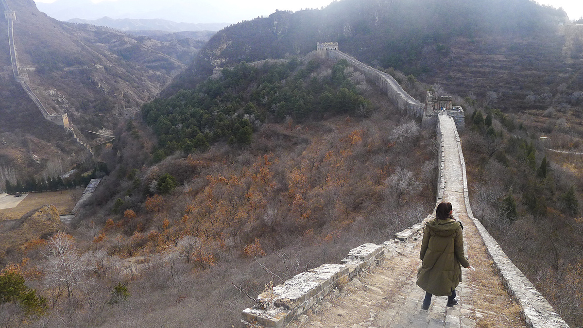
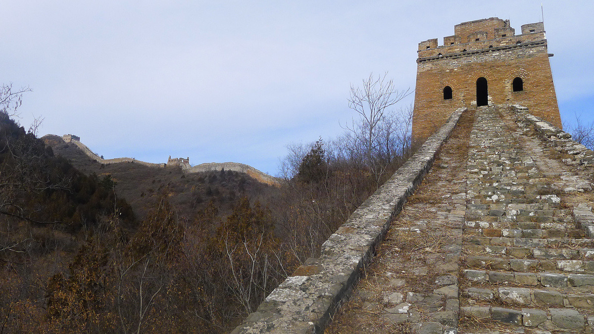
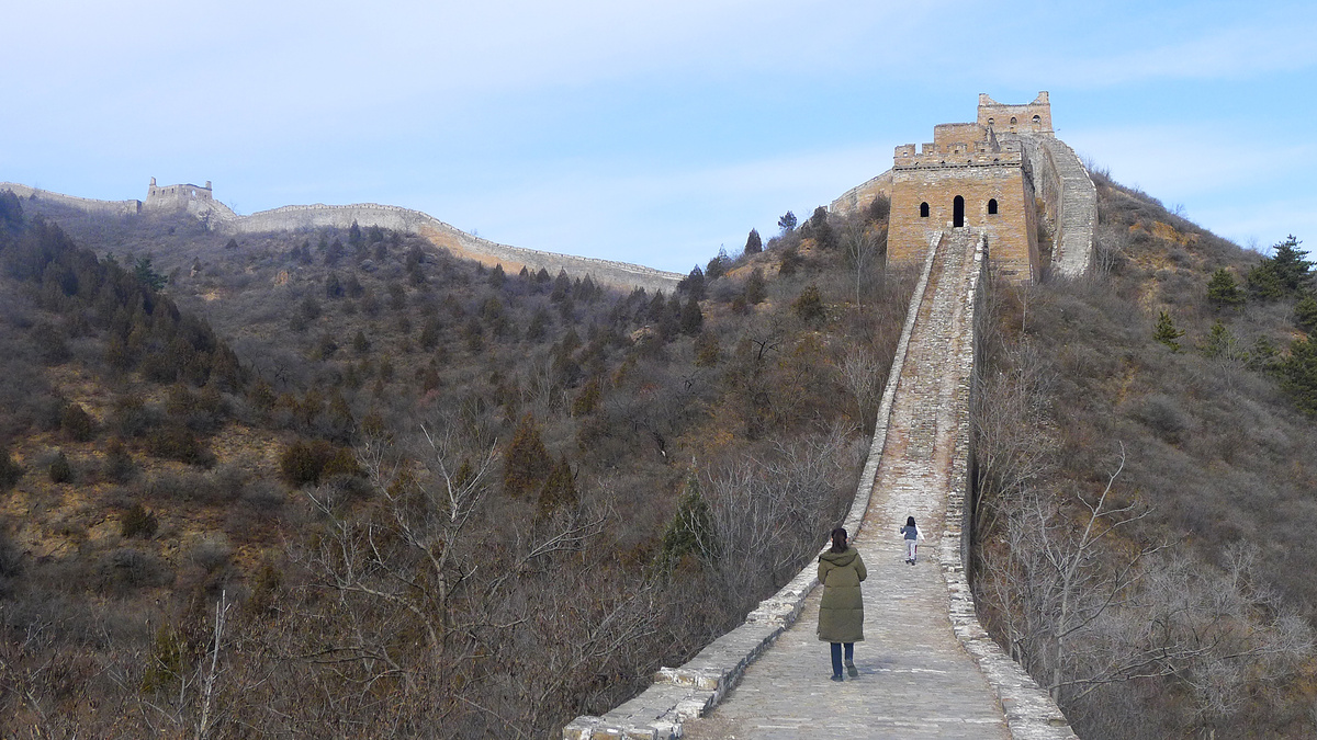
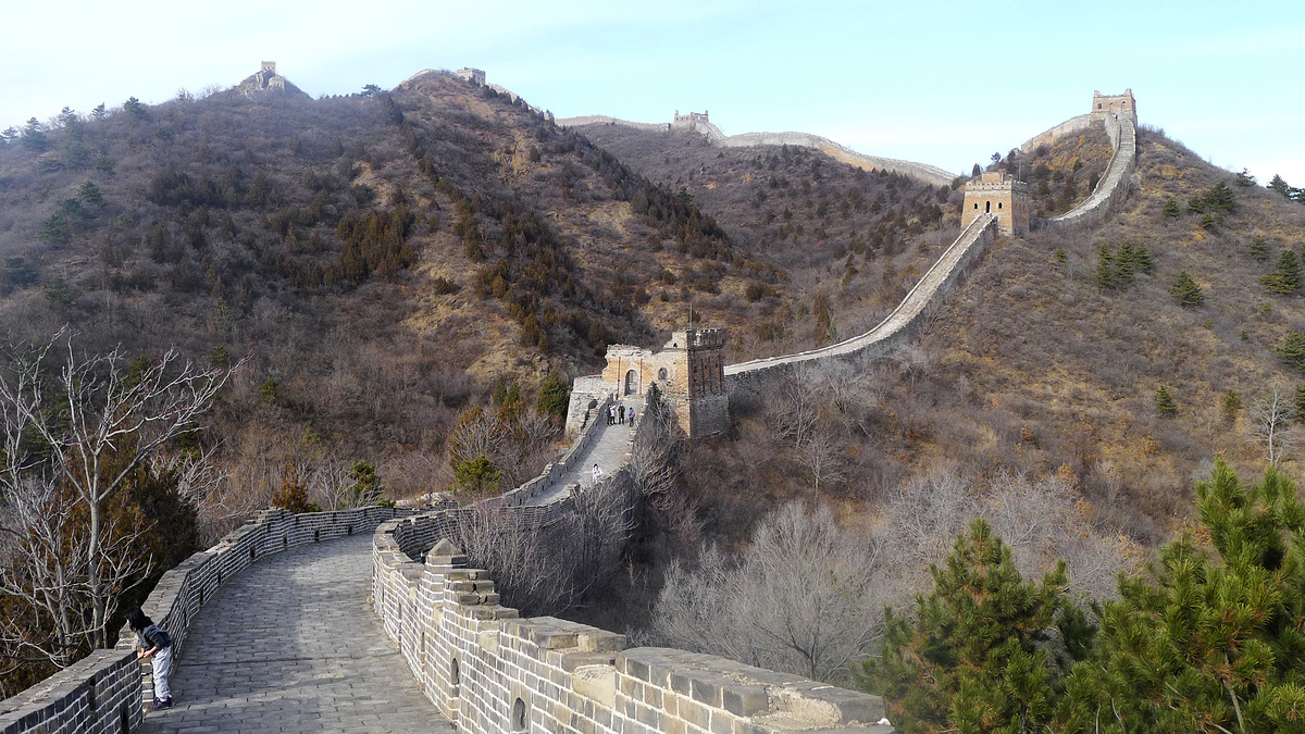
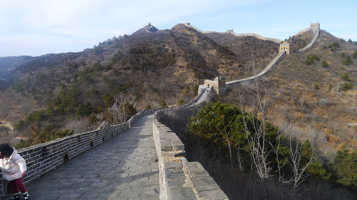
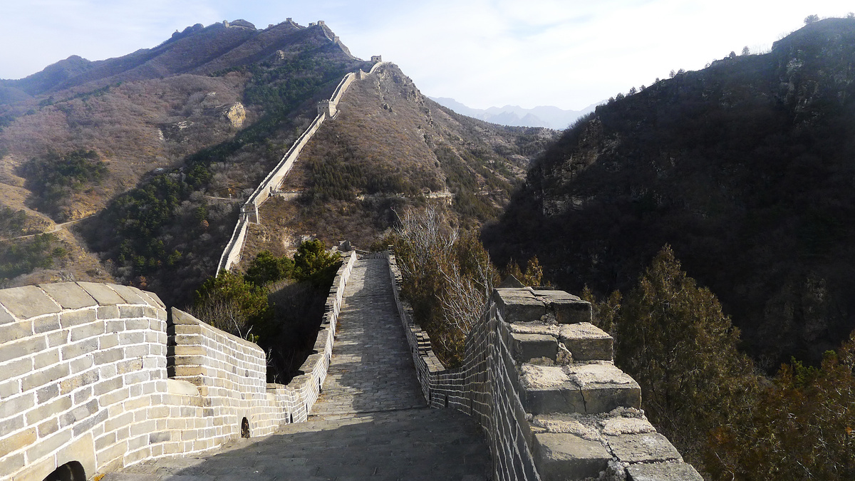
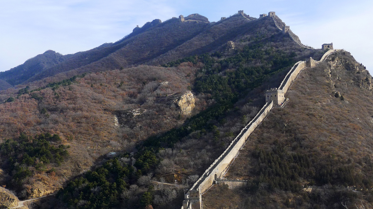
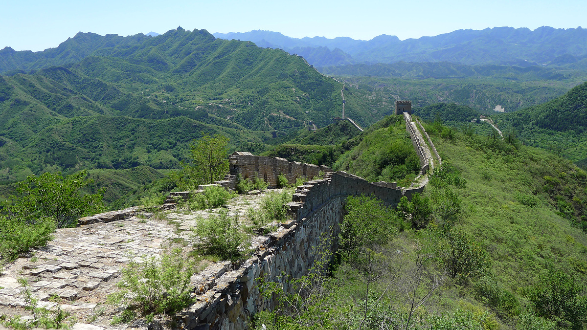
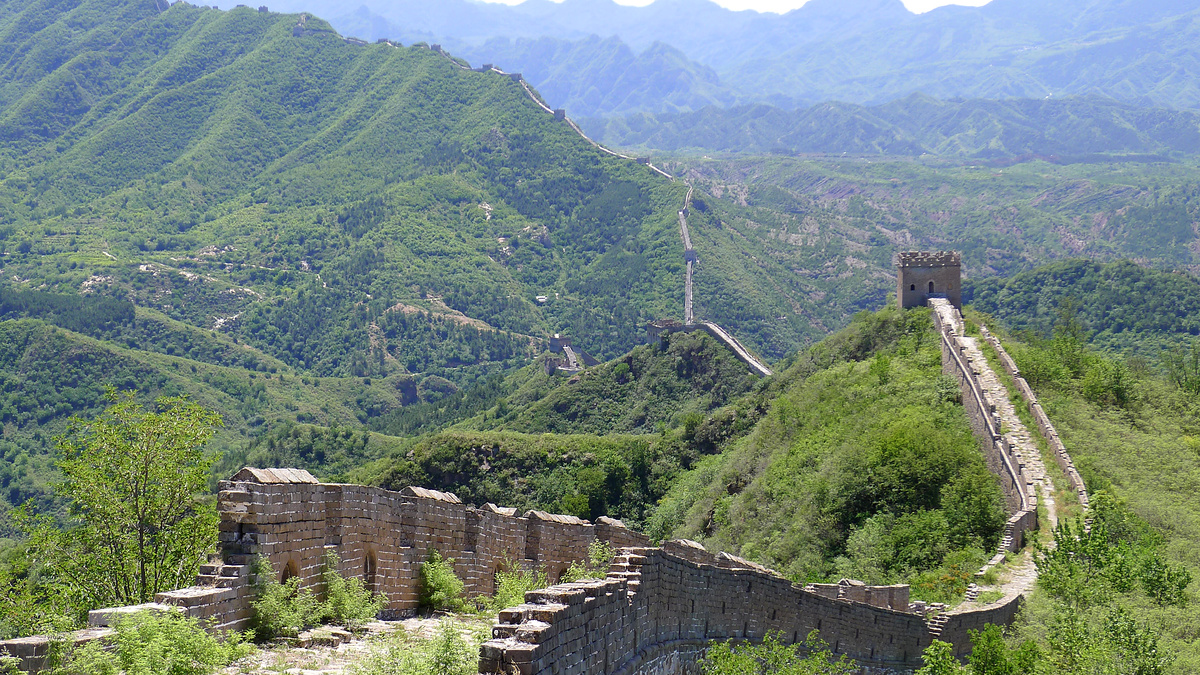
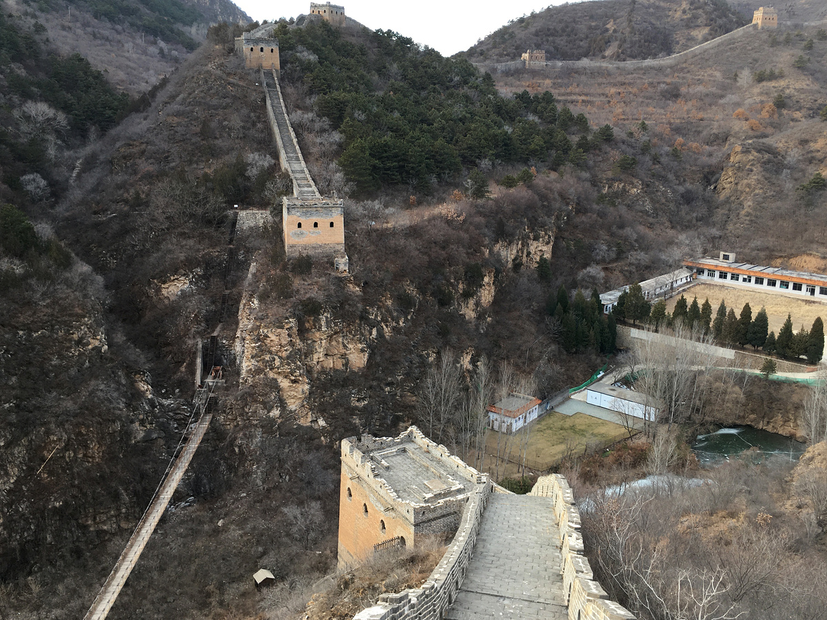
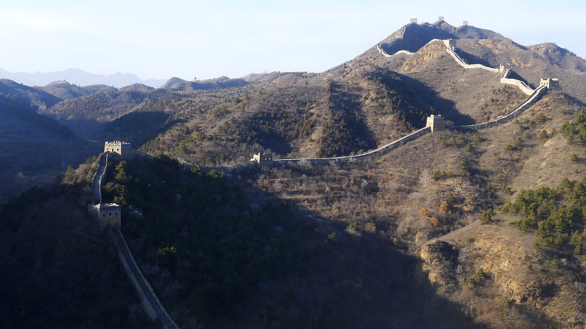
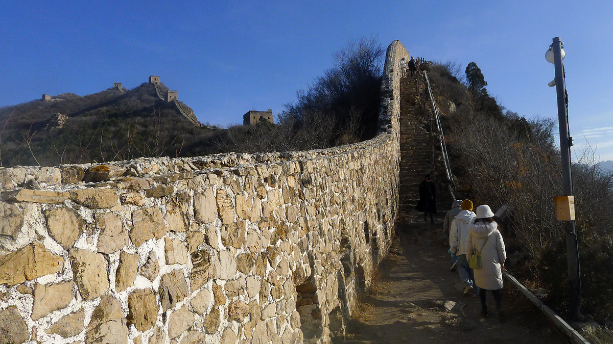
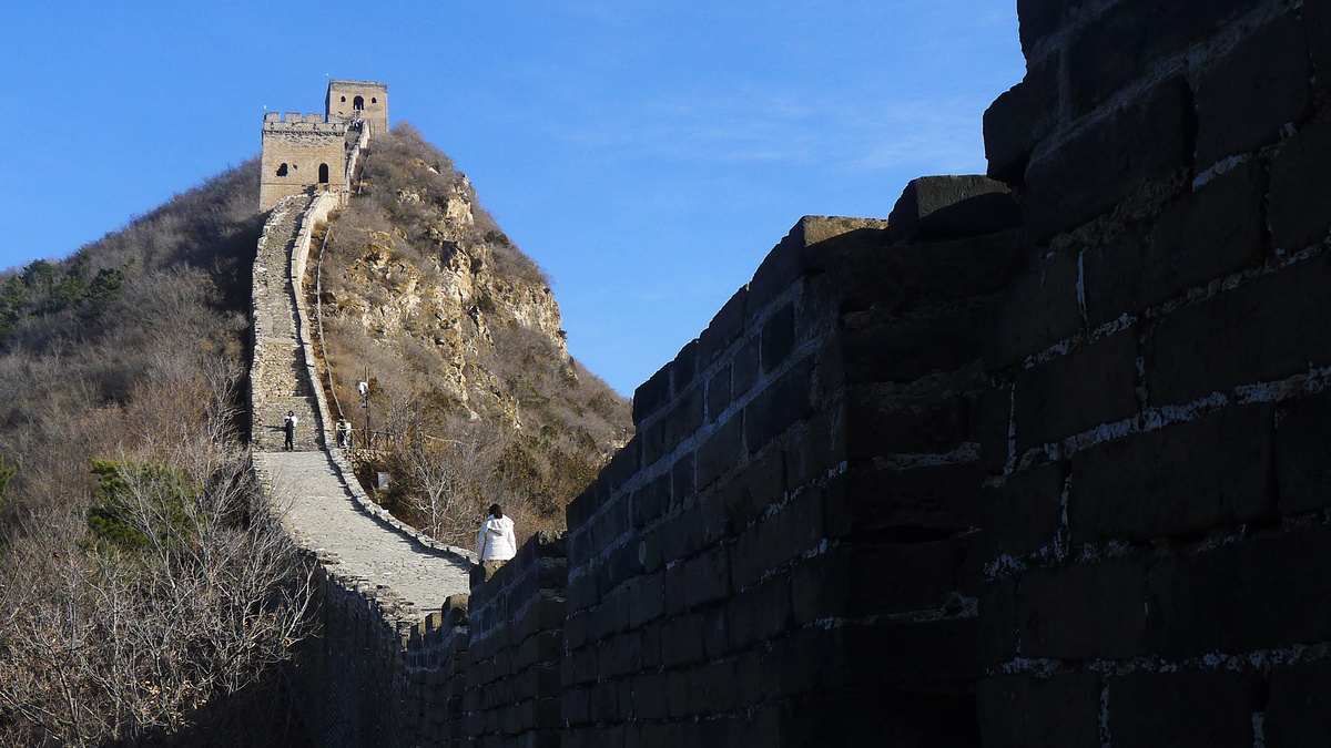
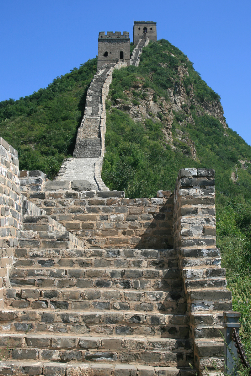
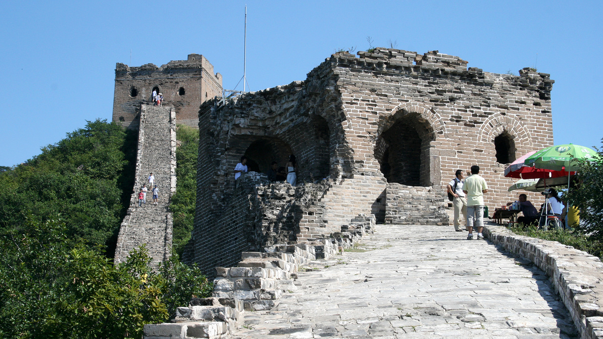
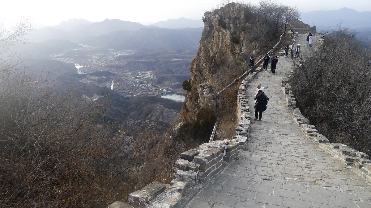
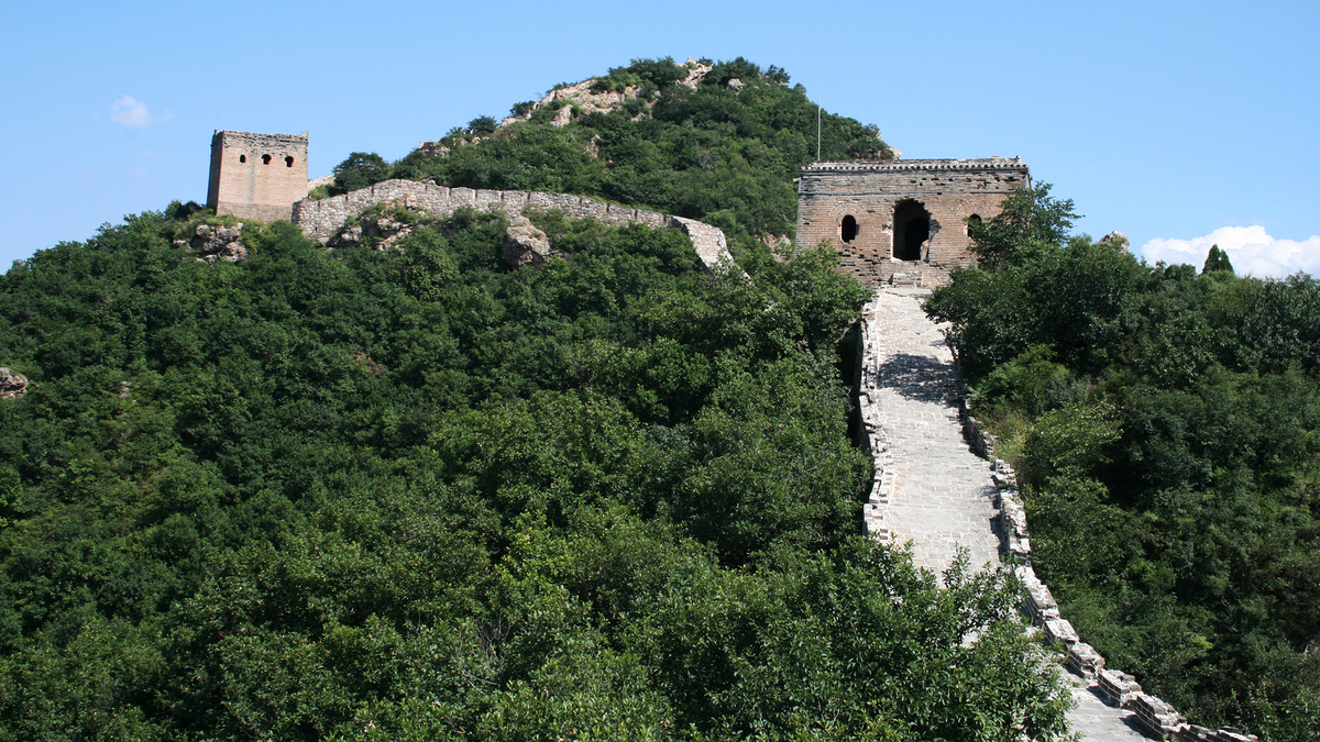
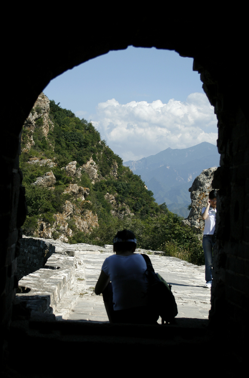
Simatai Great Wall east side
The next lot of photos were taken on the way up the east side of the Simatai Great Wall.
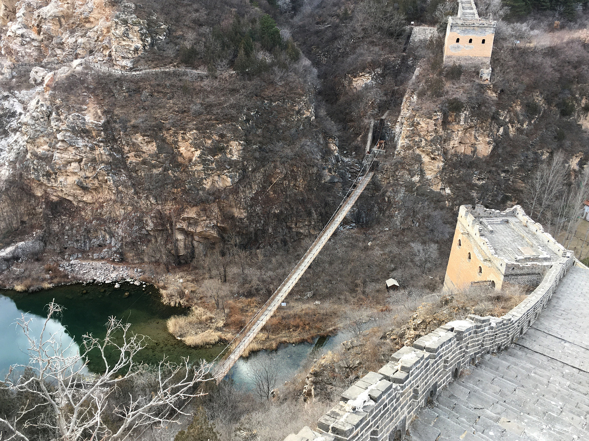
Before 2010, if you were coming down from the west side of Simatai, you could pay a 5 RMB toll to the bridge guy and continue up along the Great Wall on the east side.
Not any more. Simatai’s west side isn’t open for visits, and the paths to the bridge are blocked.
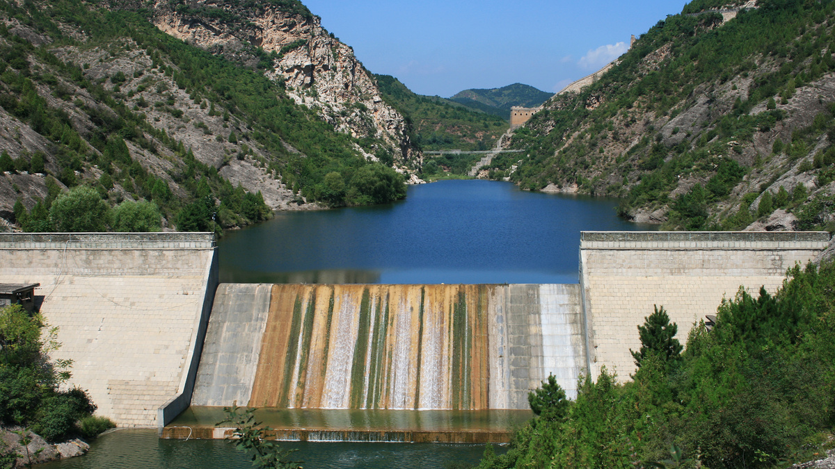
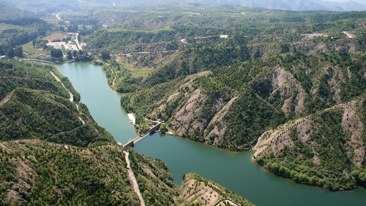
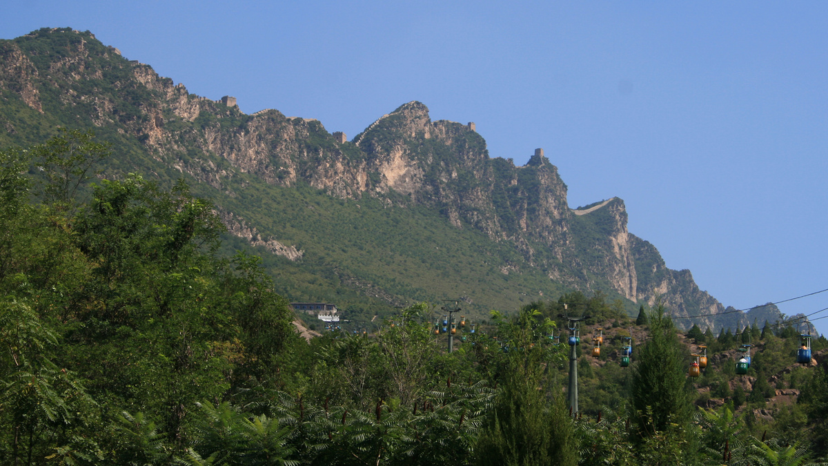
Nowadays, to get on to the east side of the Simatai Great Wall, you hike up from the Gubei Shuizhen, following the path beside the reservoir. (Or you take the cable car straight up to the top section instead of doing all the stairs.)
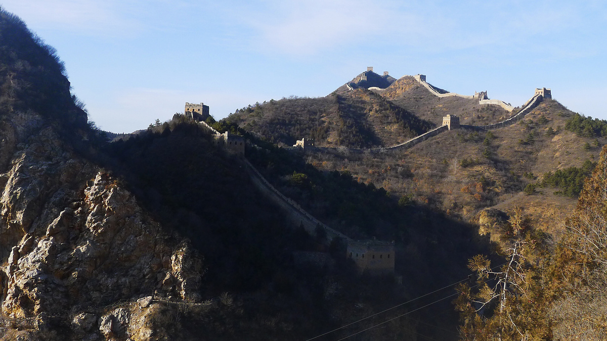
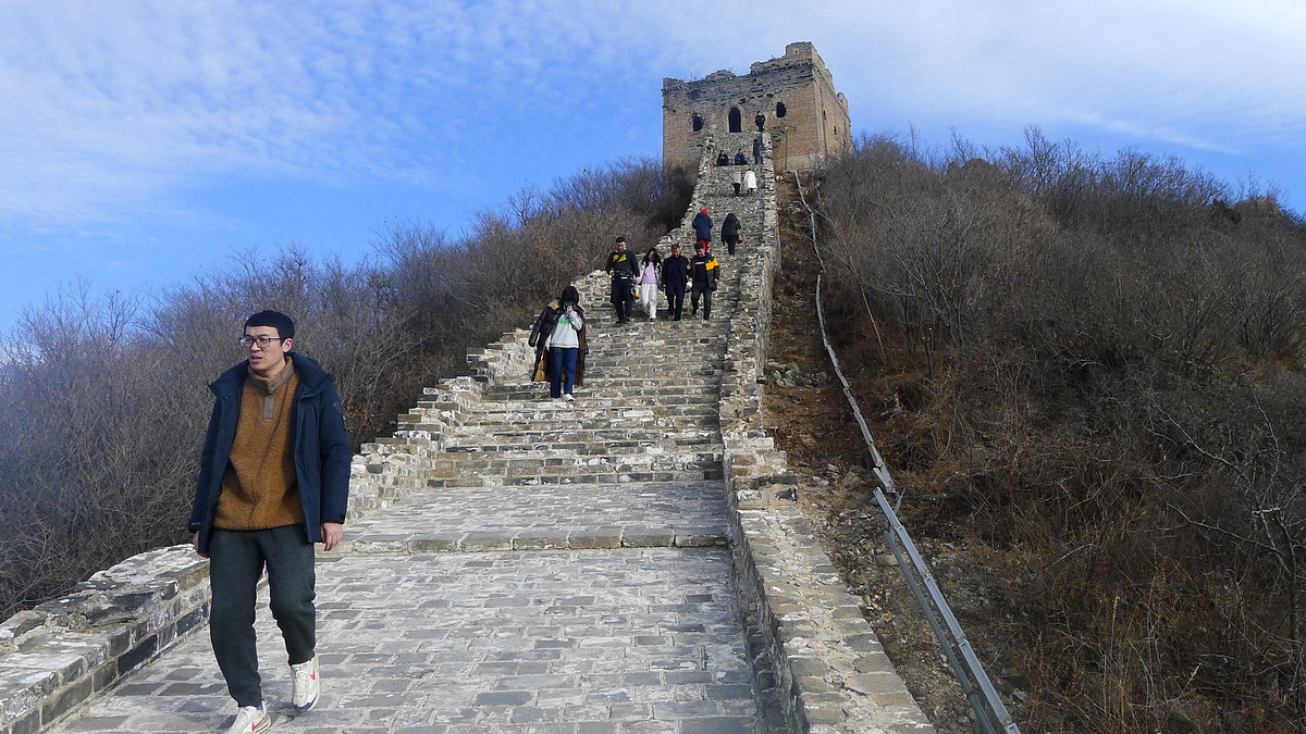
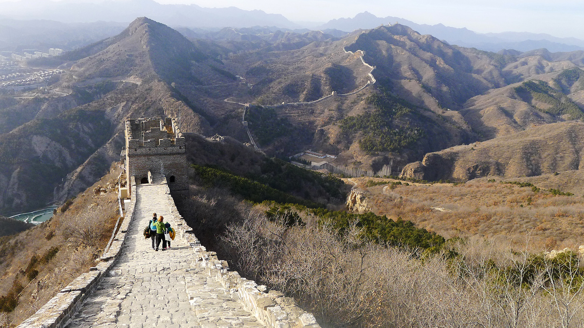
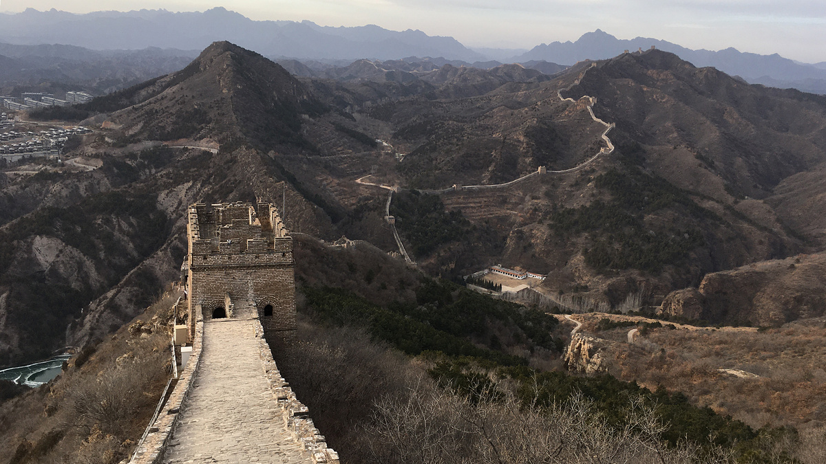
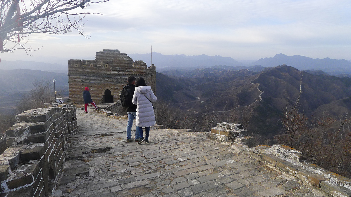
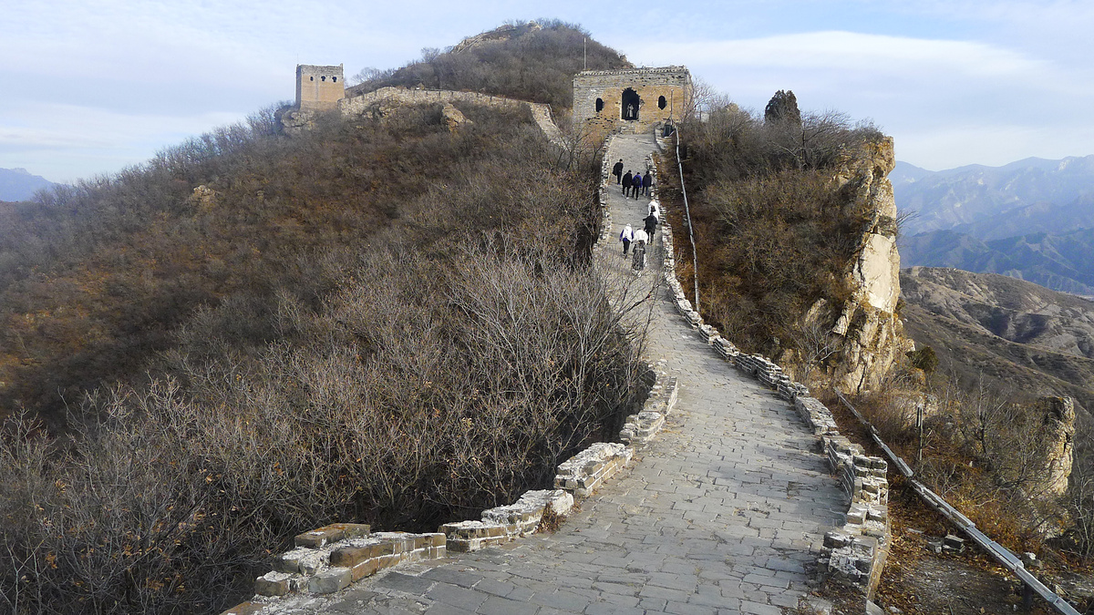
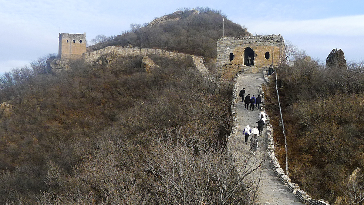
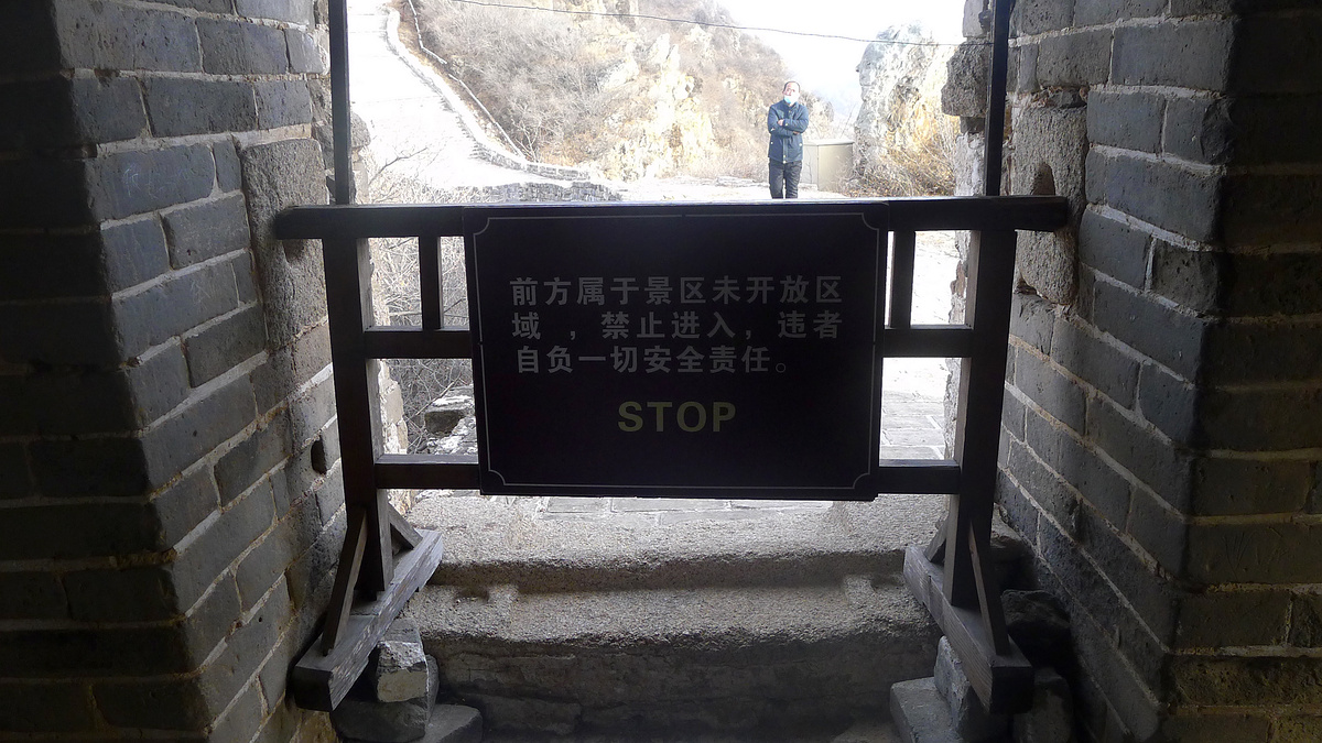

This was as far as I got in 2023.
In 2009, HJ was able to get a bit farther along.

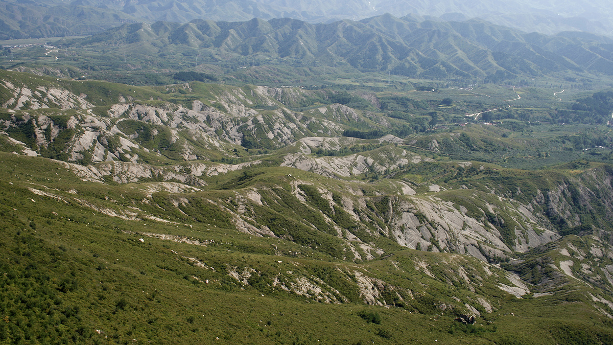
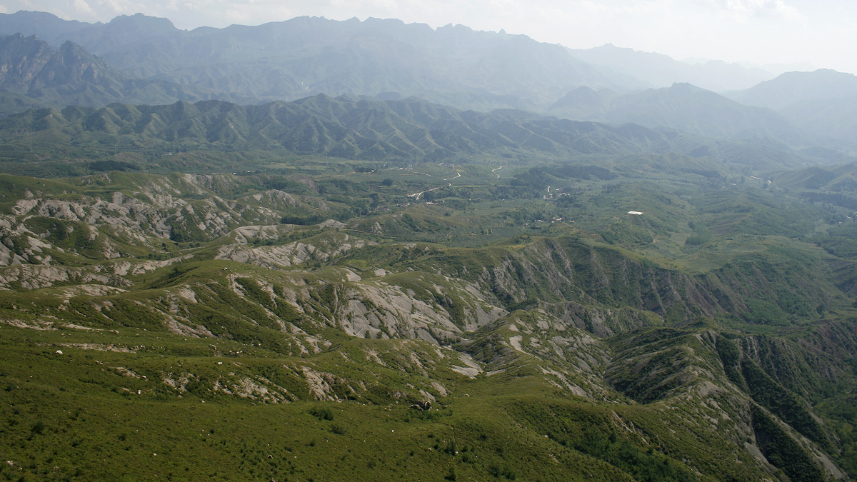
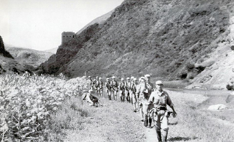
Interlude: so why build the Great Wall all the way up here?
Because people really did sneak through high mountains to attack the Great Wall guards.
This exact part of the Simatai Great Wall features in an article by Great Wall historian David Spindler titled “A Twice-Scorned Mongol Woman, the Raid of 1576, and the Building of the Brick Great Wall”.
Before the Sky Ladder was built, this particular spot was called Falcon Gap. The basic gist of the Raid of 1576 is that a group of 70 Mongolian soldiers hiked up and through the gap, crossed over the wall (just a low line of rocks and rammed earth), attacked soldiers at Falcon Gap Fort, and then lured more soldiers into an ambush back on the outside of the Great Wall. Work on brick reinforcements to the Great Wall in this area—not coincidentally—started in the year following the raid.
You can read the whole story here (PDF)—it’s extremely well sourced and documented (177 footnotes!) and covers the twice-scorned reason for the raid.
So who’s David Spindler? He’s a seemingly enigmatic independent Great Wall historian who made an extended appearance in Peter Hessler’s informative feature in the New Yorker titled “Walking the Wall”, in which the two do a spot of hiking. (PDF version)
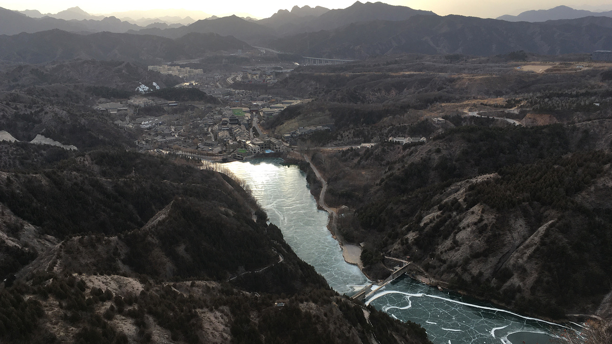
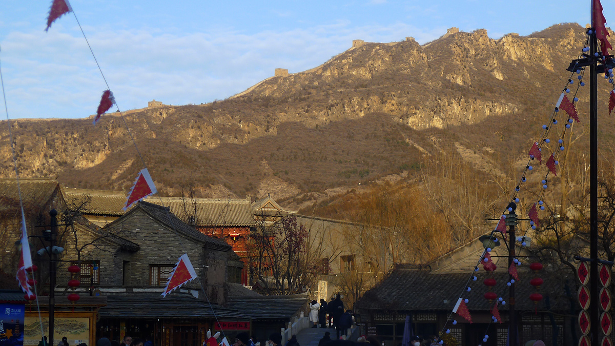
Gubei Shuizhen AKA Gubei WTown
From the Gubei Shuizhen resort there are clear views of the Great Wall running up the ridge on the east side.
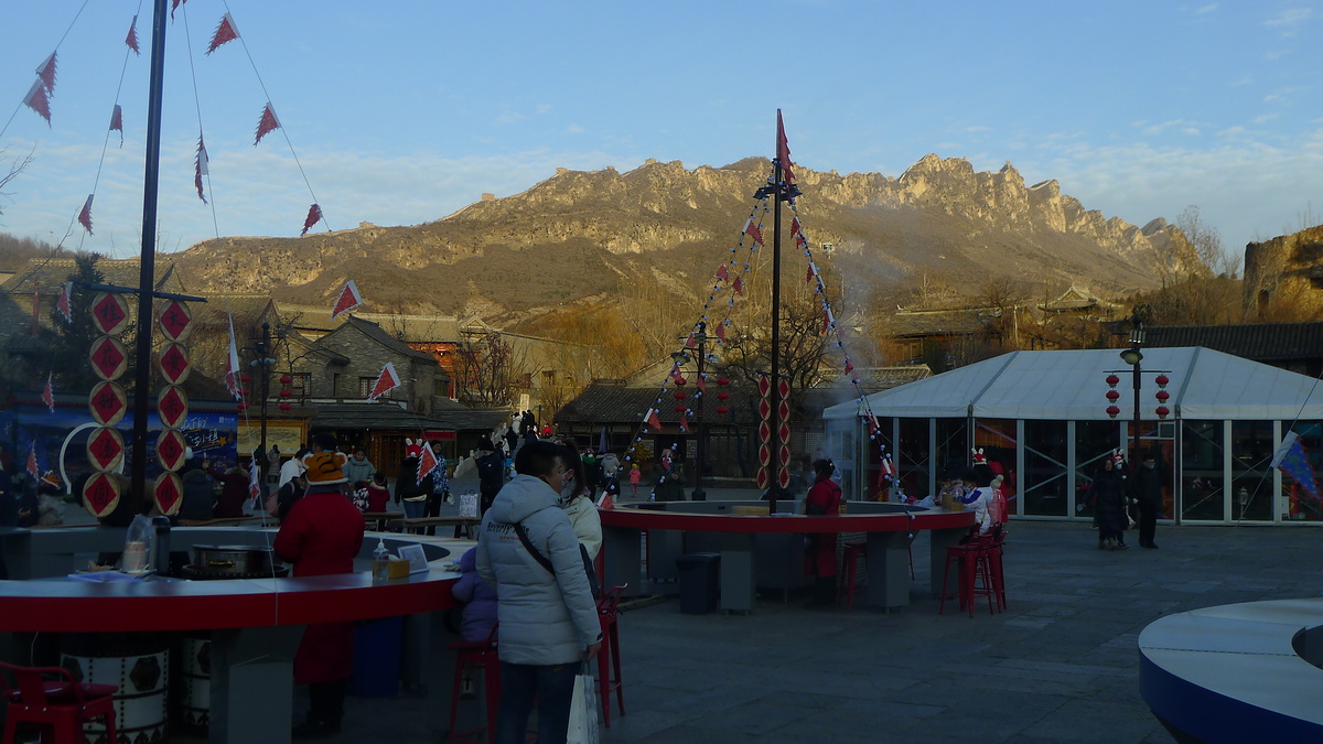

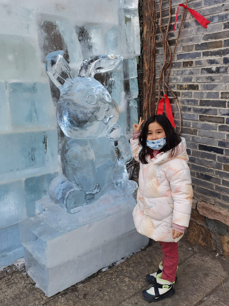
If it’s not obvious from the more recent photos, the Simatai Great Wall and Gubei Shuizhen are now set up for an extremely standard tourist visit. Which is totally okay! Little H enjoyed a visit here, checking out the ice sculptures, walking a little bit of the Great Wall, and snacking on candied hawthorns, ice cream, and even a bit of pizza while we waited for that drone show to begin.
Maps
Notes
Beijing Hikers occasionally does a visit here called Simatai Great Wall and the Gubei Shuizhen.
Simatai Great Wall
Sīmǎtái / 司马台 / Sima Platform (‘Sima’ can be a surname, or a title that means Minister of War)
Simatai info on Wikipedia
Simatai info on Baidu (Chinese language)
A Twice-Scorned Mongol Woman, the Raid
of 1576, and the Building of the Brick Great Wall
David Spindler (2009), Ming Studies, 2009:60, 66-94, DOI:10.1179/175975909X12589849512419