Gubeikou Great Wall and thereabouts
A general overview of the Great Wall (and other things) in the Gubeikou area, with photos, maps, and info.
This is Part I of a trilogy of posts about the Great Wall at Gubeikou.
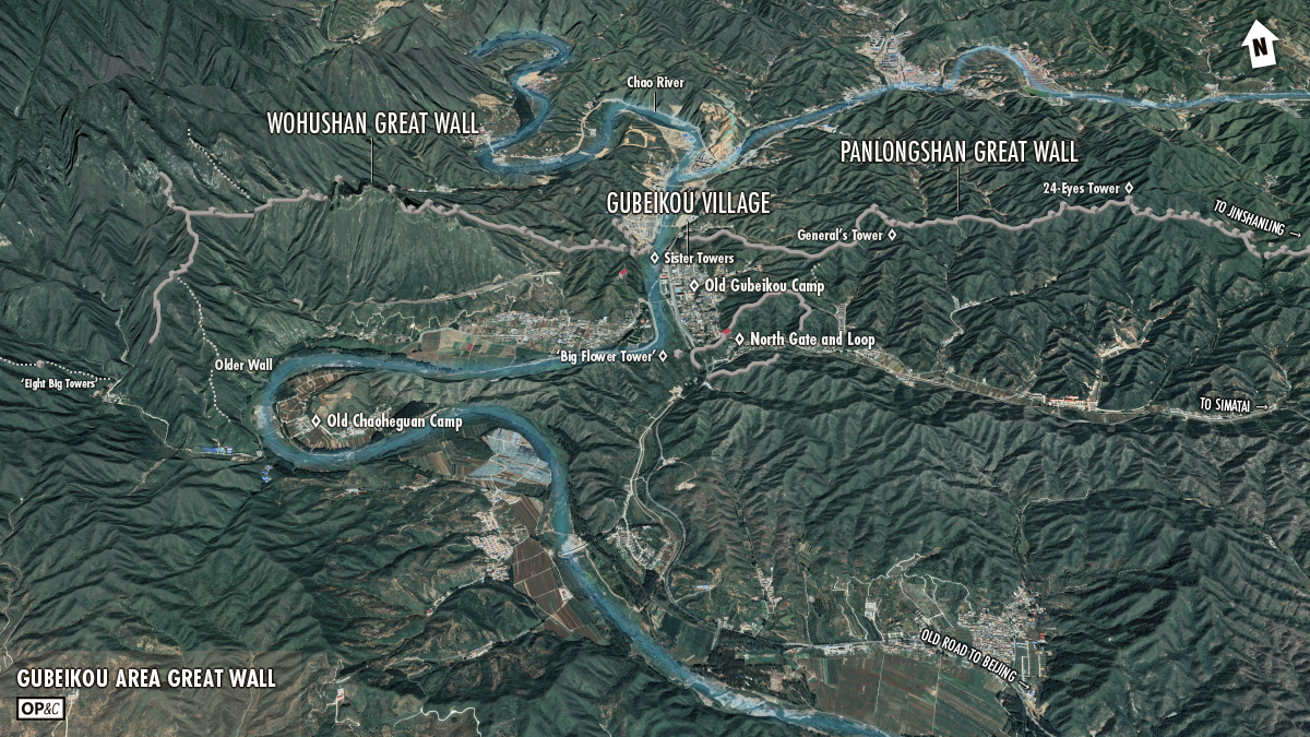
Part I is an overview of the general area, covering the Panlongshan and Wohushan sections of the Gubeikou Great Wall, Gubeikou village (where the camp and big gate in the main pass used to be), and the inner loop of Great Wall to the south of the main part of the village.
Parts II and III are separate posts that focus on the Panlongshan Great Wall and Wohushan Great Wall sections, each post (linked later) with many photos and notes on things that a curious hiker might spot on a walkabout.
The photos are mostly all mine. I borrowed a few from f.k.a. HJ, and I’ve included historical photos collected from various websites and WeChat groups. (Photo credit and copyright info provided where available.)
Gubeikou Great Wall basics
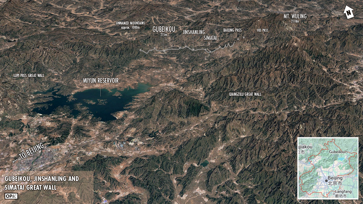
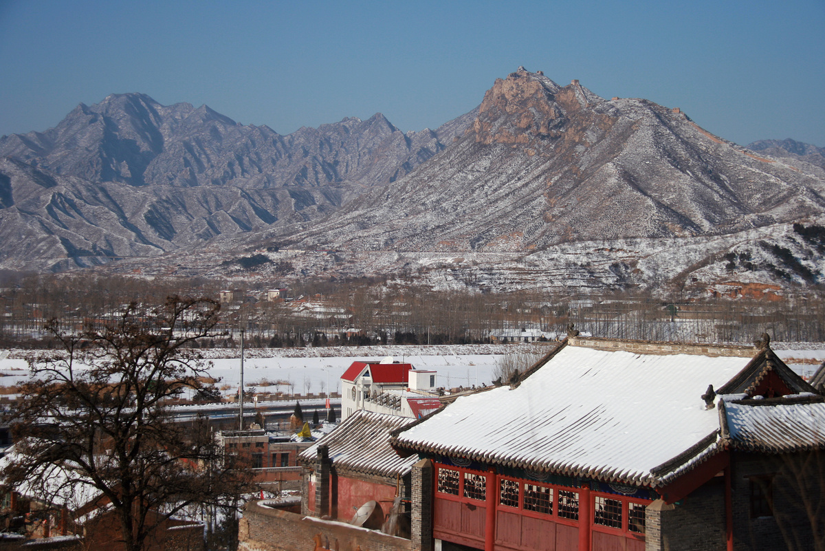
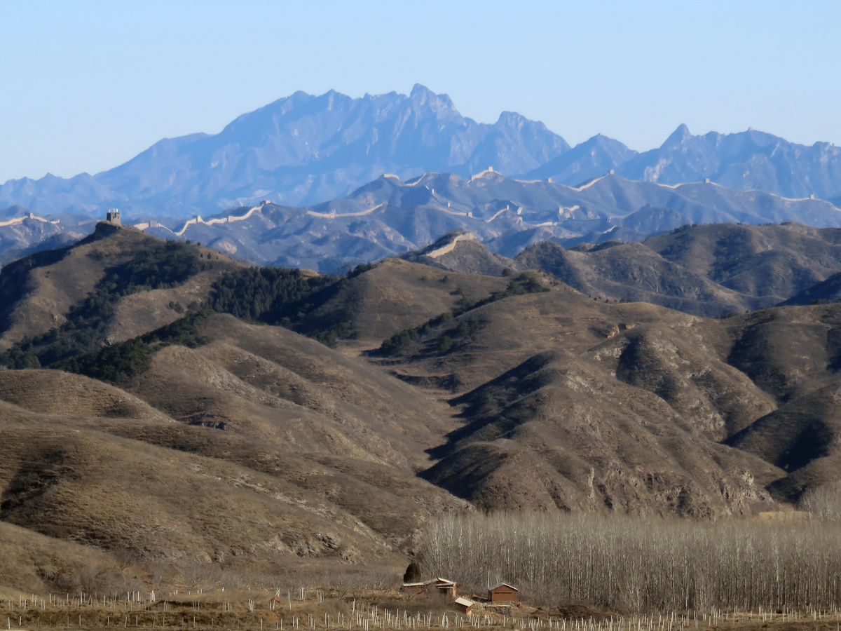
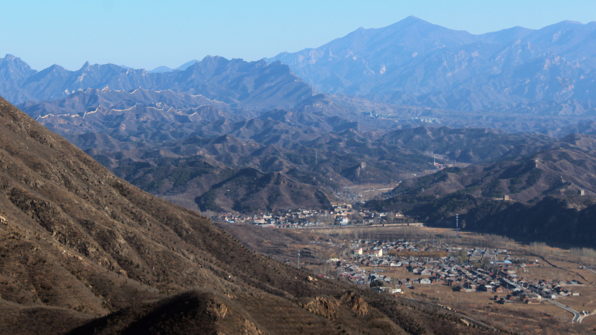
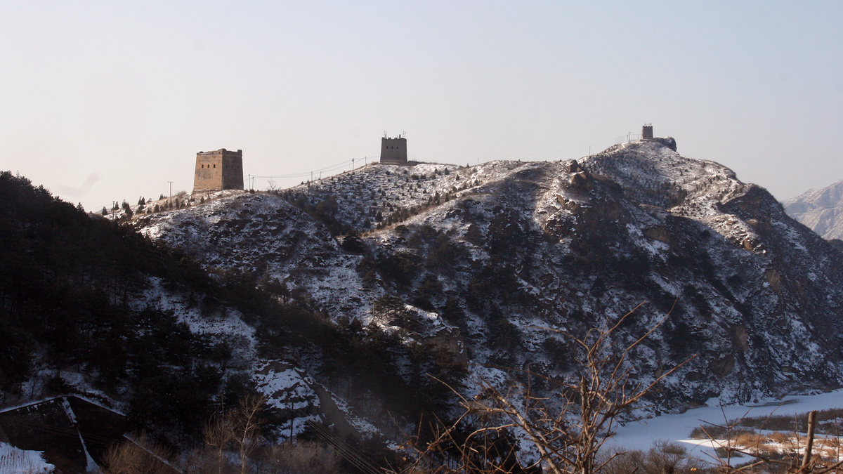
The Gubeikou Great Wall is located in Beijing’s northeast, at the western end of a 24km-ish long line of nearly uninterrupted Great Wall that includes the Jinshanling Great Wall and the Simatai Great Wall.
That long line of Great Wall runs along ridges in an area of lower hills between higher mountains, blocking one of the main passes. Following the river valleys through the pass was one of the main ways to get to Beijing from northeast China, and Gubeikou was a major waypoint.
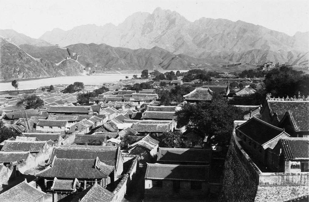
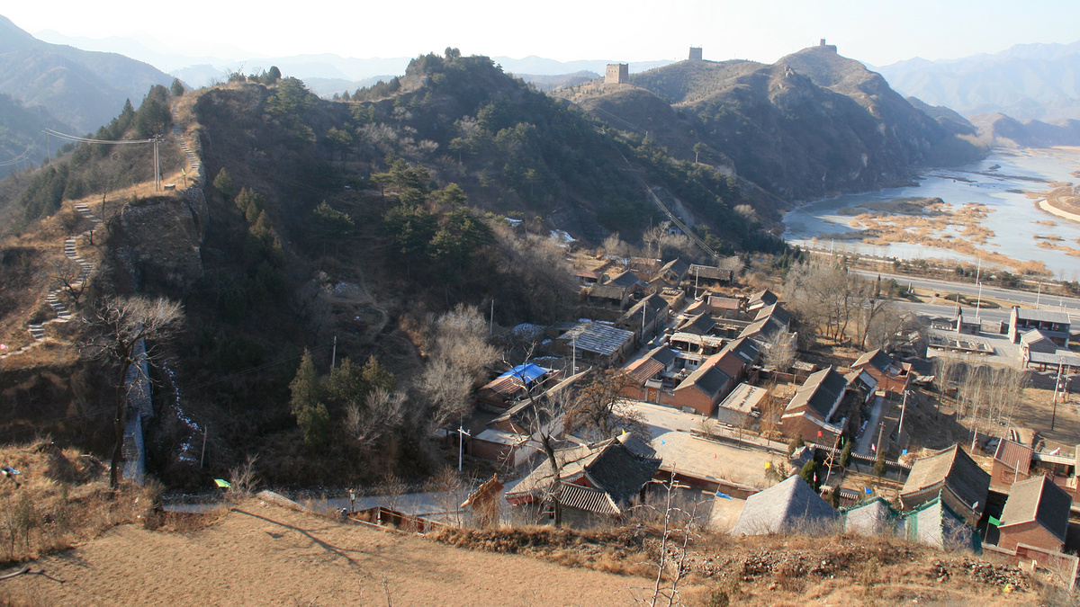
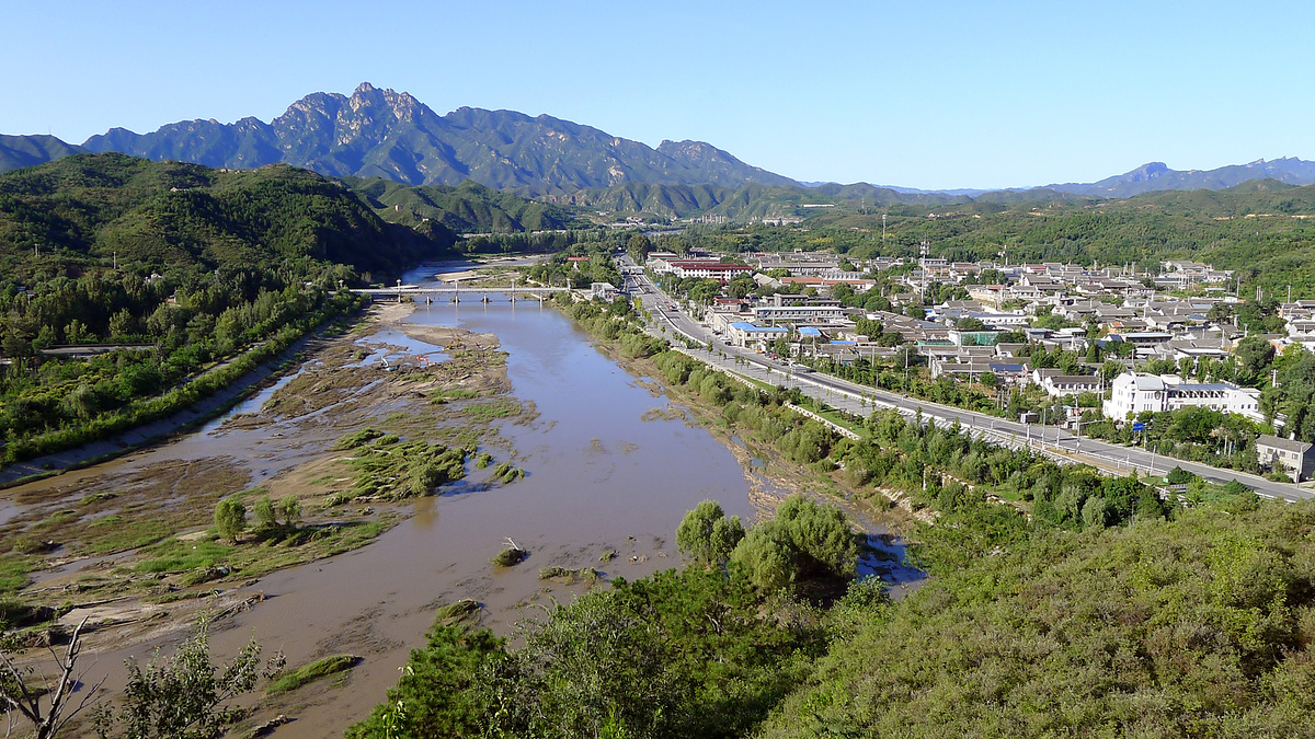
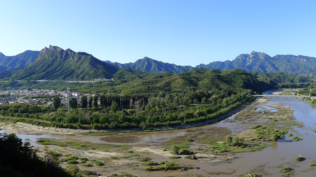
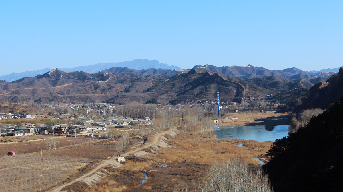
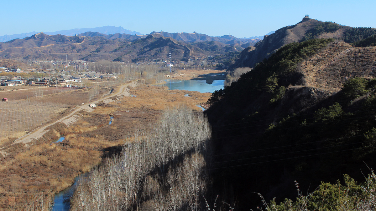
The fortifications at Gubeikou are sited near a bend in the Chao River where the pass narrows, with Great Wall built down to the banks of the river and up into the mountains on either side.
The Great Wall on the west side of the river is called the Wohushan ‘Crouching Tiger Mountain’ Great Wall. On the east side of the river, it’s the Panlongshan ‘Coiling Dragon Mountain’ Great Wall.
The Great Wall that you can see at Gubeikou is nearly all Ming Dynasty-era (1368-1644 AD).
There’s supposed to be Northern Qi-era (550-557 AD) Great Wall in the area too, and people call that “Beijing’s oldest Great Wall”.
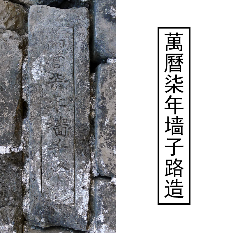
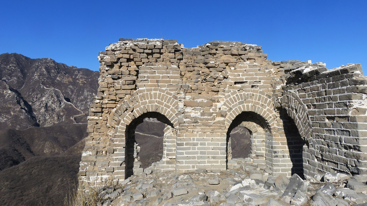
It’s easy to pick out the Ming Dynasty Great Wall. It’s all got that Ming Dynasty look—large blocks in the foundations, big towers, brick ramparts and crenellations—the type of Great Wall you see on postcards. If “the look” isn’t enough to tell by itself, some of the bricks have stamps in them, and some of those stamps say “made in the Seventh Year of the Wanli Emperor”, which would be exactly 1570 AD.
The part that’s supposed to be Northern Qi Dynasty-era is (now) just a line of rocks that follows a ridgeline on the west side of the river. The idea is that the Ming wall was built over the top of the Northern Qi wall—except for this bit, which was left exposed when the Ming wall architects decided to take it in a different direction. The ‘line of rocks wall’ definitely looks like it was from an older period of wall construction.
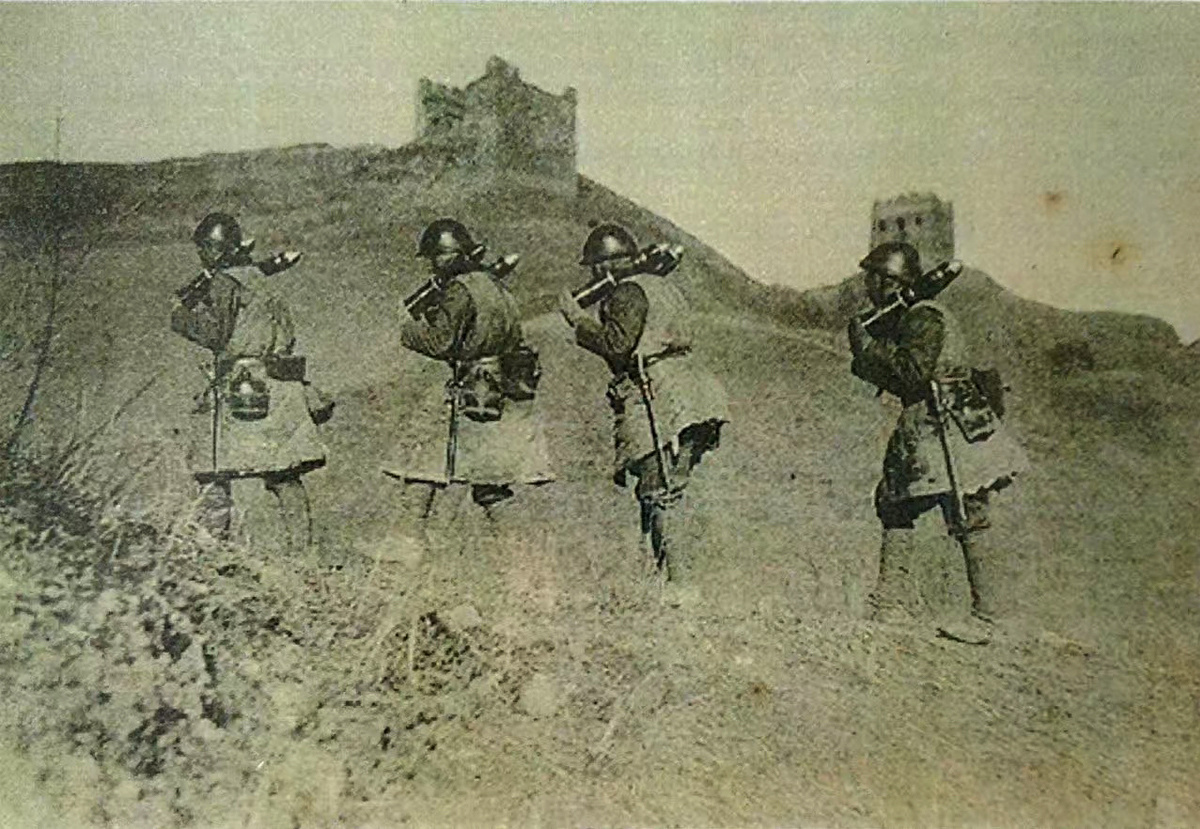
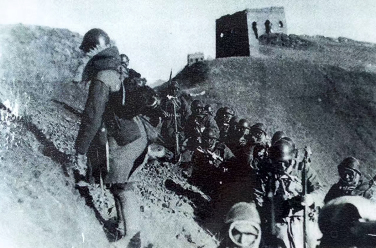
The Gubeikou Great Wall is one of the wall locations that definitely saw battles and attacks. A Mongolian army led by Altan Khan broke through here in 1550, and that’s part of the reason for extra construction and reinforcement of the Great Wall here in the later part of the Ming Dynasty. The more recent Battle of the Great Wall was in 1933, with the Japanese army fighting to force their way through to Beijing.
In this post
At Gubeikou there are four main areas to look at.
- The Gubeikou ‘Panlongshan’ Great Wall (scroll to this section)
- The Gubeikou ‘Wohushan’ Great Wall (scroll to this section)
- Gubeikou village, where the camp and big gate in the main pass used to be (scroll to this section)
- The North Gate and inner loop of Great Wall (scroll to this section)
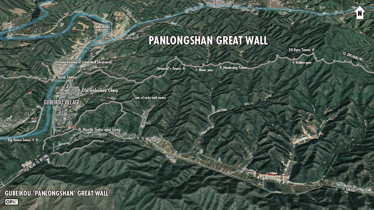
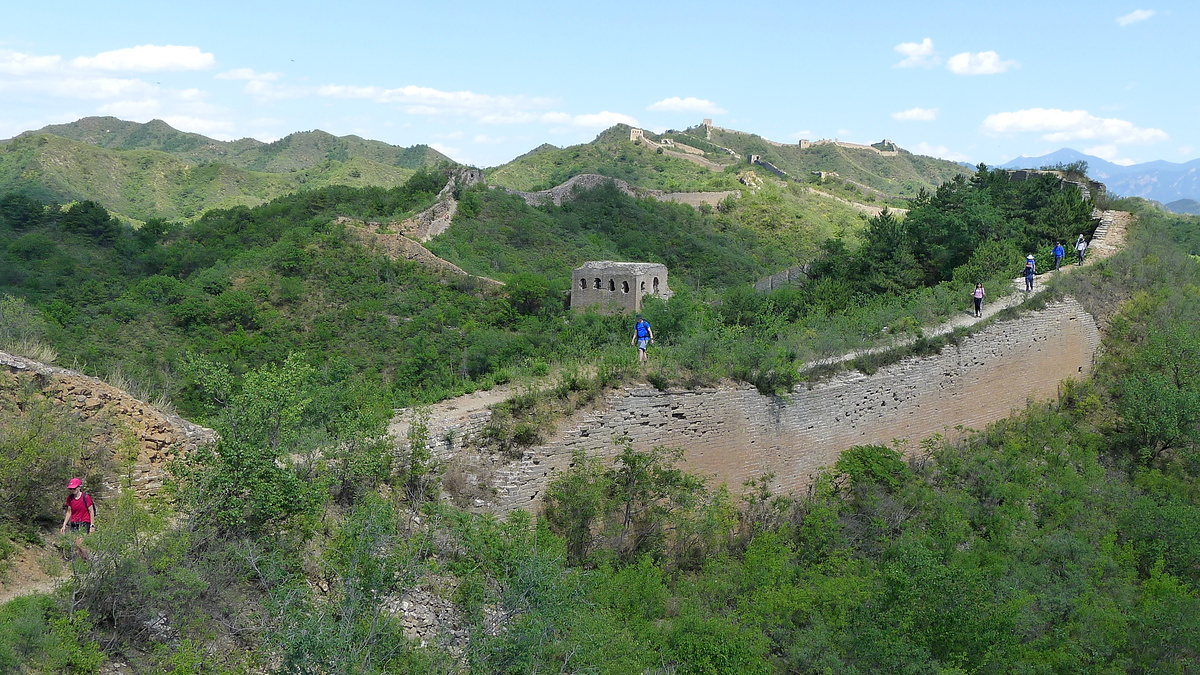
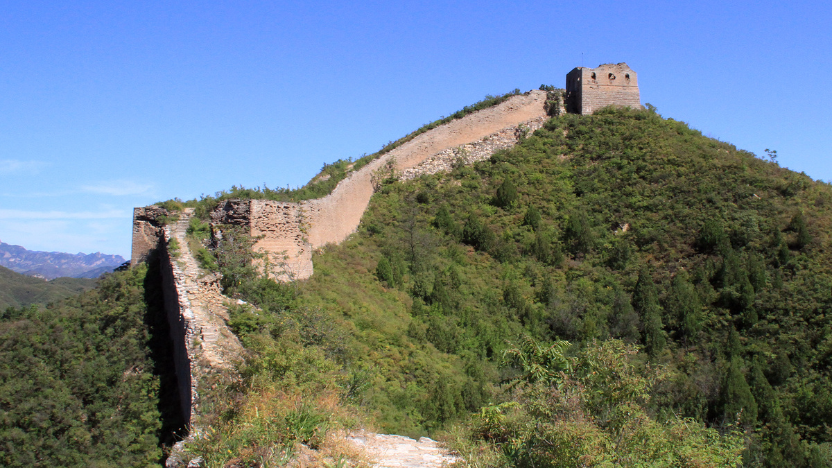
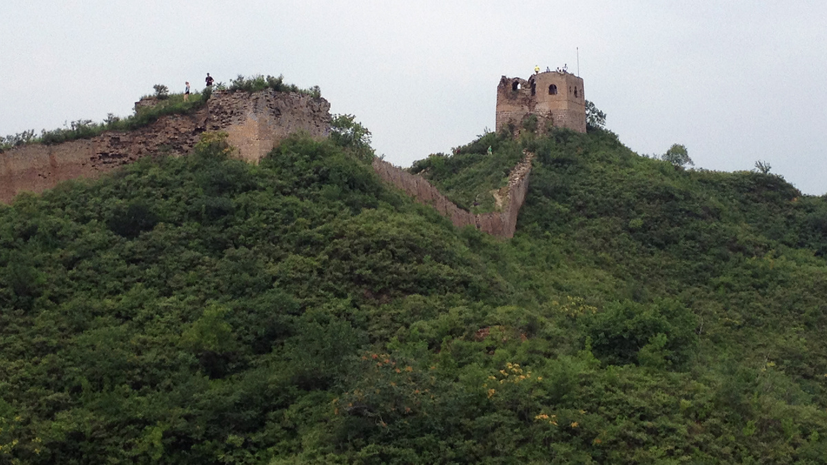
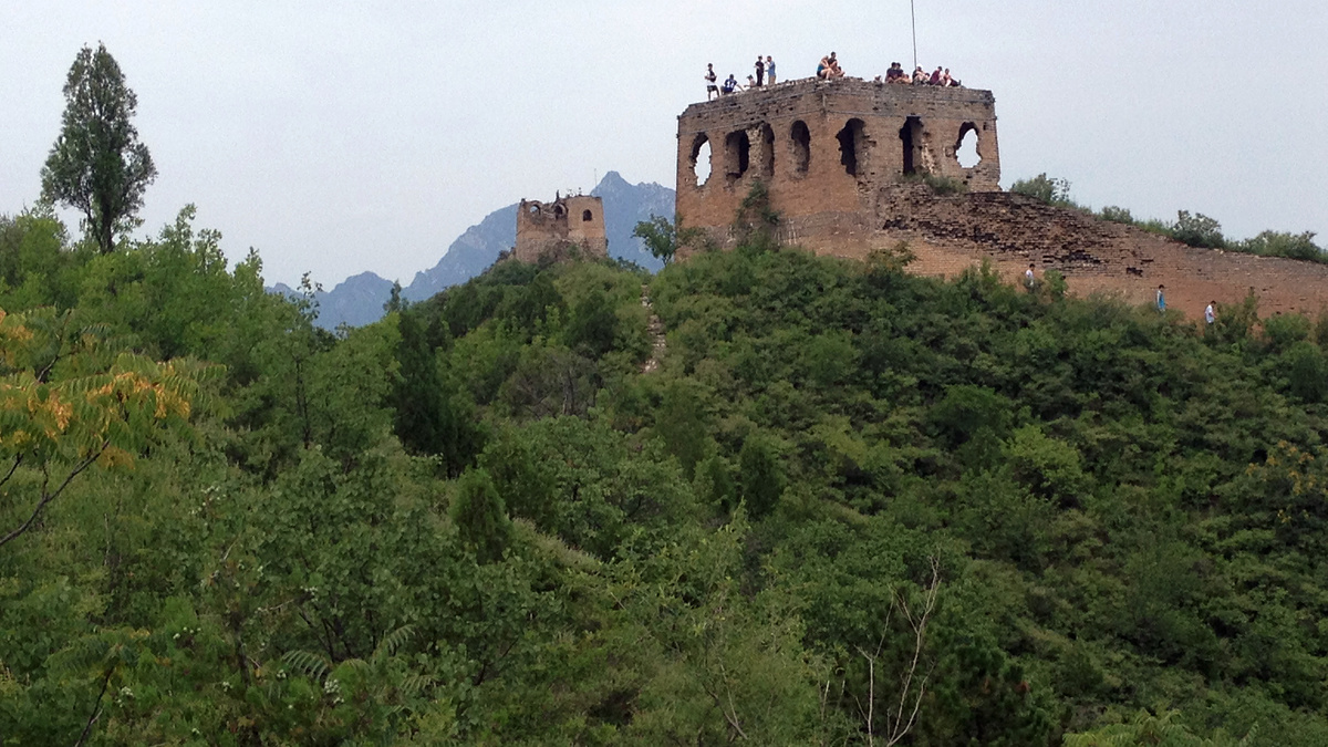
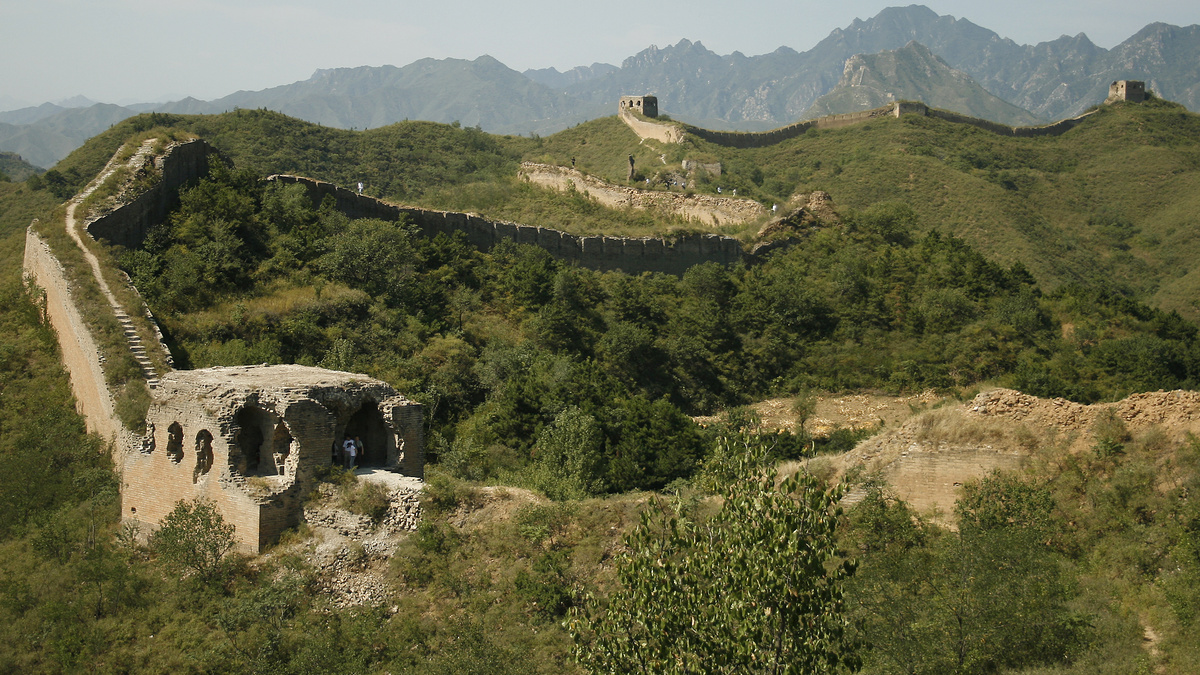
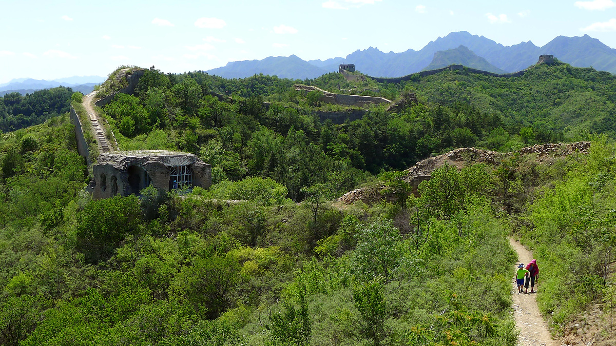
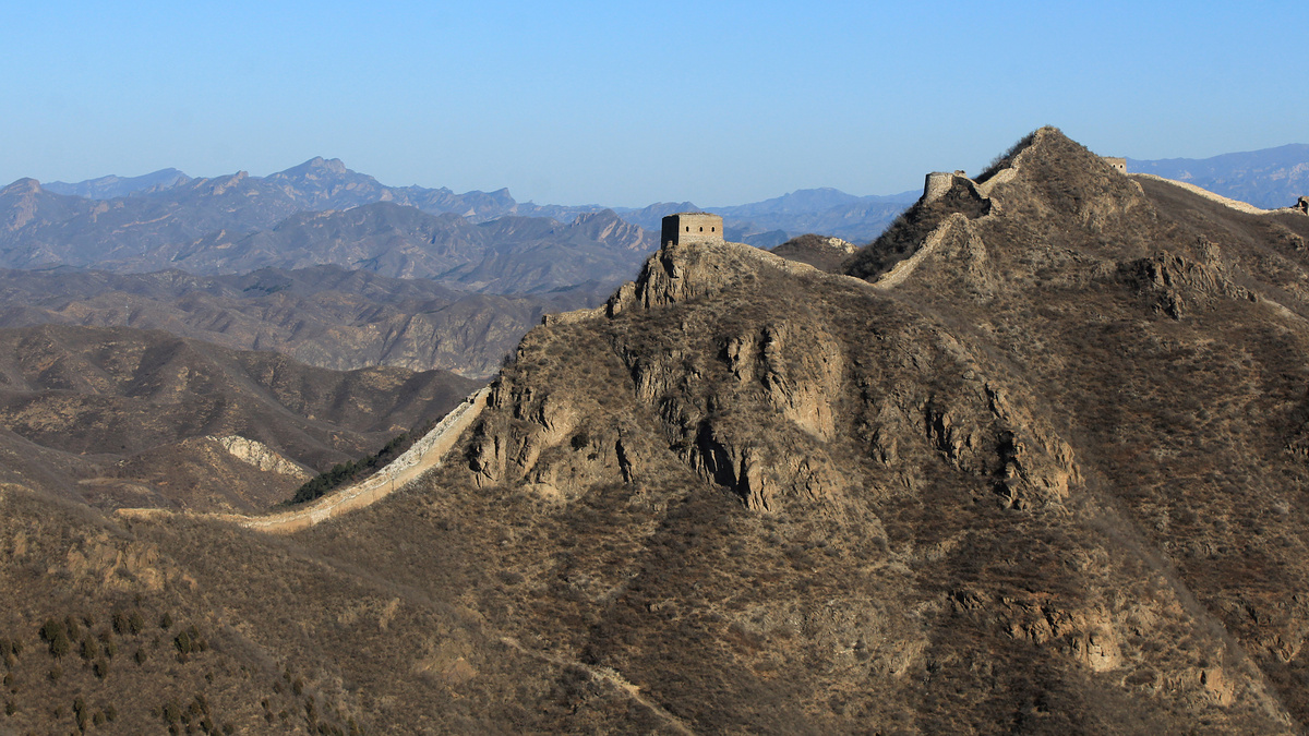
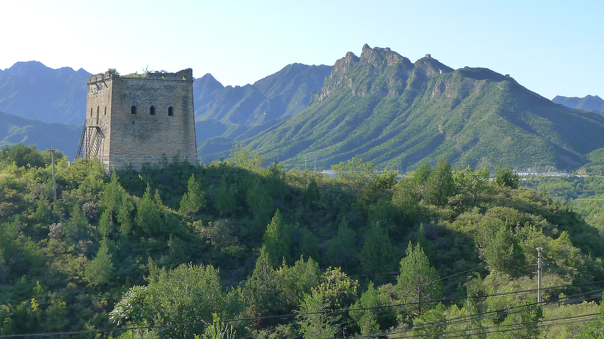
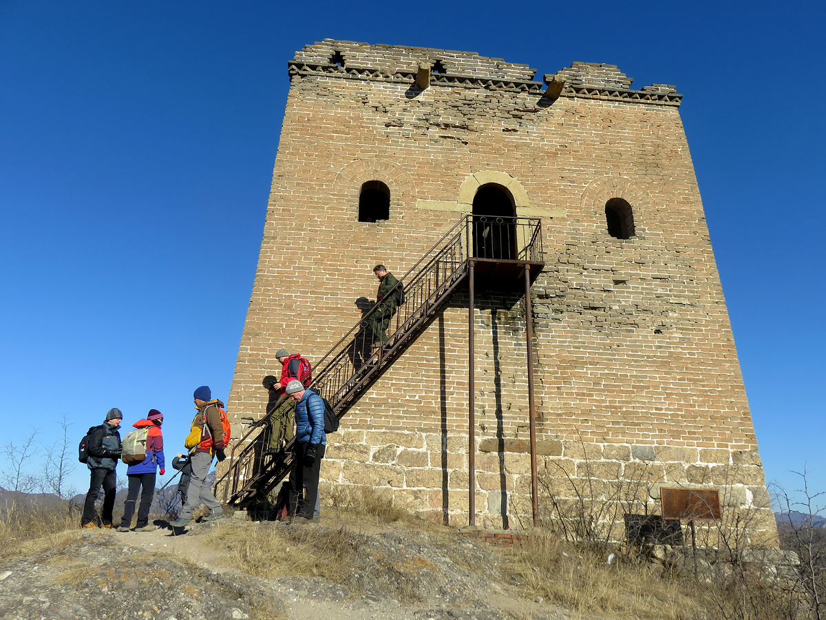
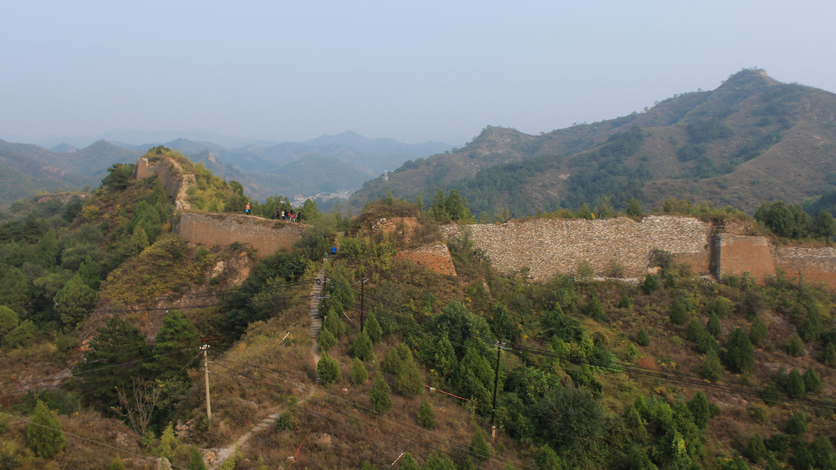
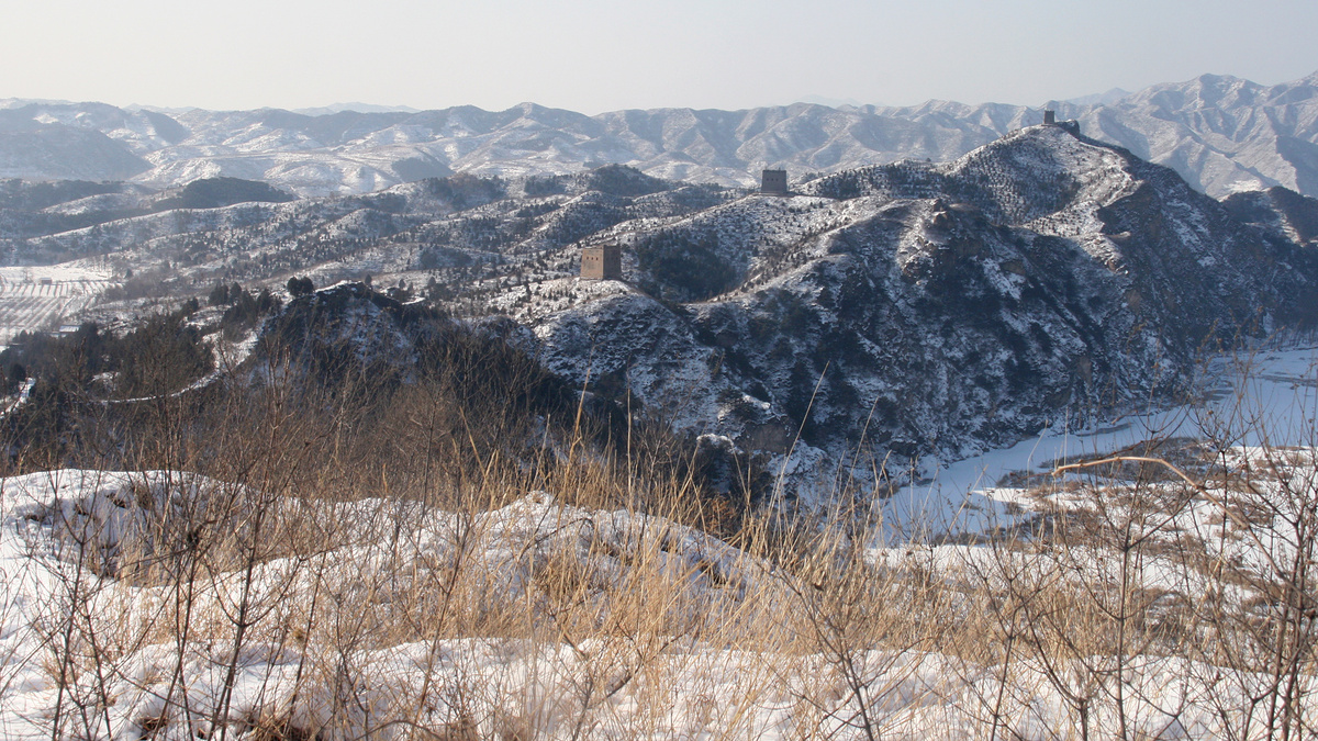
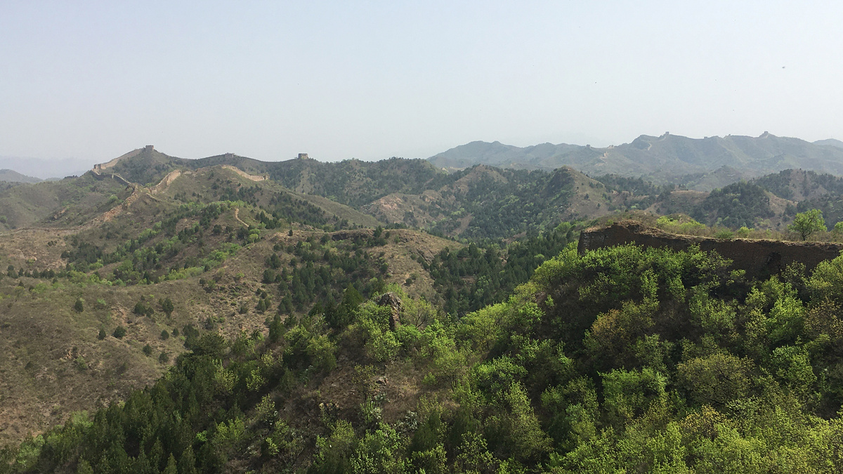
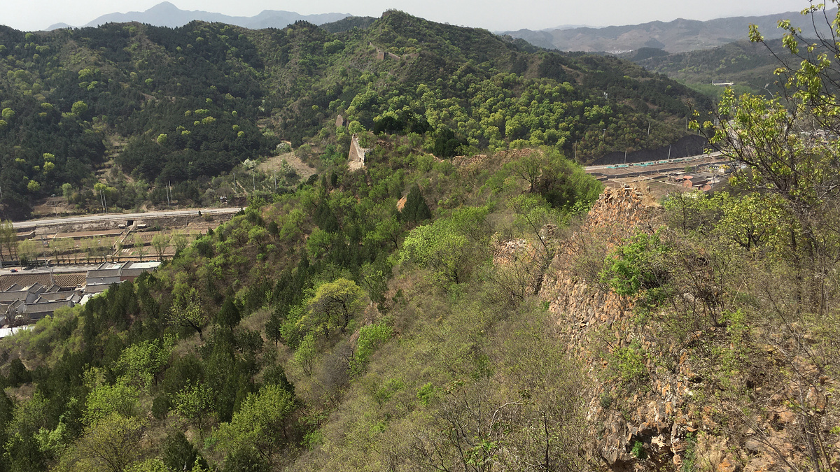
Panlongshan ‘Coiling Dragon Mountain’ Great Wall
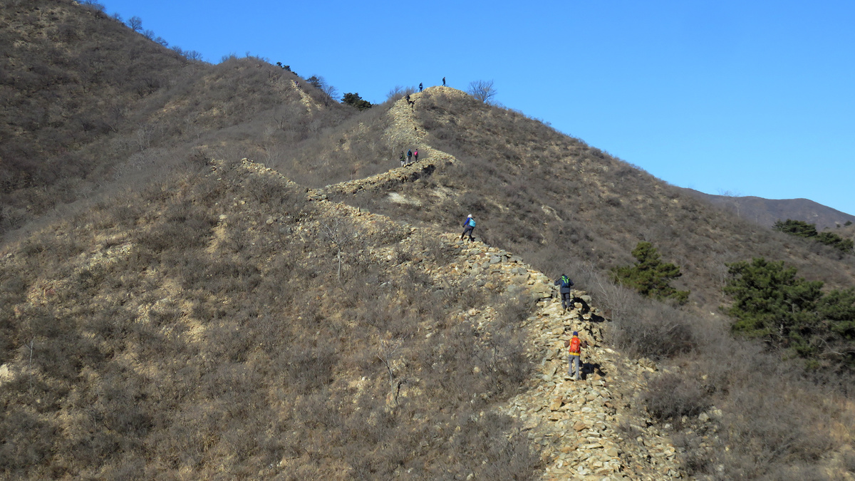
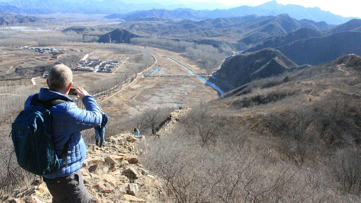
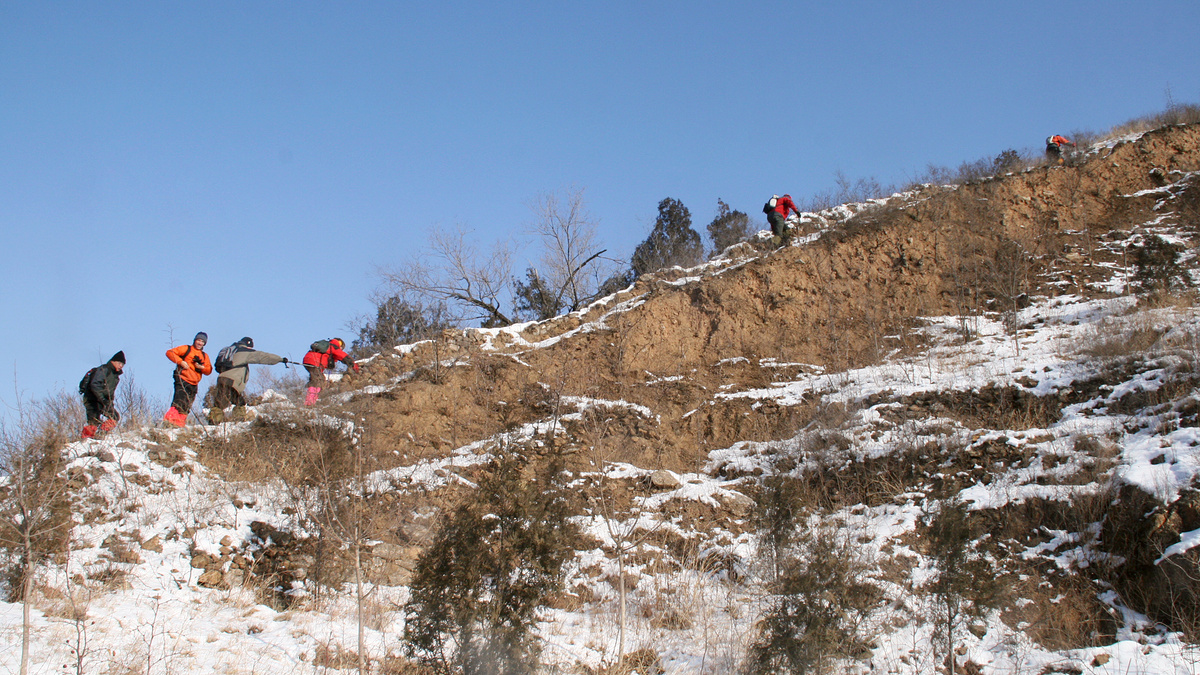
The Panlongshan ‘Coiling Dragon Mountain’ Great Wall (蟠龙山长城) is the part on the east side of the river. It’s the more mellow side of the wall here—the hills are lower, the ridgelines and wall are not extremely steep, and it’s one of the easiest wall hikes you can do.
It’s the part of Great Wall I’ve hiked the most. My first hike here was in 2007, and I’ve taken a lot of photos on all the hikes since then.
Below is a small selection of photos from the Panlongshan Great Wall.
Part II of the trilogy – the Gubeikou ‘Panlongshan’ Great Wall post – has more than 90 photos, plus maps, historical information and old photos, and notes on what a curious hiker might spot on the trails.
Click to see the main Gubeikou ‘Panlongshan’ Great Wall post.
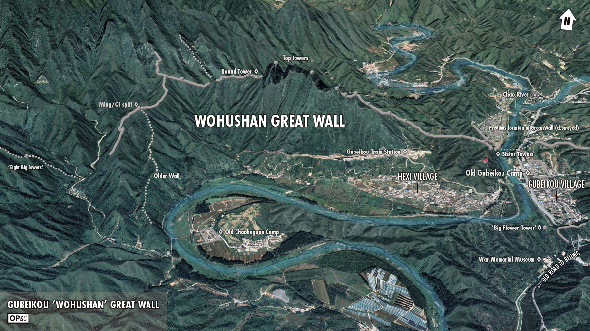
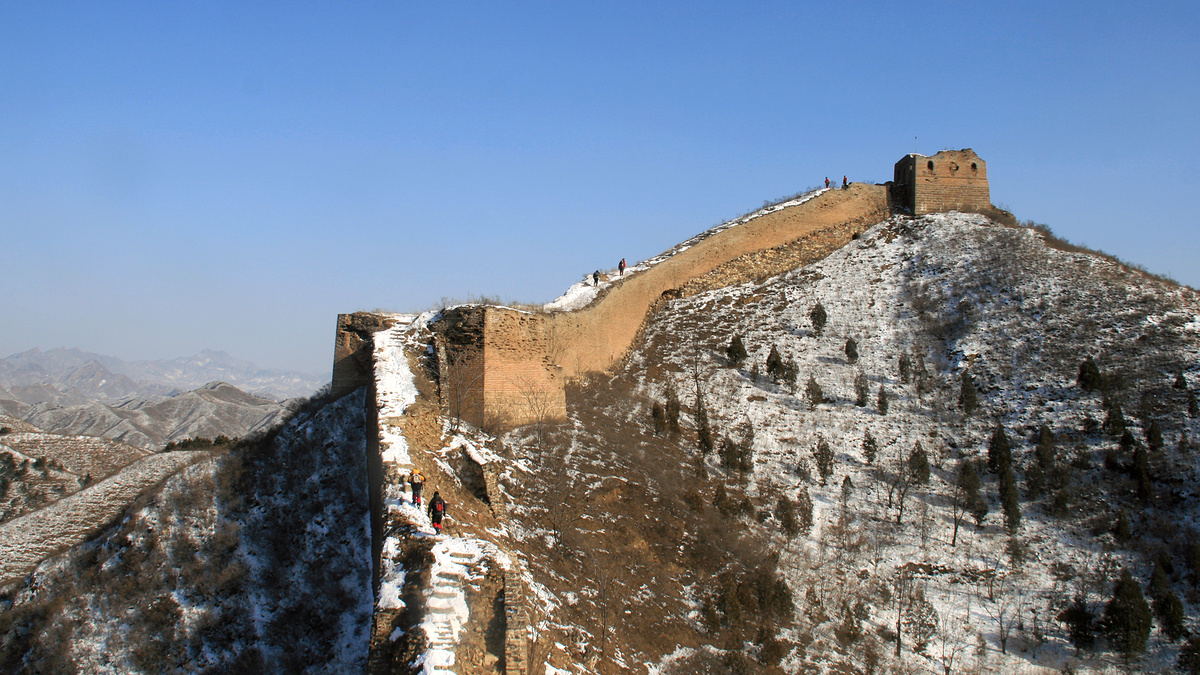
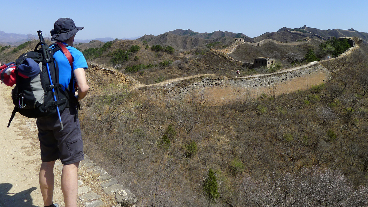
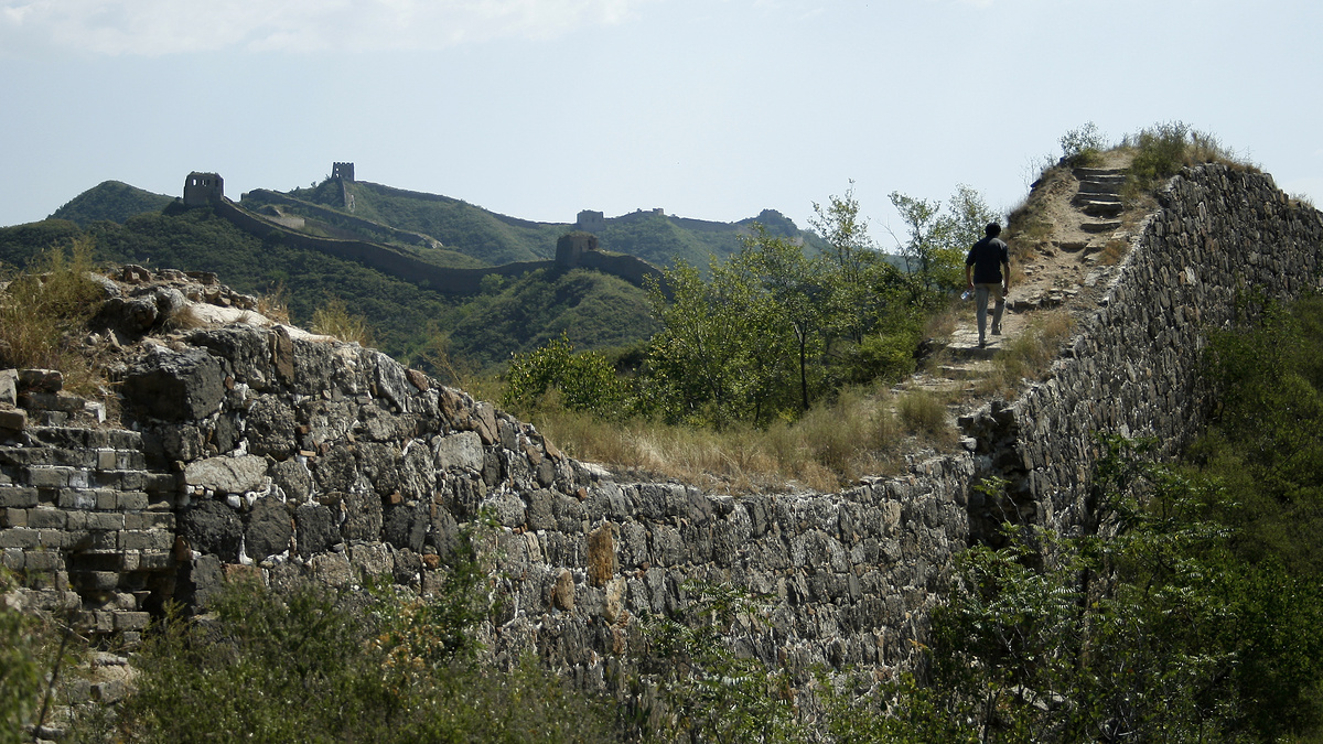
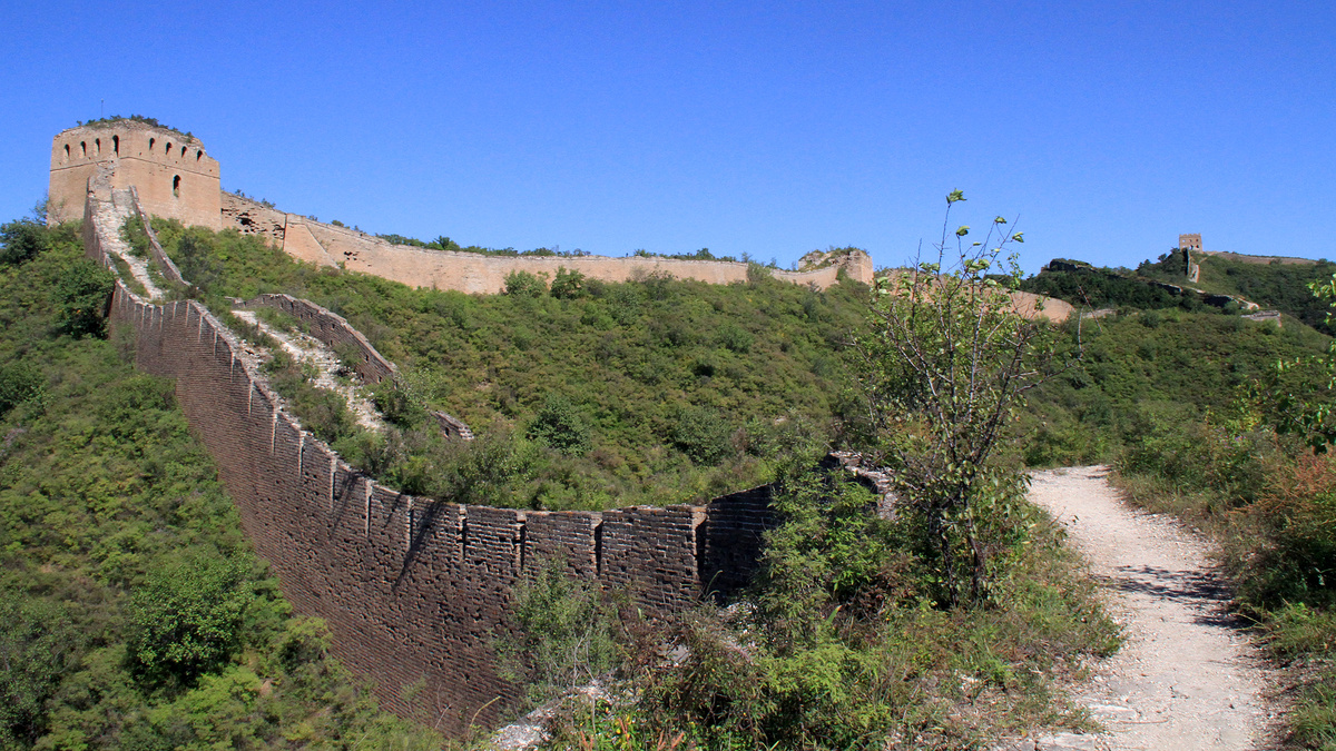
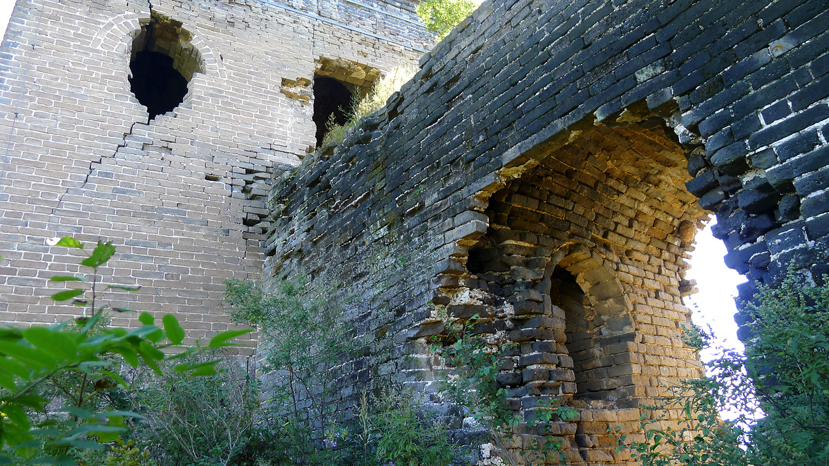
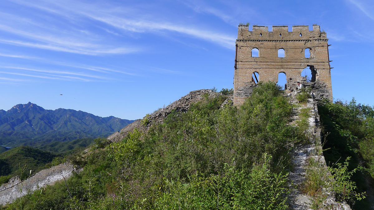
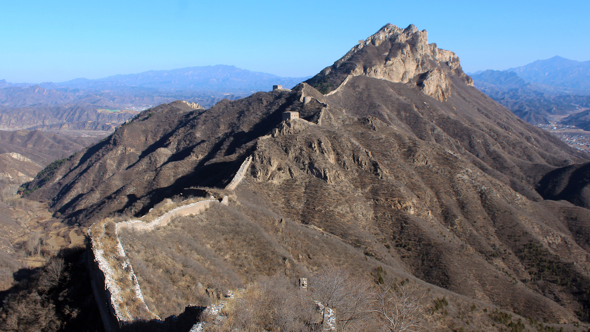
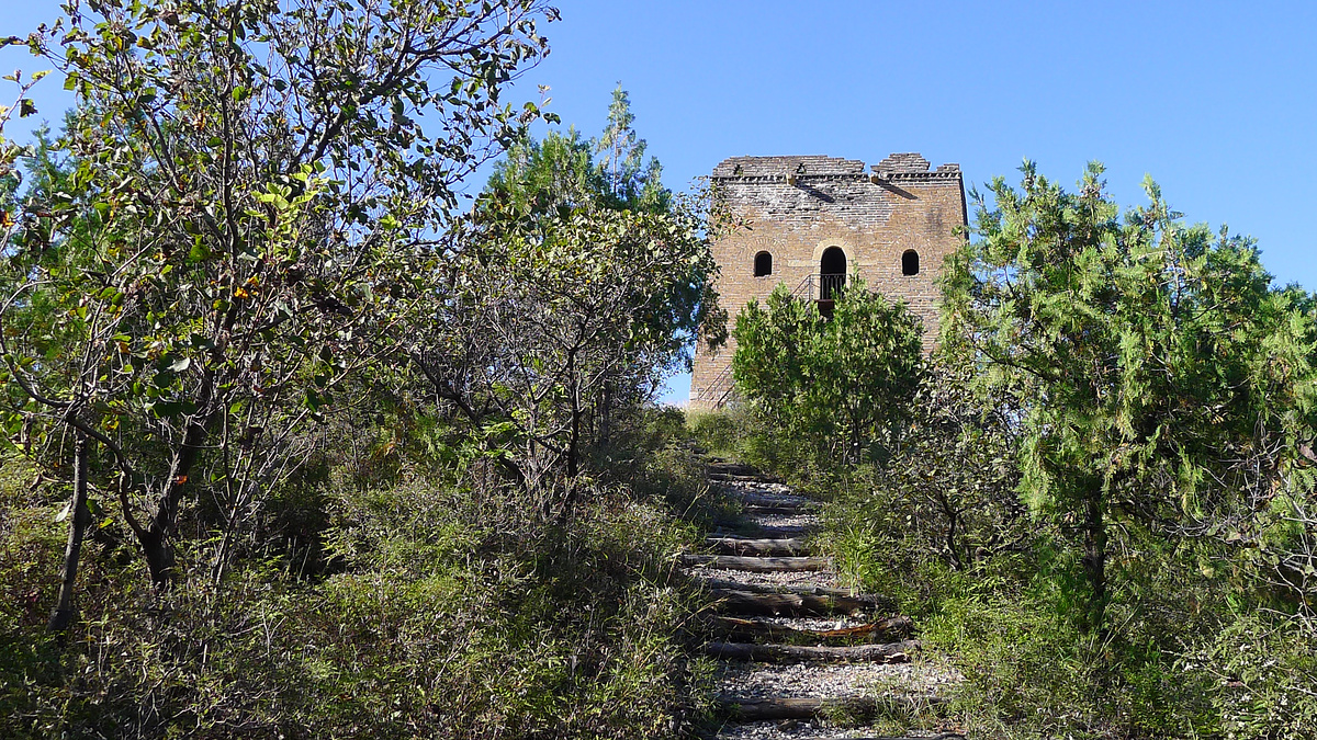
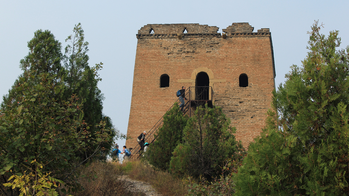
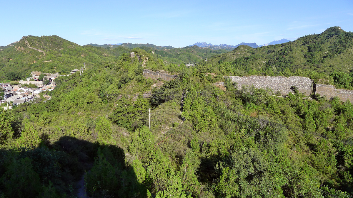
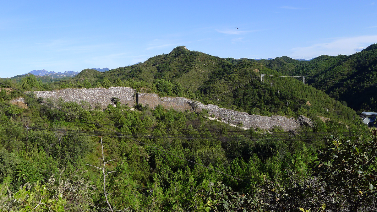
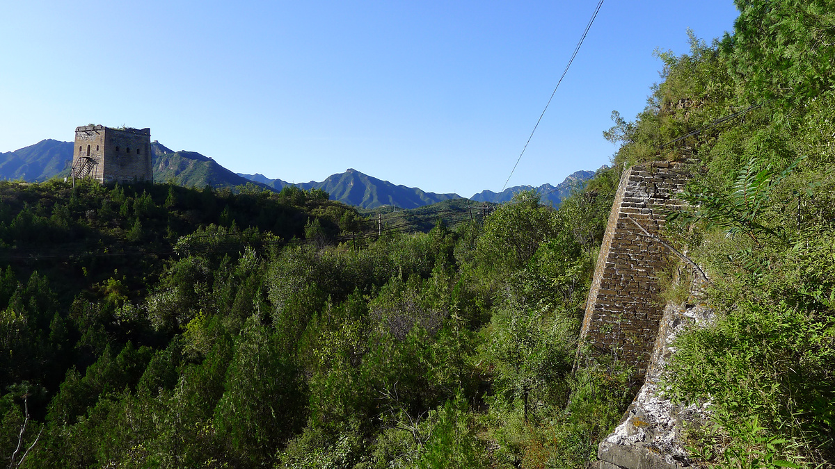
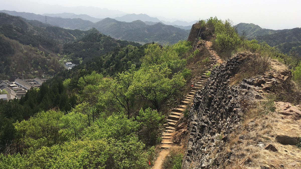
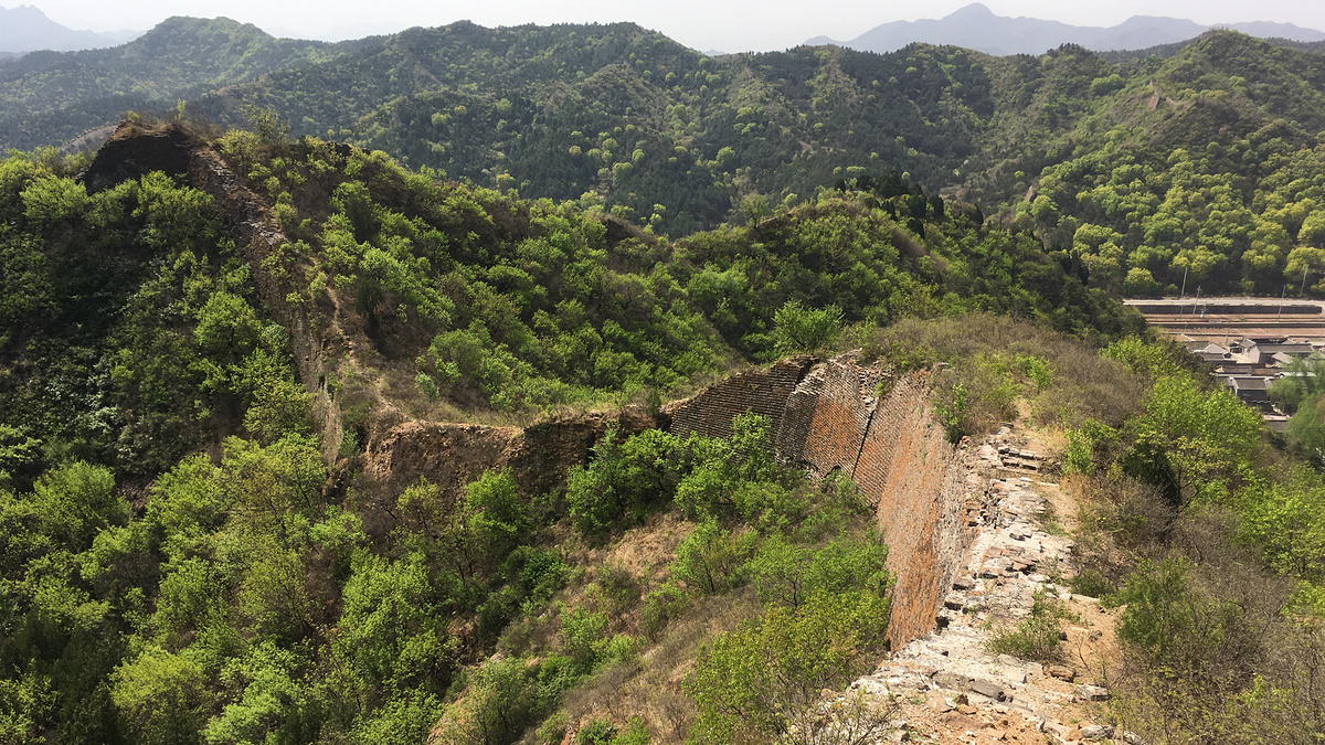
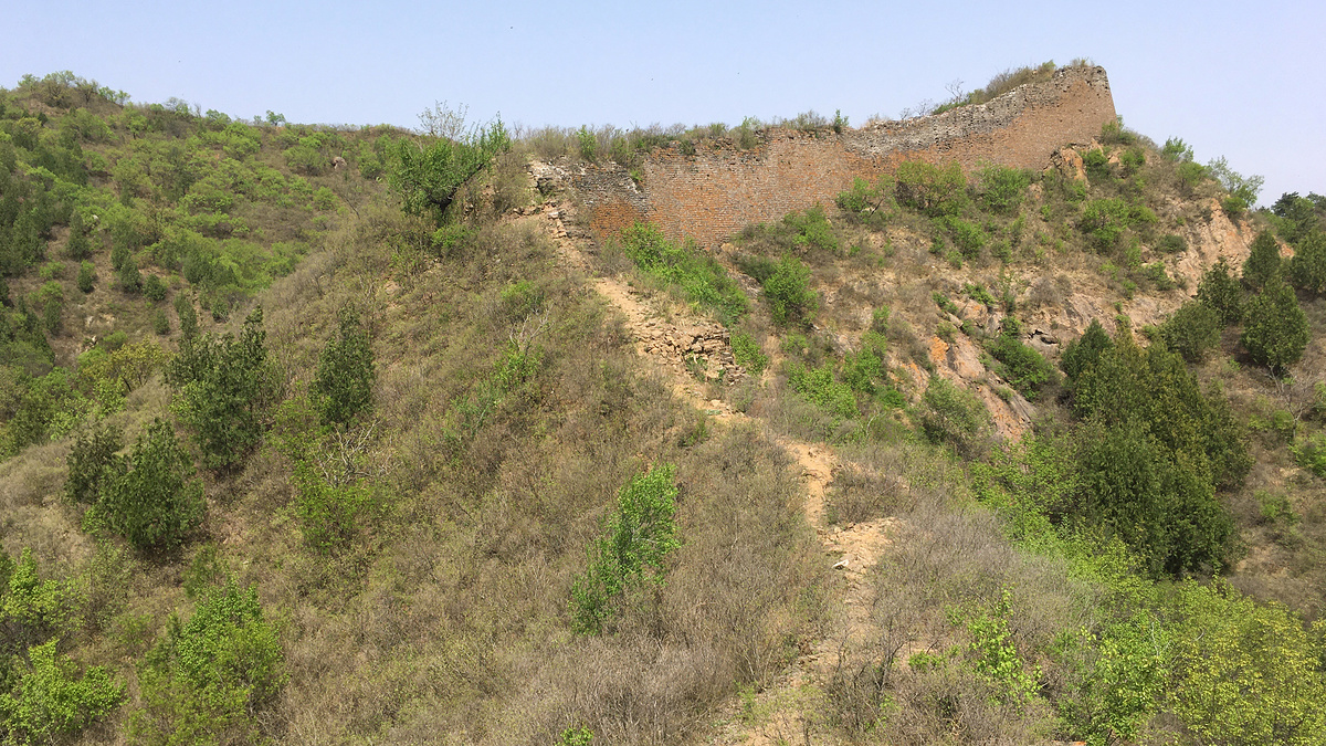
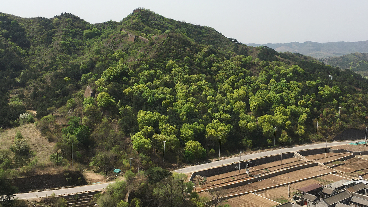
Wohushan ‘Crouching Tiger Mountain’ Great Wall
On the west side of the river is the Wohushan ‘Crouching Tiger Mountain’ Great Wall (卧虎山长城).
I’ve hiked there fewer than ten times, and I’ve never been up the ‘big ridge’, the most obvious part of the wall on the Wohushan side.
The Wohushan wall is much steeper than the Panlongshan side, especially where the wall runs atop tall cliffs on the big ridge and near the Eight Big Towers, and in general the wall is in quite rough condition. At the western end of it you can see some Northern Qi-era Great Wall (550-557 AD), which is allegedly the oldest in Beijing.
Below is a small selection of photos from the Wohushan Great Wall, including some shots that show how close the wall is to those tall cliffs.
Part III of the trilogy – the Gubeikou ‘Wohushan’ Great Wall post – has around 50 photos, plus maps, and more of the historical images.


Click to see the main Gubeikou ‘Wohushan’ Great Wall post.
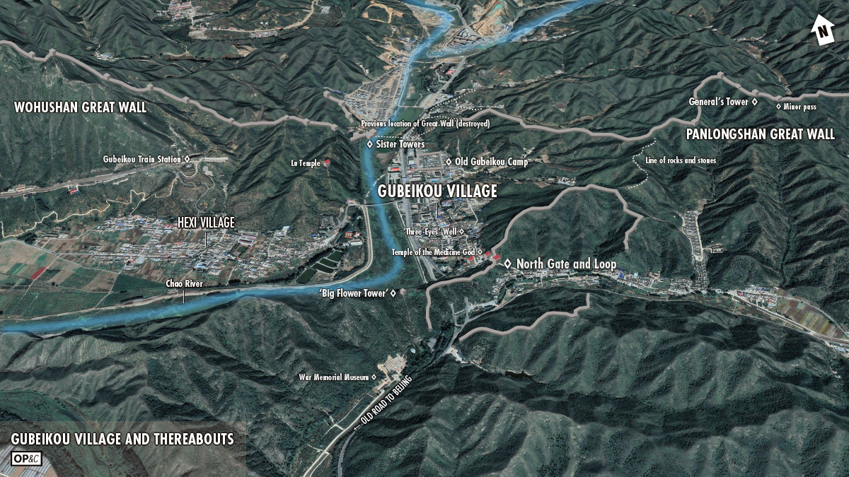
Gubeikou village, where the camp and main pass used to be
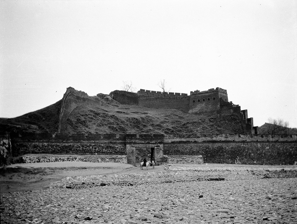
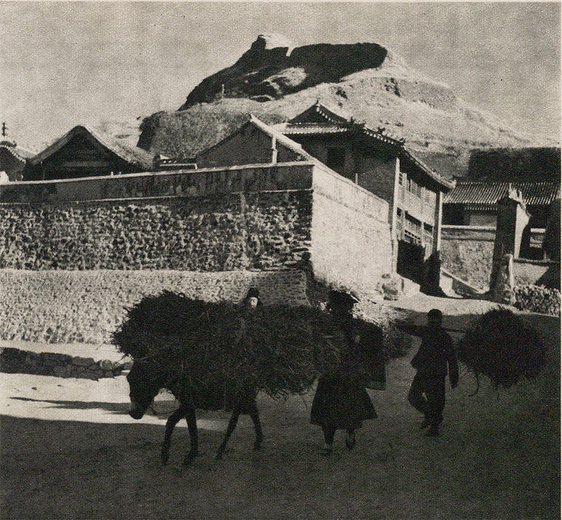
The preceding photo is the best I’ve found of the main fortifications at the Gubeikou pass. According to William Lindesay’s excellent book The Great Wall Revisited this is the second gate, and in that book you can find a photo of the first gate. There are no gates there now—I assume they were knocked down to make way for the highway.
There are quite a lot of historical photos from the Gubeikou area. Early foreign visitors passed by on the way to visit the Qing Dynasty Imperial Mountain Resort at Chengde, oil prospectors (like Mr. Clapp) came through on the way to the northeast, and photographers embedded with army and railway construction corps also took shots for magazines and newspapers.
Travellers to and from the northeast now pass through the Beijing-Hebei border control checkpoint instead of through the gates and Great Wall.
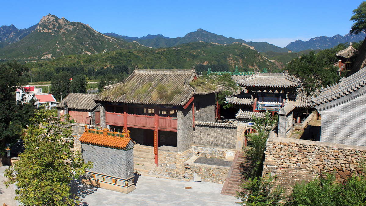
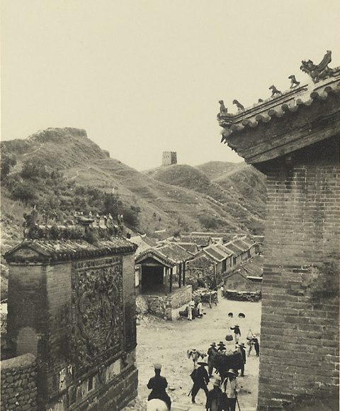
Where the gates and camp were is now a village, properly known as a ‘zhen’ (镇 / zhèn), which means it’s larger than a village (村 / cūn) or township (乡 / xiāng) and is probably the main town in the area, but it’s not large enough to count as a district or county.
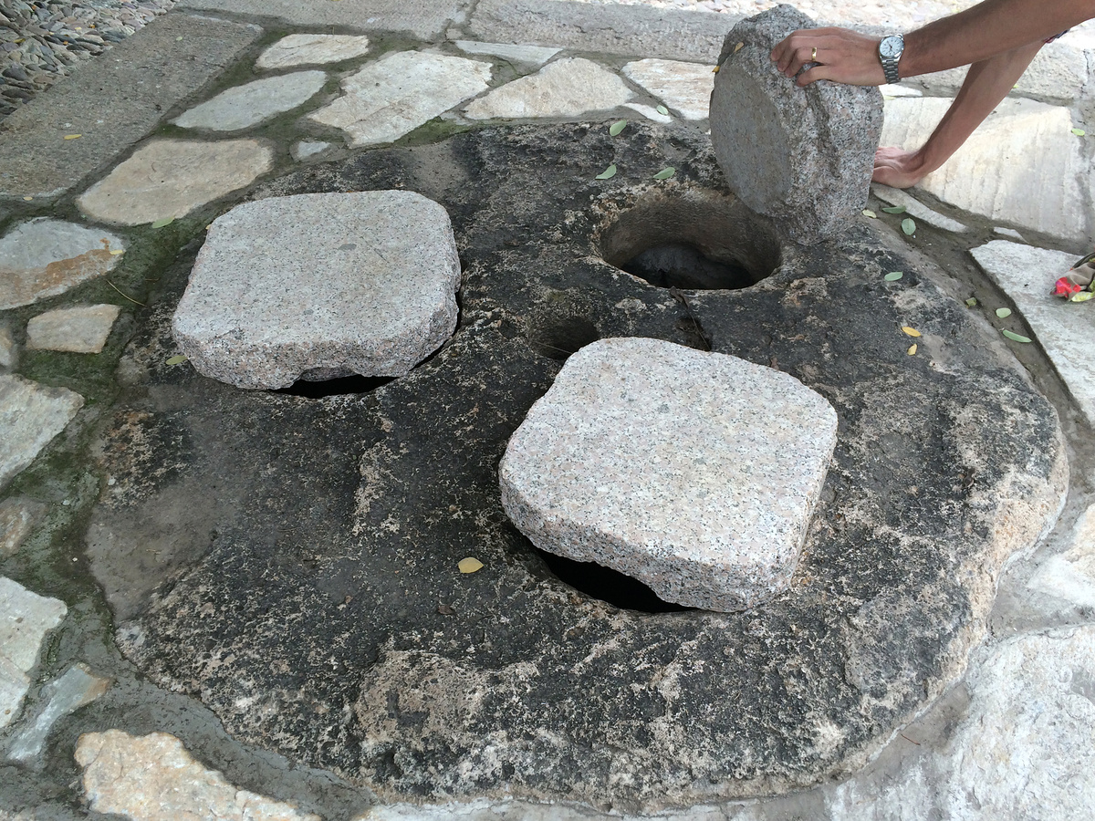
In the village there’s an old well and bridge, several temples, plus houses, shops, and little businesses.
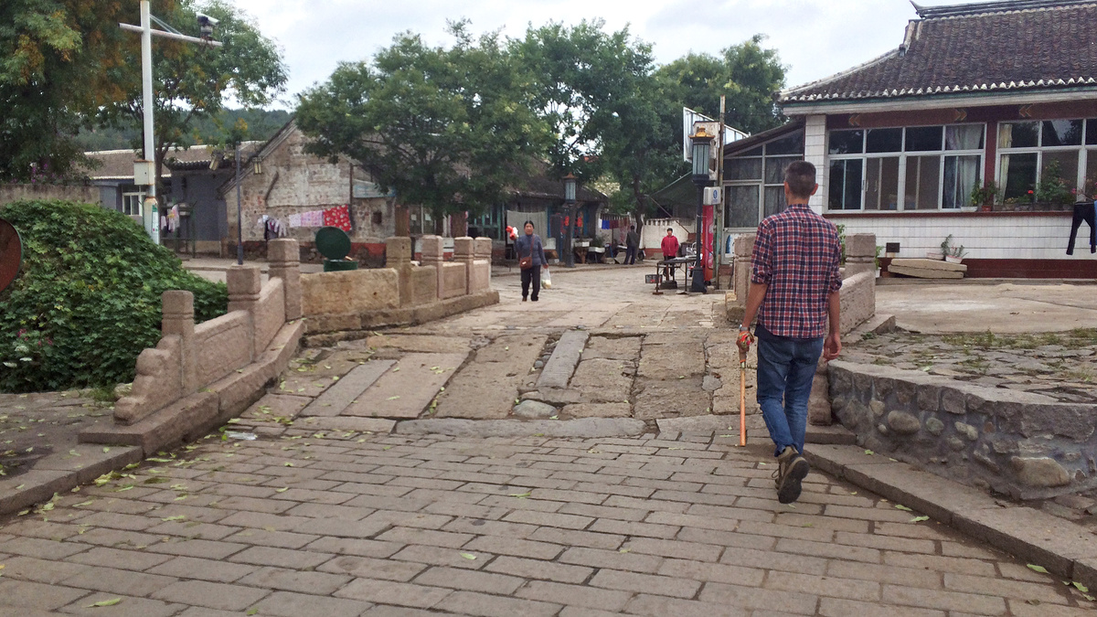
Getting some more village photos is on my to-do list.
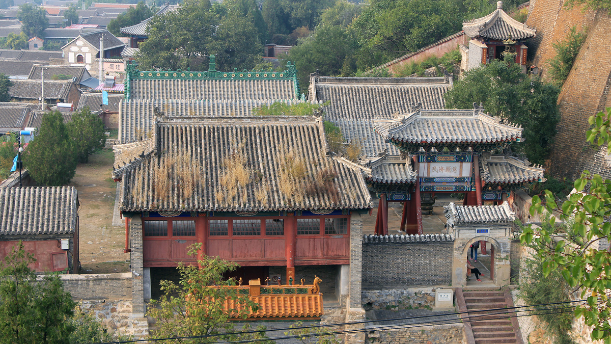
At the southern end of the village is the Temple of the Medicine God.
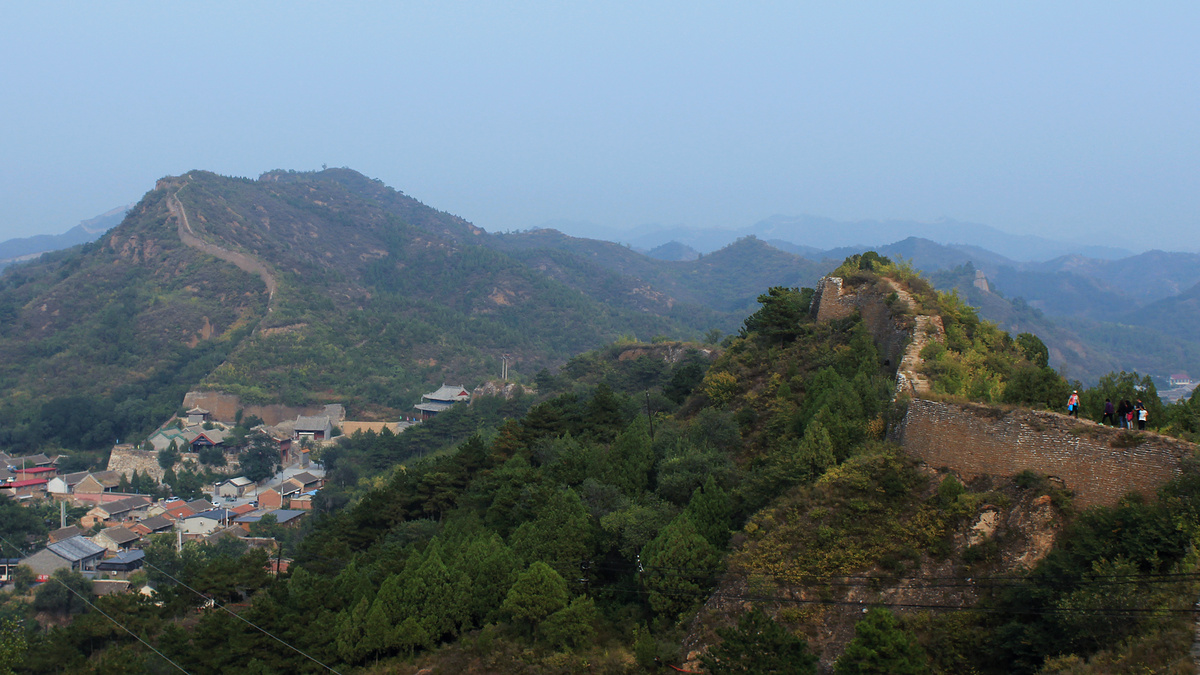
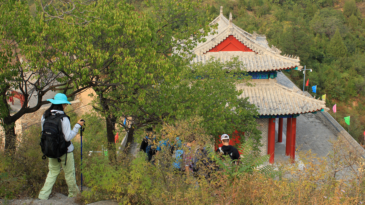
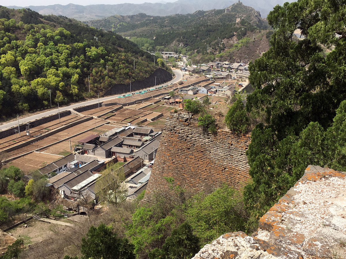
The North Gate and Inner Loop
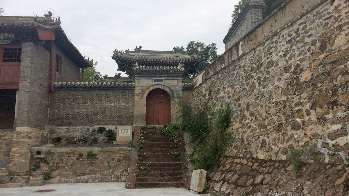
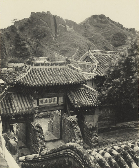
At the southern end of the village, right by the Temple of the Medicine God, is the North Gate, a large, repaired arch with a hall on top. It might seem strange to call it the North Gate, given that it’s at the southern end of the village. But it’s actually the North Gate of the inner loop of wall at Gubeikou.
The inner loop of wall encircles a smaller part of the village and blocks off two valleys – the main one, which follows the Chao River towards Beijing, and another valley that forks from the main one and goes around to the Simatai Great Wall.
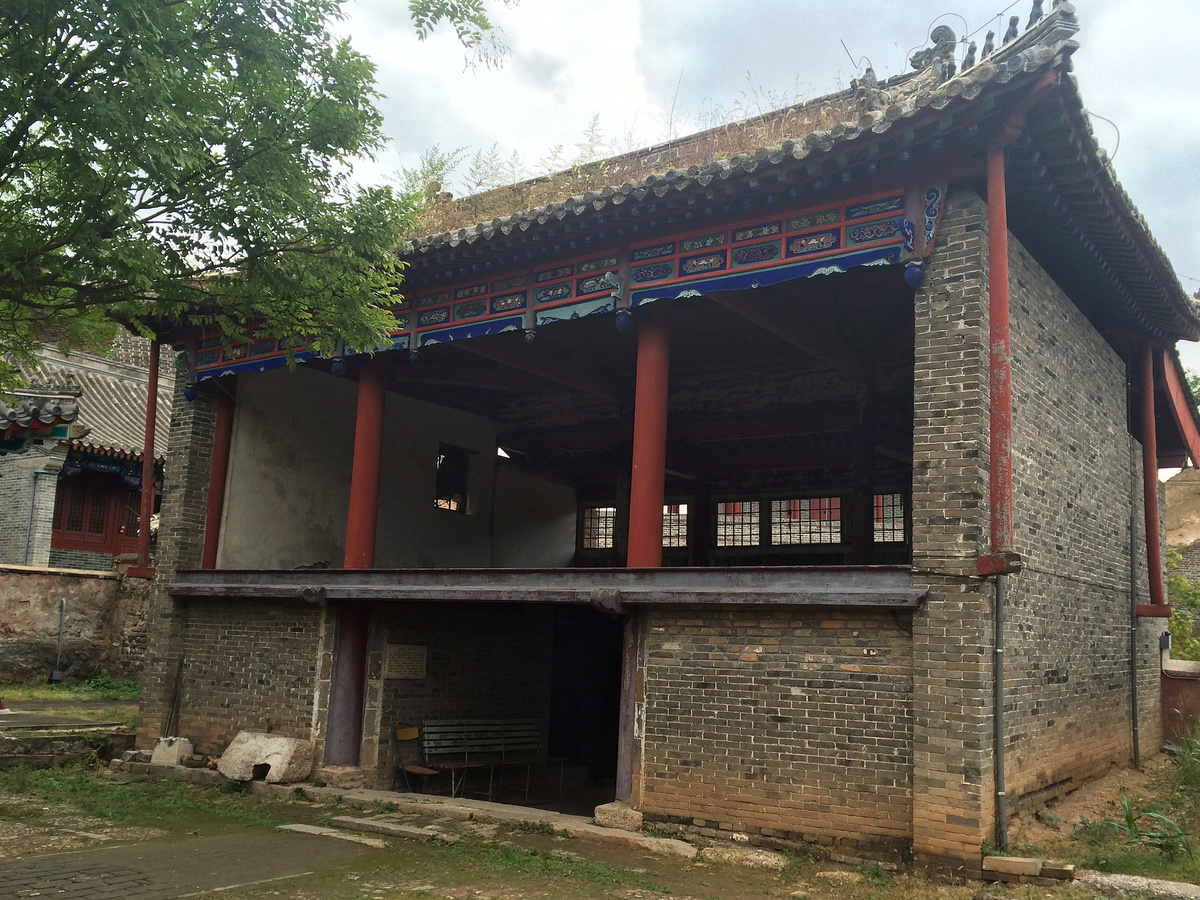
There used to be towers all around the loop, but they’re now mostly piles of rubble. Some very solid foundations and buttresses remain. There are three intact towers just outside the western segment of the inner loop: Dahua Tower, and two more that are unnamed (as far as I can tell), with one of those a repaired tower that seems to be full of telecom equipment.
North Gate
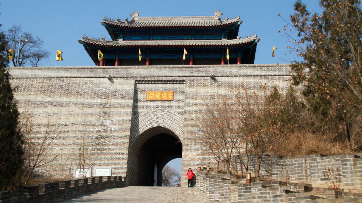
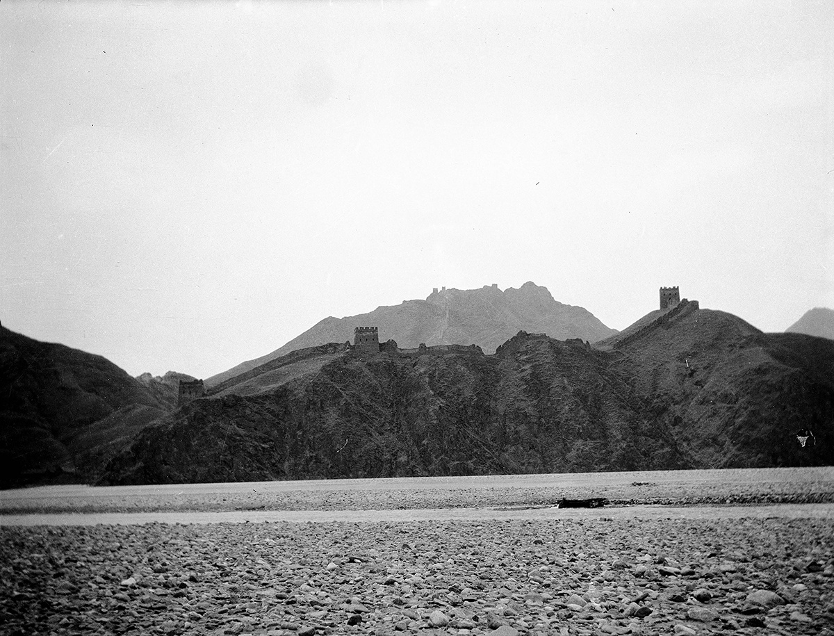
I wrote ‘current form’ in the previous caption because … it seems it actually looked like this.
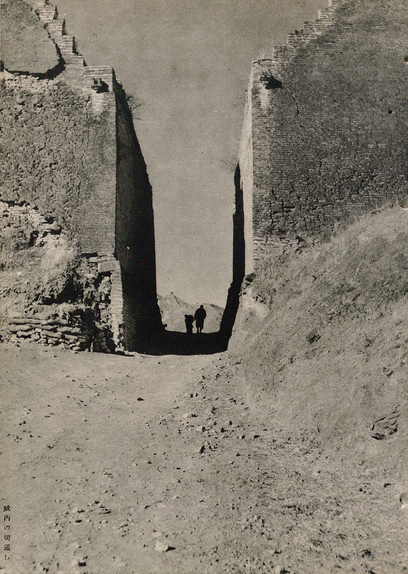
The Great Wall seen beyond the silhouetted figures makes it a match for me. But I never really paid attention to this spot before the construction of the new North Gate. The only photographic evidence I have is this next photo, which sort of shows the gap we see in the preceding photo.
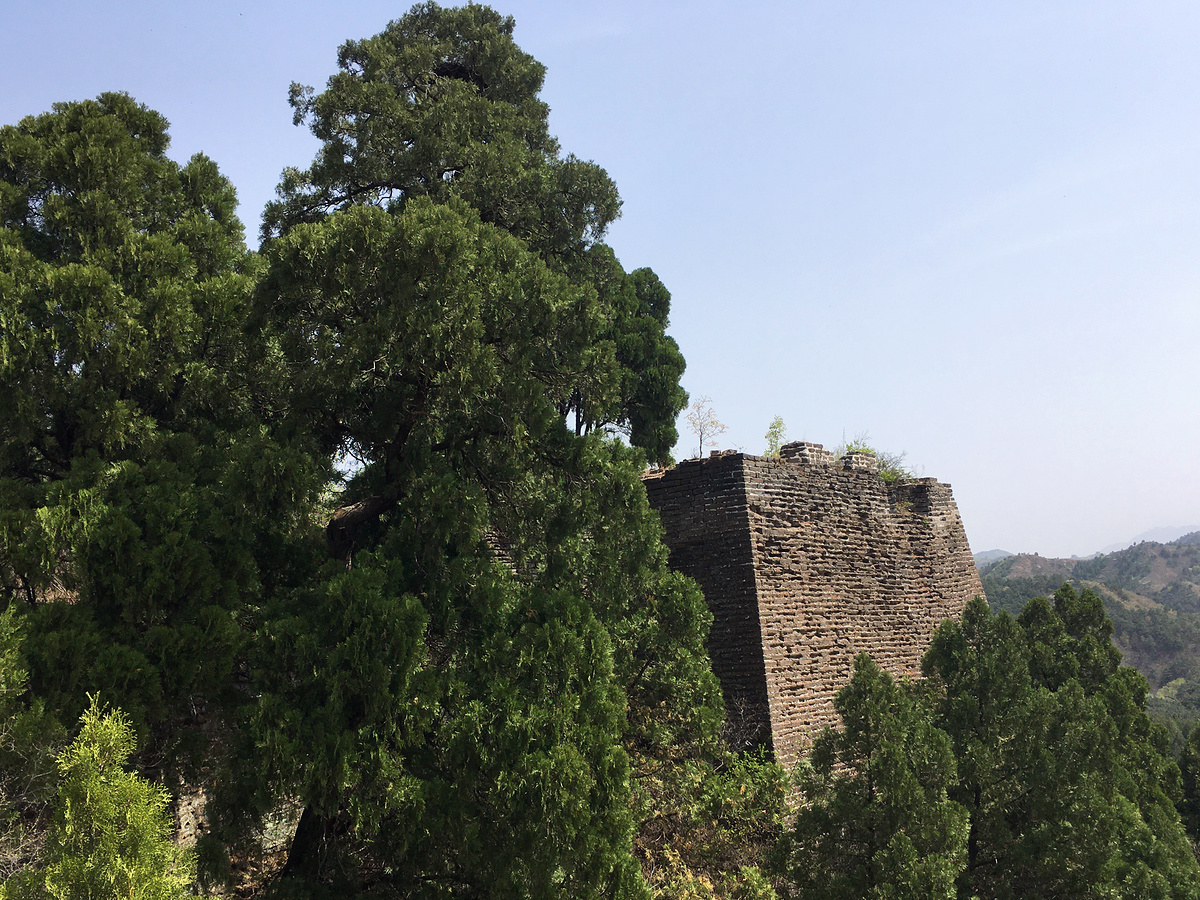
West part of the inner loop of wall
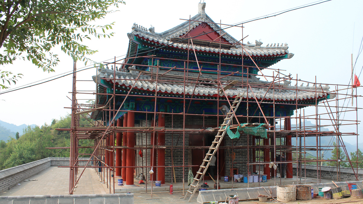
The main feature of the west segment of the inner loop is Dahua Tower, positioned to give views up the river valley.
Dahua Tower is outside of the inner loop of wall, and there are two more towers further out along the ridge.
South part of the loop
To-do! I had a spare 30 minutes to take a look at this south section on a 2025 visit, but picked the wrong trail to try and got delayed getting around a large ditch. We managed to bash our way up and got close enough to touch the wall … but we were on the outside and couldn’t climb up on top.
North part of the inner loop
If you hike up from the North Gate and head on to the Panlongshan Great Wall, you’ll hike the north part of the loop.
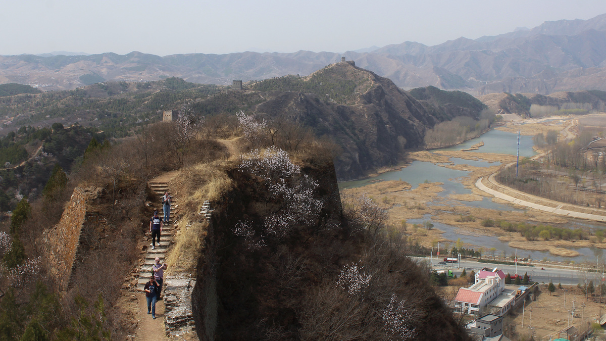
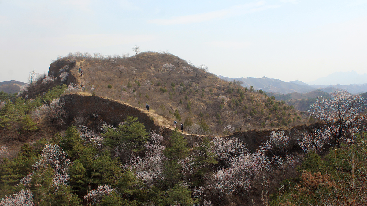
Atop the distant ridges in the preceding photo is the Panlongshan Great Wall. Most people take the turn in the trail that goes that way. If you turn the other way, you can continue around the inner loop.
Notes
Gubeikou and thereabouts
Gǔběikǒu / 古北口 / Old North Pass
Pánlóng Shān Chángchéng / 蟠龙山长城 / Coiled Dragon Mountain Great Wall
Wòhǔ Shān Chángchéng / 卧虎山长城 / Crouching Tiger Mountain Great Wall
Jiěmèi Lóu / 姐妹楼 / Sister Towers
Gǔběikǒu Zhèn / 古北口镇 / Gubeikou Village
Beijing Hikers organises Gubeikou Great Wall hikes a few times each month, and used to have a hike called the Gubeikou West Circuit (until fire-wardens and fences made it too difficult to reliably get on the Wohushan Great Wall)
To-do
- More photos from Gubeikou Village
- A street map of the village which shows where the camp and gates used to be
- Hike the southern part of the Inner Loop
- Rephotography of the old God of Medicine Temple photos